
The best mountain towns within two hours of Verona
Drive north from Verona and the ground tilts. Vineyards give way to hay meadows, then to spruce and pale limestone, and the houses change material as you climb: rendered stone below, timber balconies stacked with split wood above. Summer smells of cut grass and cow byres, with malga cheeses sold from the dairy door and polenta arriving under sausage or a plate of mushrooms. In winter the same slopes carry snow, thermal pools steam in the valley floors, and the bars keep the good grappa within reach of the coffee machine.
People do this drive already, and most of them are heading for one place. Lake Garda's northern shore, and Riva del Garda in particular, absorbs the traffic from Verona in every month with decent weather, along with the Dolomites of Cortina d'Ampezzo further on for anyone with an extra day. The reasons are sound and the pictures are famous. The result is car parks full by mid-morning, lakeside restaurants with laminated menus, and a lot of the same photograph.
The mountains do not stop at the famous names. The Lessini plateau, the Val di Non, the Val Camonica, the Brembana and the high shelves above Trento all sit inside the same driving time, and the villages up there run on grazing, timber, spa water and their own small ski lifts rather than on coach parties. These are the towns on that ground, smaller and quieter, with the cheese, the walking and the snow intact.
Of the 88 communes we have mapped in a 120-minute drive of Verona, 10 qualify as mountain towns: each sits in the mountains proper. The smallest, Luserna, has 267 residents.
Elsewhere in the catalogue: The best mountain towns within two hours of Brescia and The 9 best mountain towns within 90 minutes of Trento.
Luserna
Why visit Luserna
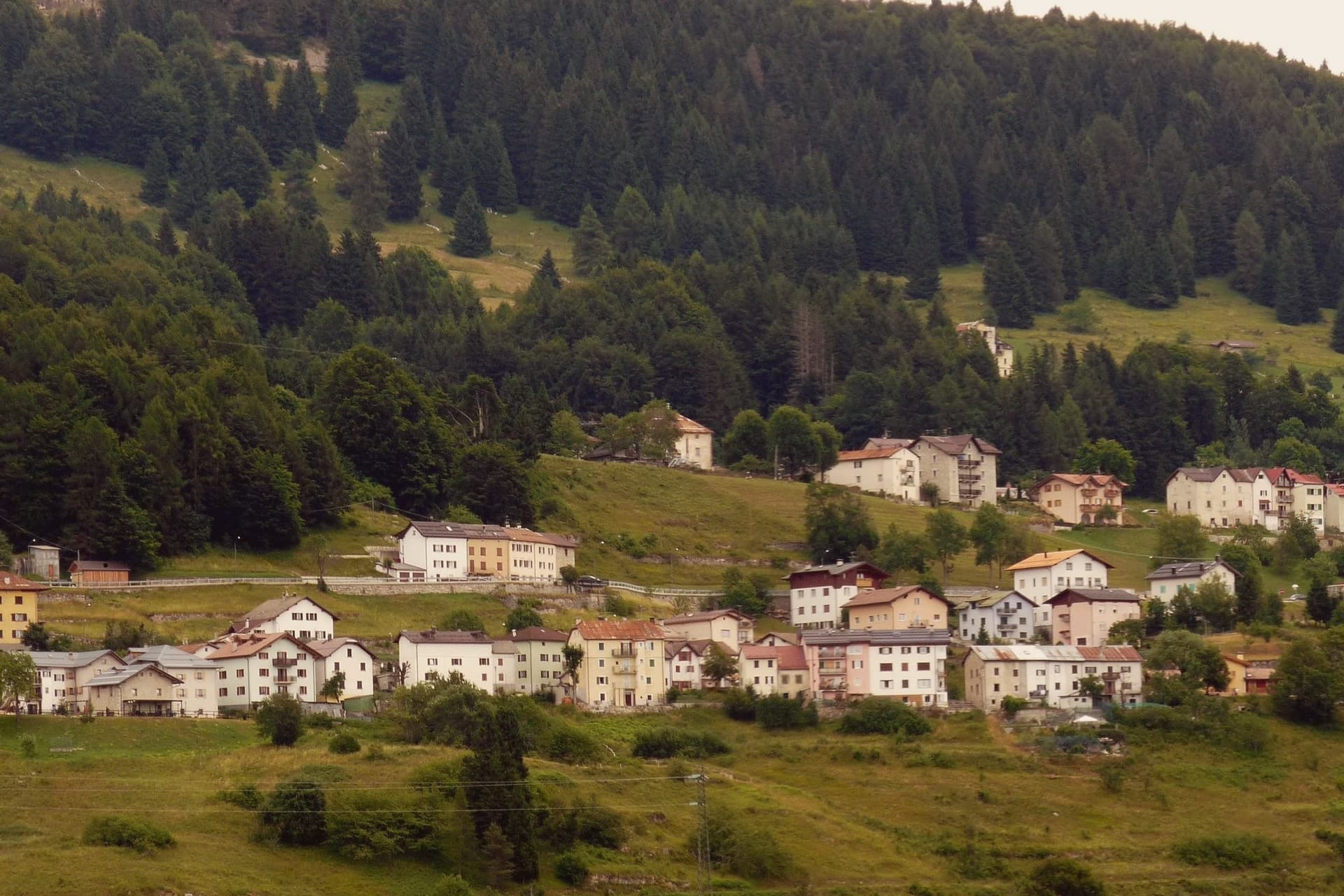
Luserna sits on the northwestern edge of the Folgaria plateau, four kilometres south of Lavarone and forty kilometres southeast of Trento. The village was founded around 1400 by Bavarian-Cimbrian colonists who moved up from nearby Lavarone, and the dialect they carried is classed by linguists as the oldest peripheral language of the German domain and the southernmost surviving in the Alps.
It was protected after the Second World War by the Gruber-De Gasperi Agreement and officially recognised in 2001 under Trentino's minority law, a legal history that runs a full half-century behind the community's own persistence in speaking the language at home. The village itself holds 267 residents, small enough that the museum complex, the restored peasant house, the old fort and the stone-and-wood core all sit within reach of each other rather than spread across a larger settlement.
What holds the place together is less any single building than the fact that the colonists' original tongue outlasted the empire whose frontier fort now stands as a museum piece nearby: the language, not the fortification, is what makes the plateau edge worth the four kilometres from Lavarone.
The village sits at 1333 metres.
What to see in Luserna
- Centro Documentazione Lusérn. Documentation Centre with permanent exhibitions on the Cimbrian community, the Great War on the plateaus, prehistoric metallurgy, and Cimbrian bobbin lace.
- Casa Museo Haus von Prükk. House museum in a restored nineteenth-century Cimbrian peasant dwelling, presented by guides who explain the dialect and the traditions of plateau life.
- Werk Lusérn. Austro-Hungarian Great War fortress on the imperial frontier with Italy, heavily shelled in 1915 and now part of the plateau's fortification museum circuit.
How to get to Luserna
Trento is roughly 51 minutes away by road.
Our tip
June through September is the alpine summer at 1,333 metres: cool evenings even in July, hiking on the plateau between Luserna and Lavarone, and the museums open at full schedule. December through March is the ski season on the Alpe Cimbra circuit, with snow holding above 1,300 metres into early April. April and May are quiet shoulder months between the lift closure and the green-up of the high pastures; many services close.
Caldes
Why visit Caldes
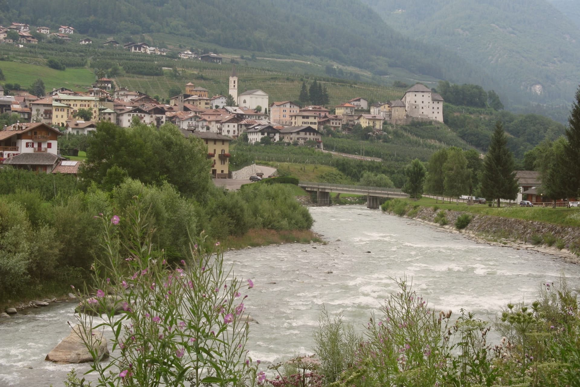
The commune sits at around 700 metres in the lower valley, along the river, thirty-five kilometres northwest of Trento and below the southern ridge of the Brenta Dolomites. It is a scattered municipality of six hamlets: the village itself, Samoclevo, San Giacomo, Cassana, Tozzaga, Bordiana and Bozzana, strung along the slope between 635 and 767 metres, each holding its own cluster of stone houses on the same grade above the river.
The castle at the centre of the arrangement was built between 1230 and 1235 by Rambaldo and Arnoldo da Cagnò as a five-storey tower-house, controlling commercial traffic up the valley together with the higher fortification above Samoclevo. It passed to a noble family in 1464, who rebuilt it into the form it holds now, and it belongs today to the autonomous province of Trento as a museum venue.
What emerges is a settlement pattern of small hamlets set at deliberate intervals along a single slope, held together historically by one river route and one controlling tower, and preserved since as a recognized example of that rural arrangement.
The village sits at 698 metres.
What to see in Caldes
- Castel Caldes. Five-storey tower-house begun in 1230 and rebuilt by the Thun family from 1464, with sixteenth-century painted rooms and coats of arms, now a Buonconsiglio museum venue.
- Borgo di Caldes. Stone-built historic centre below the castle, member of I Borghi più belli d'Italia for the preservation of its rural architecture and lanes.
- Samoclevo. Upper hamlet at 767 metres above Caldes, paired in the medieval period with the Rocca di Samoclevo to control traffic on the Val di Sole road.
How to get to Caldes
There is a railway station in the town, so you can arrive without a car and never need one while you are here. Trento is roughly 53 minutes away by road.
Our tip
May through October is the open season in the Val di Sole: the Noce runs high with snowmelt from May through July for the rafting season, and the slopes above Caldes are green for hiking from June onward. July and August are warm at 700 metres, cooler than the Trento valley but still busy with summer visitors crossing toward the Brenta Dolomites and the Stelvio. September and October are the quiet shoulder months, with clear air, low water on the river and the chestnut and walnut harvest across the hamlets.
Andalo
Why visit Andalo
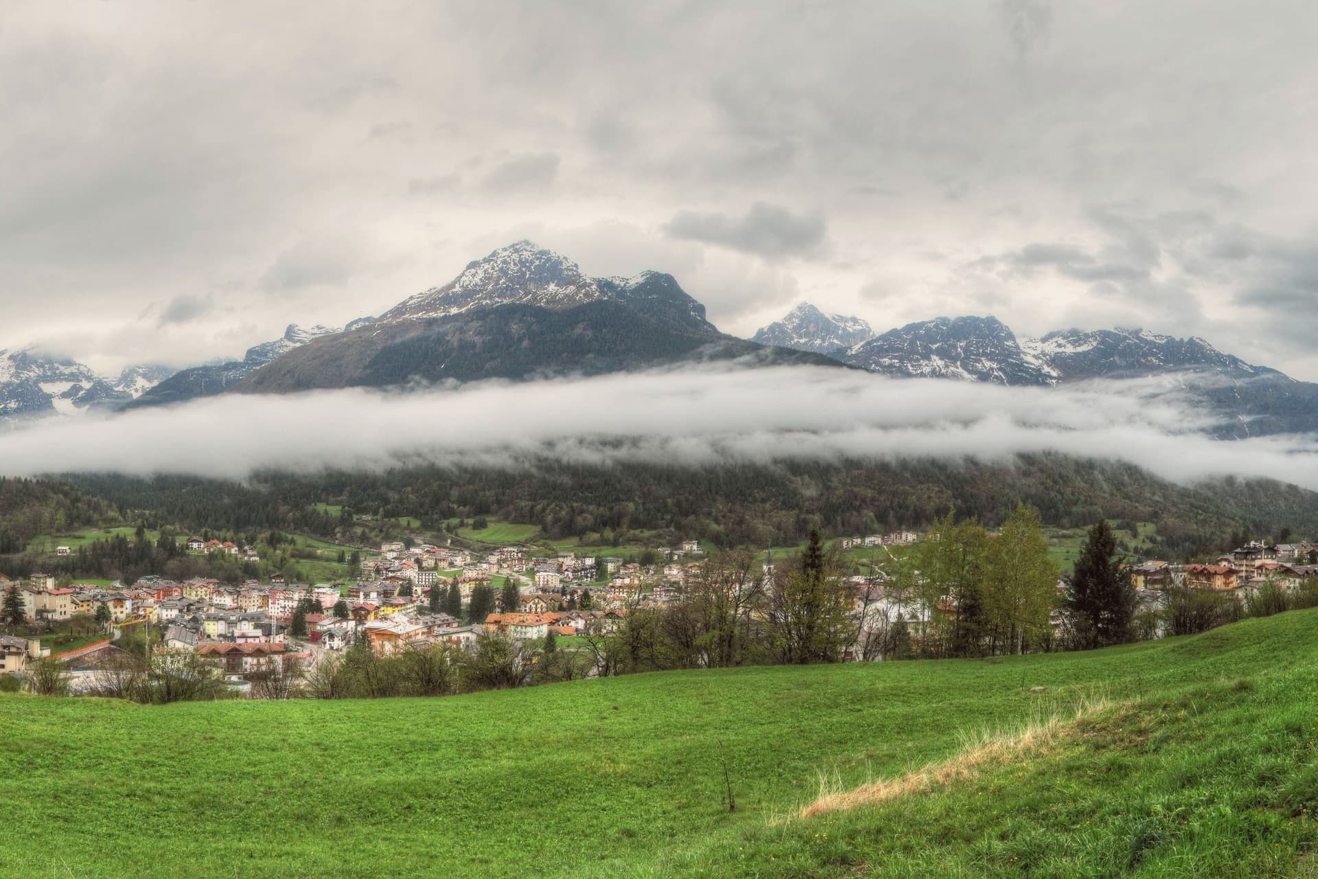
The plateau opens between Piz Galin at 2,442 metres and Cima Paganella at 2,125 metres, with the mountain massif on one side and Mount Paganella on the other. The settlement began in the Middle Ages as thirteen scattered masi, the farm clusters typical of Trentino's high pastures, which merged into a single town over the centuries: the grassy pass the village now occupies was, in effect, assembled from separate hamlets rather than founded as one place.
From the second half of the twentieth century the village grew into a winter sports resort, with lift infrastructure climbing from the village centre toward the higher slopes and summit. The lake at the edge of the settlement follows its own seasonal rhythm, full in spring and drained by late summer, apart from the built-up resort around it.
Together the pieces read as a farming settlement that kept its old shape at the centre while building a ski resort around its edge, with a nature park and a disappearing lake as the fixed, non-negotiable backdrop to both.
The village sits at 1042 metres.
What to see in Andalo
- Cima Paganella. Summit reached by gondola from the village centre via Doss Pelà, with panoramic views over the Brenta Dolomites and the Adige valley.
- Lago di Andalo. The lake sits at the edge of the village, a stretch of water that is full in spring and gone by late summer, its bed exposed where the shoreline had been.
- Parco Naturale Adamello-Brenta. The park covers most of the Andalo territory, taking in the Brenta Dolomites group inscribed in the UNESCO World Heritage list in 2009.
How to get to Andalo
Trento is roughly 39 minutes away by road.
Our tip
December through March is the ski season, the village's busiest months, with the Paganella lifts running from the centre and snow held above 1,000 metres into early April. June through September is the summer alpine season: cool evenings even in July, hiking and biking on the plateau, and the lake at its fullest in late June. April and May are quiet shoulder months when snow has gone and the meadows have not yet bloomed; many lifts and hotels close.
Lavarone
Why visit Lavarone
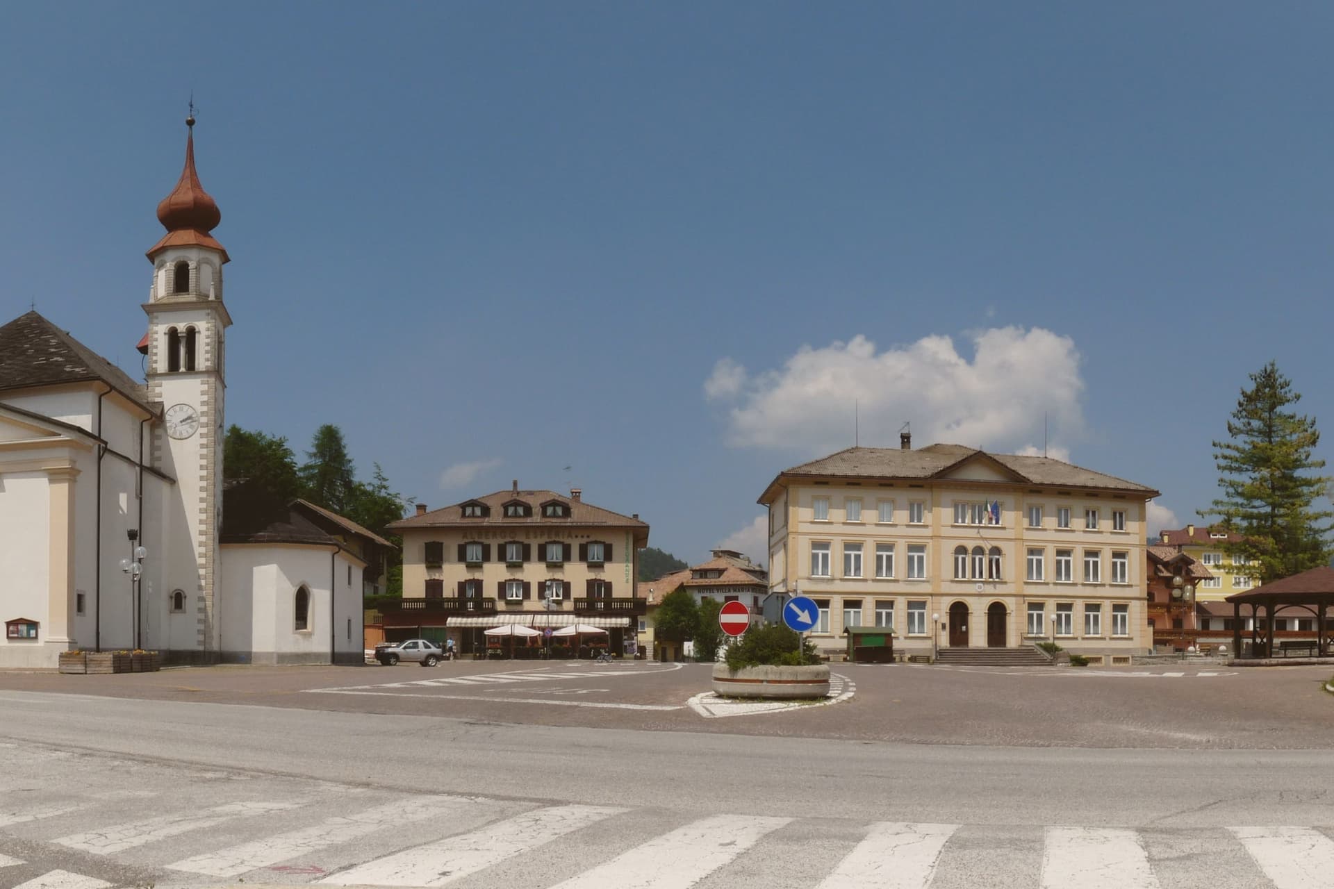
The plateau lies between the Folgaria highlands and the Cimbrian island of Luserna, forming the southern edge of the Alpe Cimbra ski circuit. Its territory is a scatter of twenty hamlets spread across pasture and conifer woods, settled by Bavarian-Cimbrian colonists between the tenth and thirteenth centuries, a history that still binds the plateau to Luserna under the same historic community.
At the centre of this scattered geography sits the lake, a sinkhole slowly filled with water, and to the south the ground rises to a limestone spur over the Val d'Astico where the fort was raised to mark the old imperial border with the Kingdom of Italy. The two landmarks sit at opposite ends of the same plateau, one low and wooded, one high and exposed, and both look out over the same valley that once divided empires.
In winter the lifts run from the hamlets above 1,000 metres, closing the loop between a pastoral upland and a line built for war.
The village sits at 1172 metres.
What to see in Lavarone
- Forte Belvedere Gschwent. Austro-Hungarian fortress built 1908-1912 on a limestone spur at 1,177 metres over the Val d'Astico, with armoured cupolas and a Great War museum.
- Lago di Lavarone. Karst lake at 1,079 metres, formed by the filling of a sinkhole, awarded the Bandiera Blu for water quality and ringed by a conifer-shaded walking path.
- Altopiano di Lavarone. Forested plateau between the Folgaria highlands and Luserna, a scatter of twenty hamlets across pasture and woods at 1,000 to 1,200 metres.
How to get to Lavarone
Trento is roughly 42 minutes away by road.
Our tip
June through September is the alpine summer: cool evenings even in July, hiking on the plateau, swimming and sailing on the Bandiera Blu lake, and the Forte Belvedere open to visitors. December through March is the ski season, with the Alpe Cimbra lifts running from the plateau hamlets above 1,000 metres and snow holding into early April. April and May are quiet shoulder months between the ski closure and the green-up of the meadows; many hotels close.
Bleggio Superiore
Why visit Bleggio Superiore
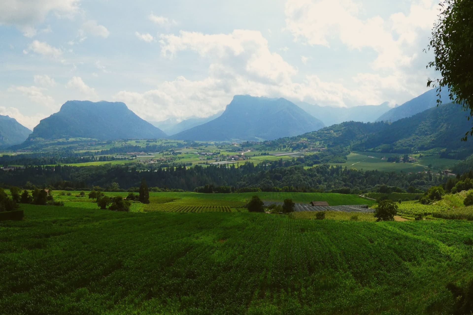
Bleggio Superiore sits in the Giudicarie Esteriori, twenty-five kilometres west of Trento and above the Sarca valley, with the Brenta Dolomites visible to the north and Lake Garda half an hour south. The commune is a scattered municipality of twelve hamlets, with its administrative seat in Santa Croce at 628 metres and Rango, its highest village, on the slope above at 799 metres.
Rango is a member of I Borghi più belli d'Italia, recognised in 2006 for the density and integrity of its rural architecture: stone houses joined by covered passages called vòlt, internal courtyards and cellars that once stored Bleggio potatoes, walnuts and cured meats. Rango holds an annual Christmas market in those same vòlt from mid-November through December.
The Noce del Bleggio, a small oval walnut grown on terraces between 400 and 800 metres, became a Slow Food Presidium in 2016 and goes into the local bread, salami and cakes. The Pieve di Santa Croce, visible from across the valley, was one of the seven medieval pievi of southwestern Trentino.
The village sits at 628 metres.
What to see in Bleggio Superiore
- Rango. Hamlet at 799 metres recognised by I Borghi più belli d'Italia in 2006 for its stone houses linked by covered passages, internal courtyards and cellars.
- Pieve di Santa Croce. Medieval parish church visible from across the Giudicarie valley, one of the seven historic pievi of southwestern Trentino, in the commune's administrative seat.
- Mercatini di Natale di Rango. Christmas market held weekends from mid-November through December inside the stone vòlt of Rango, with artisan stalls, music and Giudicarie food.
How to get to Bleggio Superiore
Trento is roughly 42 minutes away by road.
Our tip
May through September brings hiking weather across the Giudicarie terraces, with the walnut groves green and the Brenta Dolomites visible from the higher hamlets. June and July are mild at 628 metres, cooler than the valleys below, with long evenings and the start of the festa season. October is harvest month for the Noce del Bleggio, the walnut crop that feeds the local bread and salami.
Bagolino
Why visit Bagolino
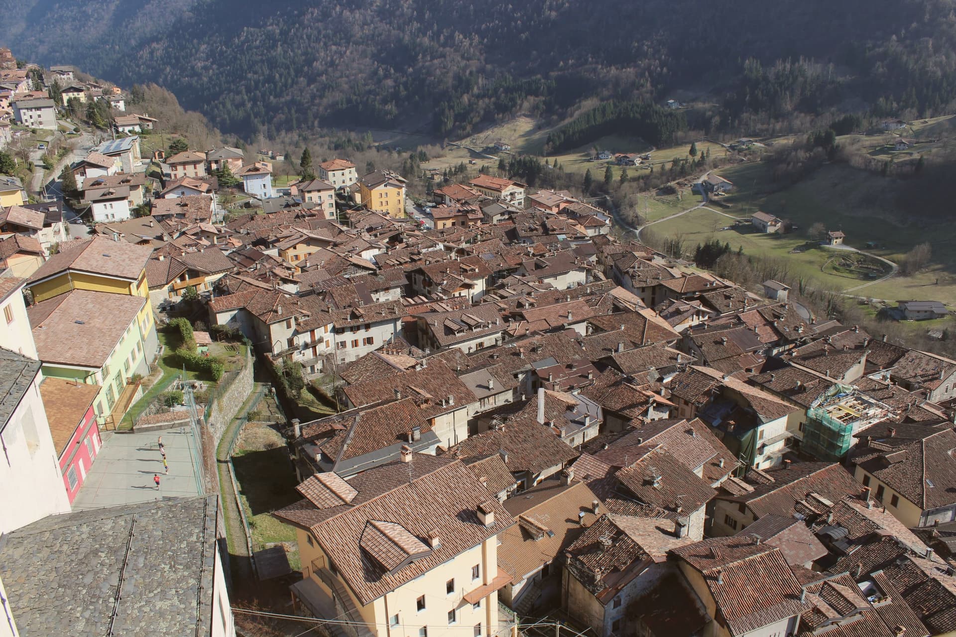
Bagolino sits at 778 meters in the Valle del Caffaro, the right flank of the Valle Sabbia, on the road that runs from Brescia to Lake Idro and over the Crocedomini pass into Val Camonica. The name probably traces to Pagolus, small village; the place was a Roman horse-changing station before anything else.
From the seventh century it sat in the Lombard duchy of Trento, then under the prince-bishops of Trento until the Venetian Republic took it over. The Chiesa di San Giorgio, designed by Giovanni Battista Lantana and built in three years in the early seventeenth century, is the third largest church in the province, with works attributed to Titian, Tintoretto, Palma il Giovane and Pietro Mera.
The Carnevale di Bagolino runs three days each February: Balari in inherited costumes, dancing to the violin and guitar of the Sonadur in tunes closer to Austria than Brescia. Bagòss, the saffron-tinted hard cheese, is still made here from Alpine Brown cow milk, about 10,000 wheels a year.
The village sits at 778 metres.
What to see in Bagolino
- Chiesa di San Giorgio. Third largest church in the province of Brescia, designed by Giovanni Battista Lantana and built in three years in the early seventeenth century, with works attributed to Titian and Tintoretto.
- Centro storico. Stone-house medieval village stacked on the slope above the Caffaro, with covered passages and the dark wood balconies typical of the Lombard prealps.
- Chiesa di San Rocco. Sixteenth-century votive church on the village edge, dedicated to the plague saint, with frescoes inside and a small porch facing the valley.
How to get to Bagolino
Brescia is roughly 76 minutes away by road.
Our tip
May through October is the season at 778 meters. June, July and September are the strongest: alpine pastures green, the Maniva pass open, Lago d'Idro warm enough to swim, the village cool at night while Brescia bakes. August fills with weekend visitors from the Bresciano plain, especially when the Bagòss producers open their cellars.
Brentonico
Why visit Brentonico
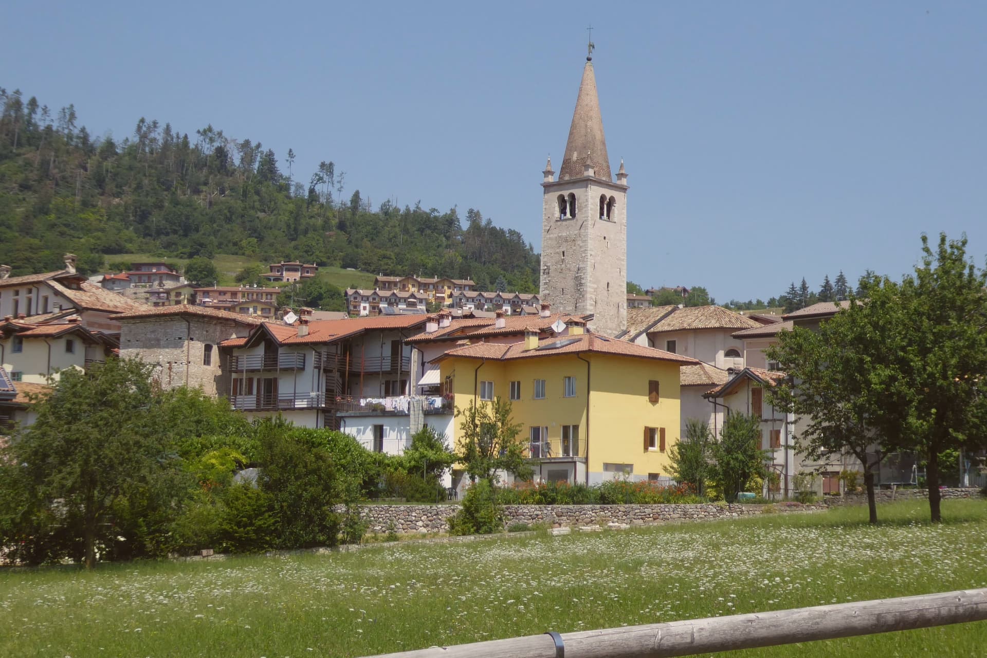
Brentonico sits at 692 metres on a plateau between Lake Garda and the Vallagarina. The commune runs from 500 metres in the valley to over 2,000 at the ridge, an altitude range wide enough to hold a chestnut hamlet at one end and ski hamlets at the other.
Castione, the lower hamlet, faces the Adige valley and lives by its terraces. San Valentino, Polsa and San Giacomo, the upper hamlets above 1,200 metres, face the opposite way, toward pasture and snow.
Palazzo Eccheli-Baisi anchors the centre and has changed hands once in a way that says something about the town: built in 1597 by mine managers, it passed in 1840 to a family of salami merchants, before ending up, in this century, as a house for fossils and for the office that manages the mountain's protected slope. That slope, and the garden set in front of the palace, both draw on the same fact: the mountain was named by European botanists for what grows on it, and the town's two conservation projects, one wild, one planted, sit on either side of the same building.
Above Crosano the ground still carries the trenches of the First World War, dug where the Austro-Hungarian line crossed the plateau. The valley below has been worked for chestnuts and the ridge above was fought over, and the palace in the centre now holds the record of both.
The village sits at 692 metres.
What to see in Brentonico
- Palazzo Eccheli-Baisi. The building's later life traces the town's own turns: sold in 1840 by the founding mine-manager family to salami merchants, it now sits open to visitors as museum and park office at once, fossils in the rooms where ore accounts were once kept.
- Giardino Botanico di Brentonico. Opened in 2005 at 690 metres, directly in front of the palace, the garden gathers native and rare Monte Baldo plants into a plot small enough to walk in an afternoon.
- Parco Naturale Locale del Monte Baldo. The protected slope is where the mountain earns its old reputation: paths through it cross the endemic flora that gave the range its name among European botanists.
How to get to Brentonico
Trento is roughly 42 minutes away by road.
Our tip
May through October brings the warm months on the plateau, with the botanical garden in flower from late May, the Monte Baldo paths open above 1,500 metres, and the chestnut hamlets cool against the heat of the Vallagarina below. June and July see the rare Monte Baldo endemics in bloom on the upper slopes. October is the chestnut harvest, the busiest month in Castione, with the marroni roasted at autumn sagre.
San Pellegrino Terme
Why visit San Pellegrino Terme
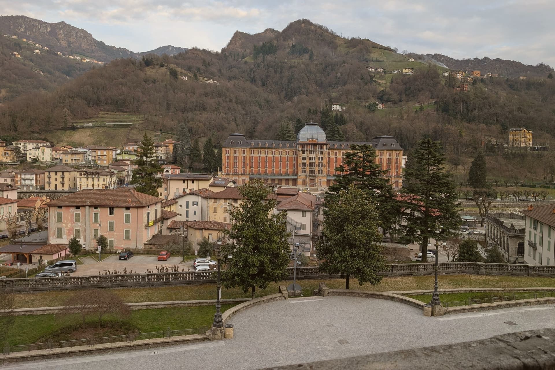
The town sits along a single bend of the Brembo river, where mineral and sulfur springs had been documented since the 13th century but were only commercialised after the railway from Bergamo reached the valley. That timing explains why the whole ensemble reads as one build: the hotel, the casino and the bath house went up within a few years of each other, facing each other across the water rather than scattered through the town.
The bottling plant sits a kilometre downstream from the springs, turning the source into the mineral water sold worldwide. Above the built-up centre, the funicular climbs to the Vetta panoramic point on the ridge, putting the whole valley below in view.
The Val Brembana around it is one of Lombardia's Cittaslow-style slow-tourism valleys, with the Borghi-più-belli of Cornello dei Tasso fifteen kilometres north and a chain of cycling routes along the river. What holds the town together, in the end, is the water itself: it drew the springs' early notice, funded the Liberty building spree once the railway arrived, and still leaves the valley in bottles long after the casino stopped taking bets.
The village sits at 358 metres.
What to see in San Pellegrino Terme
- Grand Hotel San Pellegrino. Completed in 1904, the most elaborate facade of the ensemble: cast-iron balconies, stained glass, and a marble entrance hall by Romolo Squadrelli.
- Casinò Municipale (Casinò Liberty). Matching Liberty style across the Brembo from the hotel, closed to gaming since 1917 but open for events and as a visitable architectural set piece.
- Terme di San Pellegrino (QC Terme). Original 1900 building running on the historic sulfur springs, operated today by QC Terme as a full-day spa with indoor and outdoor pools at 36°C.
How to get to San Pellegrino Terme
There is a railway station in the town, so you can arrive without a car and never need one while you are here. Bergamo is roughly 30 minutes away by road.
Our tip
April through October is the prime spa-town season — outdoor pools open at the Terme, funicular running, and the riverfront promenade in full use. May and September are the architectural-photography months: warm Liberty facades, fewer guests at the Grand Hotel, long light. July-August is busiest — the QC Terme can be fully booked weekends.
Clusone
Why visit Clusone
Clusone lies thirty-five kilometers northeast of Bergamo, seat of the upper Val Seriana mountain community. The first written record is a deed from 774 transferring the rocca from Charlemagne to the monks of Saint Martin of Tours.
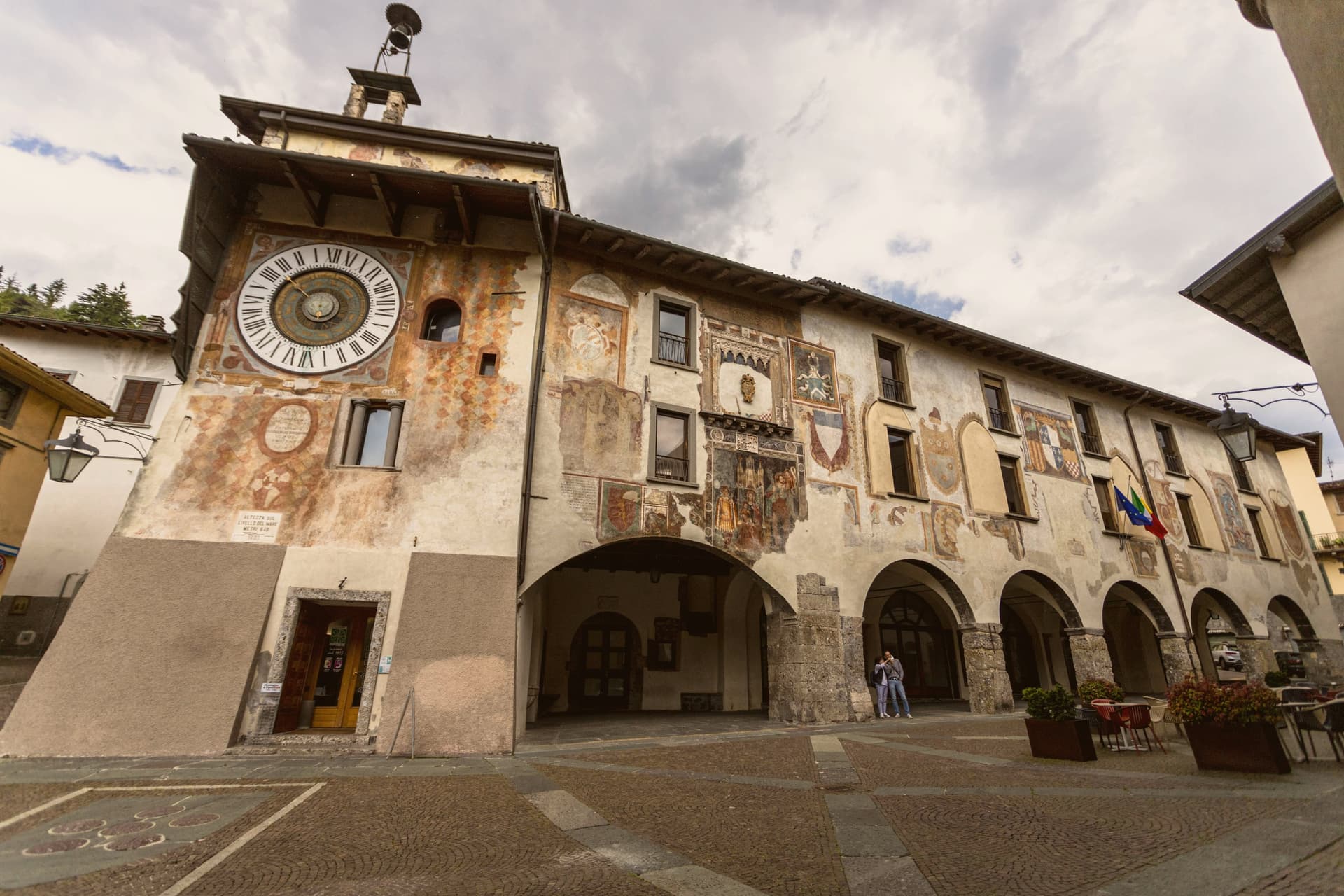
Under Venice, from the late fifteenth century onward, the town reached its artistic and commercial peak, and it was in this period that both the fresco and the clock on the civic tower were made, a generation apart, for a town governed from the sea. The upper town holds the old civic core: the oratory and the basilica face each other across the square, with the civic palace and its tower a short walk off, and steps linking the frescoed houses between them.
Clusone was awarded city title by Napoleonic decree in 1801 and reconfirmed by the Republic in 1957. A mountain seat of government, twice granted city status under different regimes, that spent its wealthiest century decorating a single square with images of death and the measure of time.
The village sits at 648 metres.
What to see in Clusone
- Oratorio dei Disciplini. Medieval oratory of the Disciplini confraternity, its fresco covering the full façade above the entrance.
- Orologio Planetario Fanzago. Clock on the Torre Civica still tracking the sun, moon and zodiac, mounted high on the tower face over the square.
- Basilica di Santa Maria Assunta. Seventeenth-century basilica across from the Oratorio, with a tall bell tower and Baroque interior at the heart of the upper town.
How to get to Clusone
Bergamo is roughly 44 minutes away by road.
Our tip
May through September is the open season in Clusone. The upper Val Seriana hills are walkable, the Oratorio façade is in clear light from late morning, and the Fanzago clock can be read from the piazza without winter glare. The Festa dell'Asparago in May and the summer concerts in Piazza Orologio fill the centro storico on weekends.
Darfo Boario Terme
Why visit Darfo Boario Terme
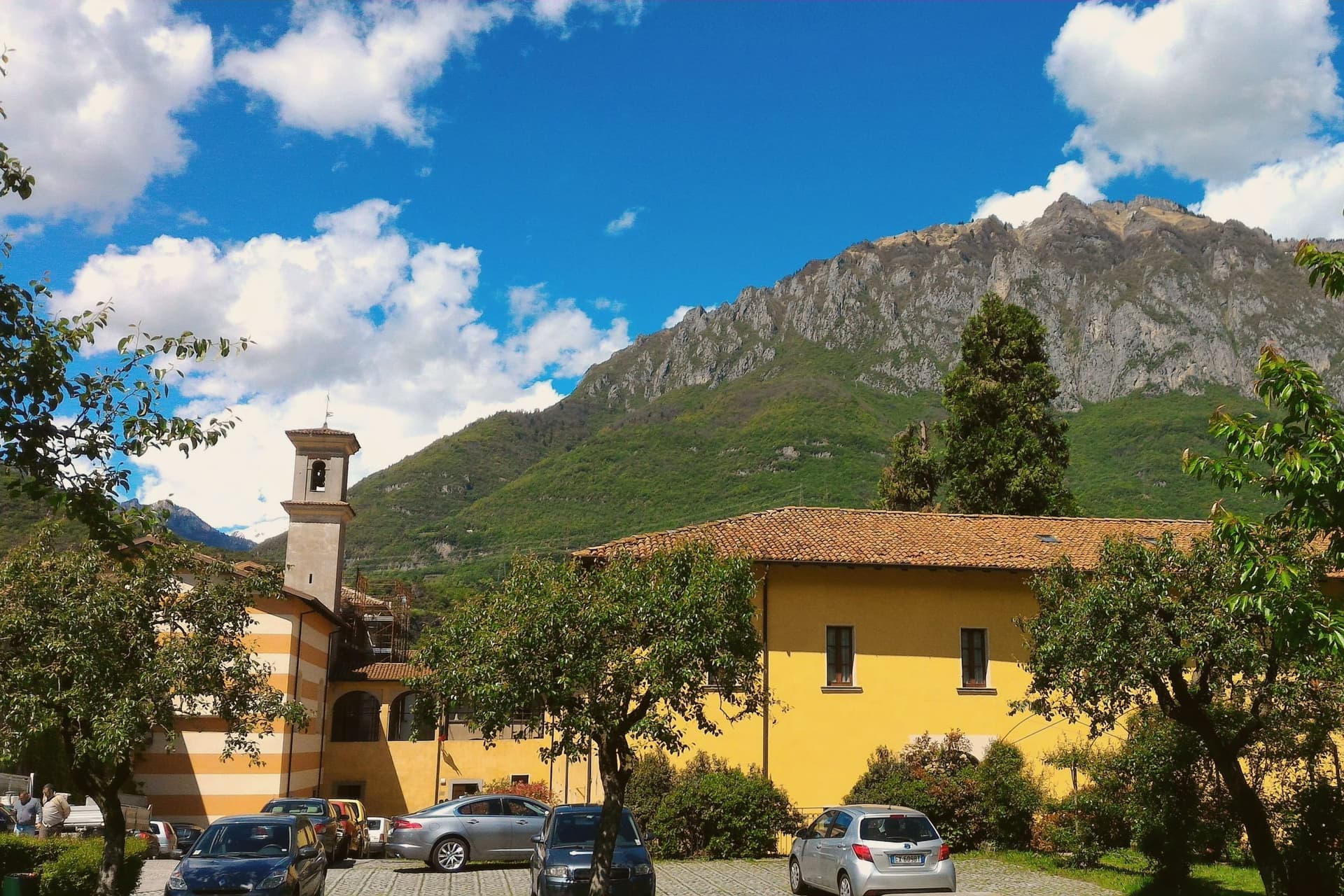
The commune sits at the lower end of the valley, a few kilometres north of Lake Iseo, where the Oglio leaves the mountains for the plain. Its name joins two places: Darfo, the capoluogo, and the spa hamlet of Boario Terme.
The thermal water was already in use in the 18th century, and Doctor Biffi called it the most active in Lombardy in 1857, well before the first spa building went up with its dome in 1906. The Comuni Virtuosi recognition the town holds today reflects later environmental commitments rather than this older history.
The rock-art park sits inside the commune boundary, its engraved surfaces part of a wider world heritage site spanning the valley, the first Italian entry on that list in 1979. The castle above the centre and the small church above the river belong to a different register of the town's past, one of fortification and parish life rather than prehistory or cure.
Between the thermal hamlet, the rock park, the castle spur and the river church, Darfo Boario Terme reads as a place where several distinct pasts, geological, medieval and modern, sit within walking distance of each other without overlapping.
The village sits at 218 metres.
What to see in Darfo Boario Terme
- Terme di Boario. Thermal complex with an Art Nouveau dome, set inside an early 20th-century spa park.
- Parco delle Incisioni Rupestri di Luine. Open-air rock-art park with more than a hundred engraved surfaces, part of the Valle Camonica UNESCO world heritage site.
- Castello di Gorzone. 13th-century Federici castle on a rock spur above the centre, still partly inhabited.
How to get to Darfo Boario Terme
There is a railway station in the town, so you can arrive without a car and never need one while you are here. Brescia is roughly 54 minutes away by road.
Our tip
May through October is the main season. Spring opens the rock-art parks and dries the trails above the valley; summer brings spa guests up from Brescia and Milan for water cures, and the temperature in the valley stays cooler than in the Po plain below. September and October are the cleanest months for walking the Luine engravings and the Capo di Lago promontory.
More from Anywhere Italy
 The best mountain towns within two hours of Brescia
- The 9 best mountain towns within 90 minutes of Trento
- The best hidden ski towns in the province of Trento
- The best mountain towns within two hours of Milan
- The prettiest small villages within 90 minutes of Trento
- The 10 best high-altitude villages in the province of Trento