
The best hill towns within 75 minutes of Genoa
Genoa ends abruptly. The city stacks itself against the hills and then the hills win, and within half an hour the road is climbing through chestnut and beech towards passes where the sea air meets the cold coming off the Po plain. The towns up here are built of grey stone and roofed in slate, with arcaded lanes, a castle or the stump of one, and a river running fast below. Autumn is the season that suits them best: porcini in the market, new wine, the smell of woodsmoke, honey from the Beigua slopes and amaretti sold from bakeries that have made them the same way for a very long time.
Almost everyone who lands in Genoa turns towards the water instead. The Cinque Terre absorbs the day trips, the trains fill from La Spezia onwards, and the terraced villages take more visitors between spring and October than their footpaths were ever built for. It is a reasonable thing to want to see. It is also the one part of Liguria where you queue.
The interior takes the pressure off, and it starts much closer to the city than most people assume. The same Apennine spine that shelters the coast carries valleys inland towards Piedmont, and the towns on those ridges keep their markets, their trattorie and their festivals whether or not anyone comes up from the port. Fewer people go. The drive is short, the food is regional rather than coastal, and the ground is high.
Of the 30 communes we have mapped in a 75-minute drive of Genoa, 8 qualify as hill towns: each stands on high ground rather than on the plain. The smallest, Garbagna, has 609 residents.
If you are still choosing, we have also written The 10 best hill towns within 90 minutes of Genova and The best small towns inside a nature park in Liguria.
Garbagna
Why visit Garbagna
The town sits in the Tortonese hills of eastern Piedmont, forty kilometers from Genova and thirty-five from Alessandria, at the point where the Curone, Grue and Ossona valleys meet. The architecture leans south toward Liguria rather than west toward the wider Piedmontese hill towns: tall houses pressed together, narrow stone streets, carved portals and an aristocratic palace surviving at the center, all giving the place the feel of a Ligurian entroterra village transplanted into Piedmont.
The upper Val Curone around the town is the growing ground for the Ciliegia Bella di Garbagna, the deep-red cherry harvested by hand each June, with Garbagna standing as its commercial center. The same eastern slopes fall inside the Colli Tortonesi DOC, where Pinot Nero is grown alongside the cherry orchards.
The town's built form and its produce both point the same direction: a Piedmontese address with a Ligurian character, shaped as much by the valley's geography as by the province it belongs to on the map.
What to see in Garbagna
- Palazzo Fieschi-Alvigini. Historic palace in the centro storico, the surviving aristocratic anchor of the medieval Ligurian-style core.
- Centro storico. Tall houses leaning against each other along narrow streets, arches and carved portals, closer in feel to Ligurian than Piedmontese borghi.
- Cherry orchards of the Val Curone. Hand-harvested groves of the Ciliegia Bella di Garbagna across the central weeks of June, the town's signature agricultural landscape.
How to get to Garbagna
Genova is roughly 65 minutes away by road.
Our tip
April through June is cherry country at 270 meters, with the trees in flower in April and the Ciliegia Bella harvest in mid-June. September and October bring the Colli Tortonesi grape harvest and dry, warm days that suit walking the narrow streets of the centro storico. July and August are warm in the Tortonese hills; the tall houses pressed together give shade through the hottest hours.
Sassello
Why visit Sassello
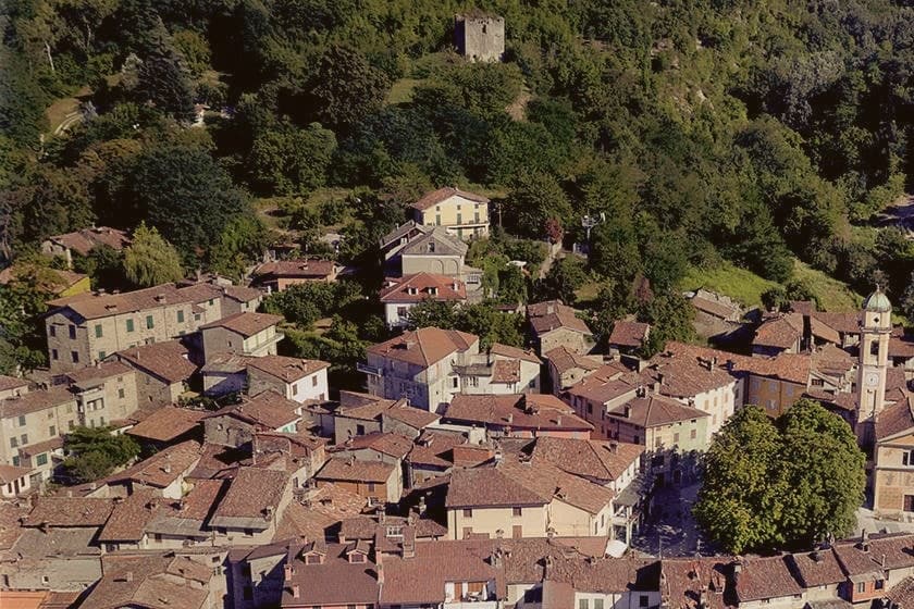
Sassello sits at 381 meters on the northern flank of the Ligurian Apennines, inside a UNESCO Global Geopark that stretches between Genova and Savona. The old village divides into two bastie: the Bastia Soprana, dating to the twelfth century, and the Bastia Sottana, founded by the Doria in the fifteenth, the two halves joined by stone bridges over the Sansobbia stream and threaded with frescoed palaces and baroque churches.
Most visitors arrive from Savona, thirty kilometers south, or from Genova, thirty-five east. The biscuit that carries the town's name past its own borders began in an ordinary kitchen: Geltrude Rossi ran an inn with a kitchen in the centro, and in 1860 started baking small almond biscuits she eventually named amaretti.
By 1892 they had a bronze medal at the Columbian celebrations; by 1911, gold in Paris. The Rossi and Virginia families still make them, and the town holds the trademark on amaretti morbidi di Sassello.
A hill town shaped by a river split and a fifteenth-century feudal addition has, almost as an aside, given its name to something baked in a kitchen and sent to Paris. The geography explains the two halves of the village; the biscuit explains why the name travels.
What to see in Sassello
- Centro storico. Two-bastia village of the twelfth and fifteenth centuries split by the Sansobbia, with frescoed palaces and baroque churches.
- Chiesa della Santissima Trinità. Parish church in the Bastia Sottana, baroque interior with stuccoed vaults and seventeenth-century altarpieces.
- Parco naturale regionale del Beigua. Geopark land stretching between Genova and Savona, reaching up to the peak that anchors it and gives the long sightline to the sea.
How to get to Sassello
Genova is roughly 72 minutes away by road.
Our tip
April through June and September into October are the strongest months for walking the Beigua and pairing the trails with the bakeries on Via Badano. July and August are warm but the elevation keeps the heat below the coastal numbers; the village fills with families from Savona and Genova on summer weekends. November through March is quiet, with the amaretti workshops in steady production for the holiday markets and the Beigua sometimes under snow above 1,000 meters. Festa dell'Amaretto falls in September.
Varese Ligure
Why visit Varese Ligure
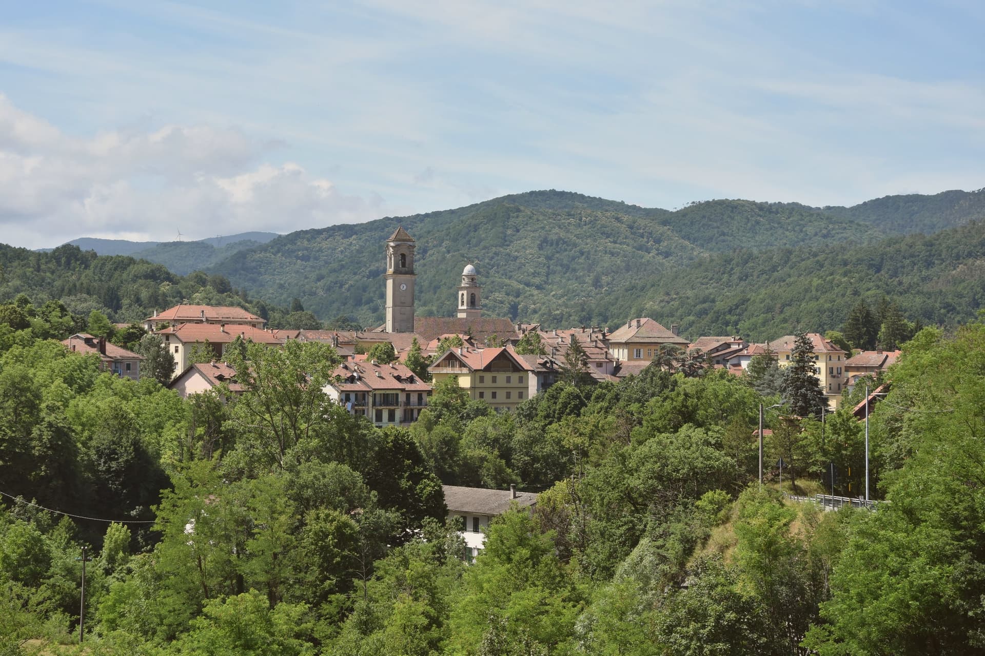
Varese Ligure sits at 358 meters in the upper Val di Vara, fifty kilometers east of Genoa. The Fieschi counts founded the borgo in the thirteenth century at the confluence of the Crovana and Gottero streams.
The Borgo Rotondo, an ellipse of pastel houses with arcaded ground floors, was laid out as a planned market town for trade between the Po valley and the Ligurian coast: the inner ring stayed open as a marketplace, the outer ring as defensive wall. The Castello dei Fieschi, two cylindrical towers and a central keep, anchors the upper end.
In 1999 Varese Ligure became the first European municipality to receive ISO 14001 environmental certification. The Val di Vara Biodistretto, founded in 2006, now counts 95 organic producers across seven communes, with 60 percent of the certified agricultural area in Varese Ligure itself organic.
The dairy cooperative was the first in Liguria certified bio. The borgo carries Bandiera Arancione and Borghi più belli badges together.
What to see in Varese Ligure
- Borgo Rotondo. Thirteenth-century elliptical plan of pastel-fronted houses with arcaded ground floors enclosing two piazzas, laid out as a market ring.
- Castello dei Fieschi. Fifteenth-century fortress at the upper edge of the borgo, two cylindrical towers and a central keep, residence of the Fieschi counts.
- Chiesa dei Santi Filippo e Giacomo. Eighteenth-century parish church on the main piazza, Baroque interior, replaced an earlier medieval church on the same footprint.
How to get to Varese Ligure
Genova is roughly 70 minutes away by road.
Our tip
May through October is the working season in the upper Val di Vara: the Crovana runs clear, the surrounding pastures green, the Borgo Rotondo arcades cool even in midsummer. The Festa di San Lorenzo in early August fills the inner ring with market stalls, the layout used as the Fieschi intended seven hundred years ago. July and August can touch 28 degrees in the valley but the 358-metre elevation keeps nights comfortable.
Brugnato
Why visit Brugnato
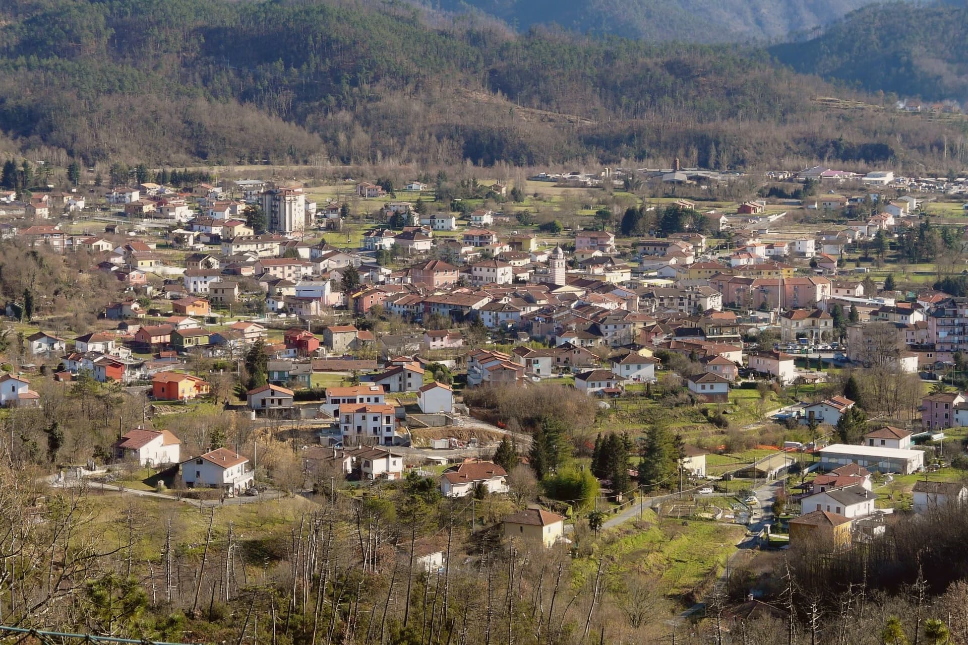
Brugnato sits at 115 meters in the Val di Vara, the broad inland valley that runs from the Apennine ridge down toward the La Spezia coast. The town grew around a monastery dedicated to Saint Columbanus, the Irish missionary who founded Bobbio in 614, and the settlement that formed around it took its shape from the monks' presence long before it took its later civic form.
The centro storico is laid out on a rare medieval grid for Liguria, straight lanes of pastel houses inside a walled perimeter, set on a low rise inside a meander of the river. The layout and the site both point back to the same origin: a religious foundation that outgrew its walls and organized a town around itself, one that later carried authority over the surrounding valley as a bishopric until 1820.
Brugnato holds Borghi più belli, Bandiera Arancione, and Infioritalia, the last for the Corpus Domini flower-petal carpets that cover the streets each June. The town's present character, an inland valley seat with a monastic and diocesan past now expressed mostly through architecture and a single yearly ritual, follows directly from that founding order having outlasted the institutions that built it.
What to see in Brugnato
- Concattedrale dei Santi Pietro, Lorenzo e Colombano. The building rises over the foundations of the older monastery, its eleventh and twelfth century stonework the visible layer above what the monks left underneath.
- Museo Diocesano. Diocesan museum housed in the former Episcopal Palace next to the cathedral, with sacred art and documents from the long bishopric.
- Centro storico. Walled medieval grid of pastel houses, a rare orthogonal layout in Liguria, set on a low rise inside a meander of the river.
How to get to Brugnato
Genova is roughly 62 minutes away by road.
✷ We have written about Brugnato
“You walk in expecting a town, and the town never arrives. You get the coil, the colors, the empty windows, the church waiting in the middle like a spider that stopped being hungry centuries ago. Somewhere under the cathedral floor, the diocese says, lie the remains of a Roman post and two older churches, layer under layer under layer, the whole history of the place stacked vertically because the plan never allowed it to spread.”
Read our piece on Brugnato →Brugnato | The Town With No Piazza
Our tip
April through June and September into October are the right months in the Val di Vara. The valley turns green in spring, holds its color into early summer, and dries to gold in autumn. Corpus Domini, late May or early June depending on the year, brings the Infiorata to the streets of the centro storico.
Campo Ligure
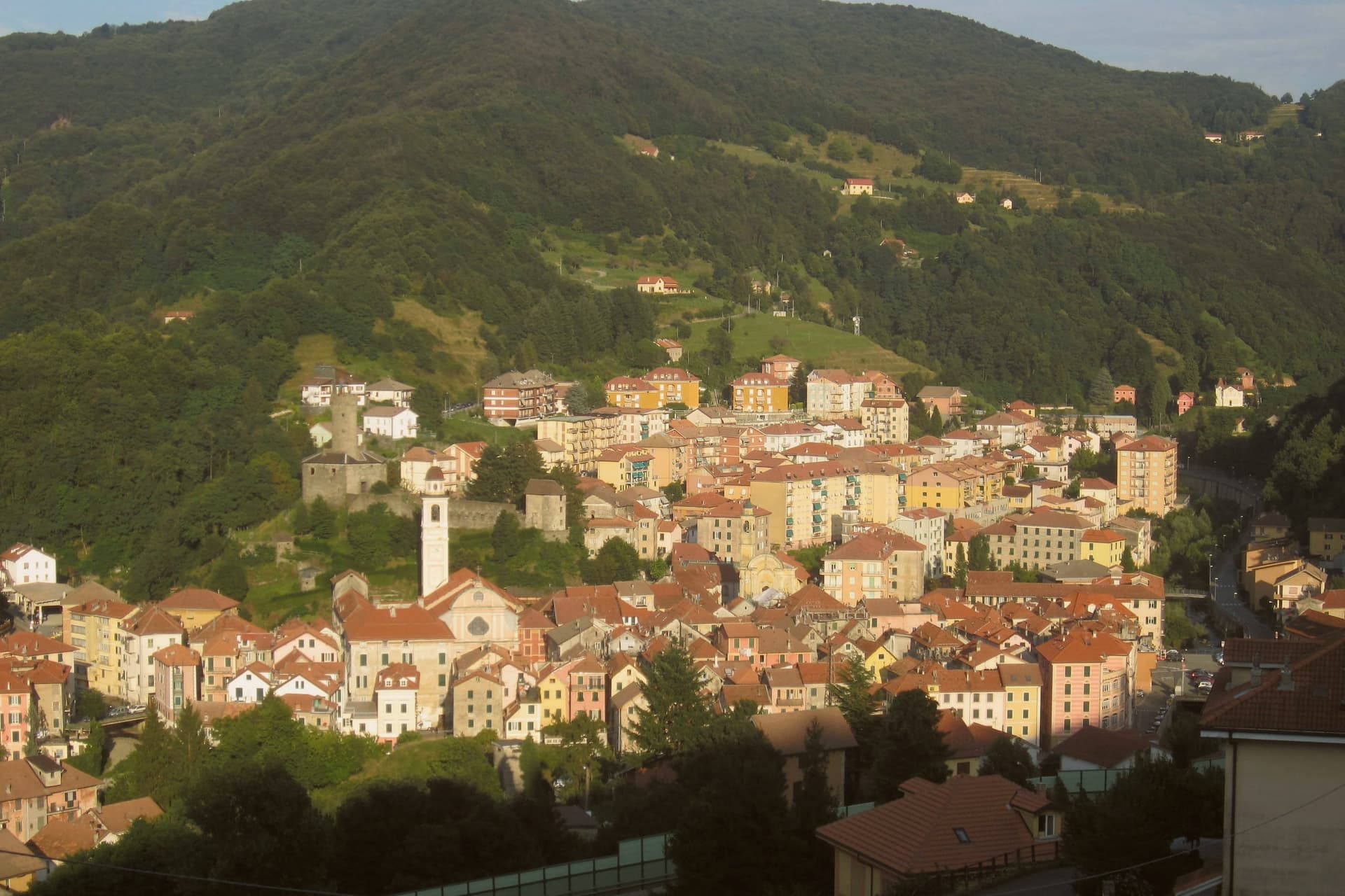
Why visit Campo Ligure
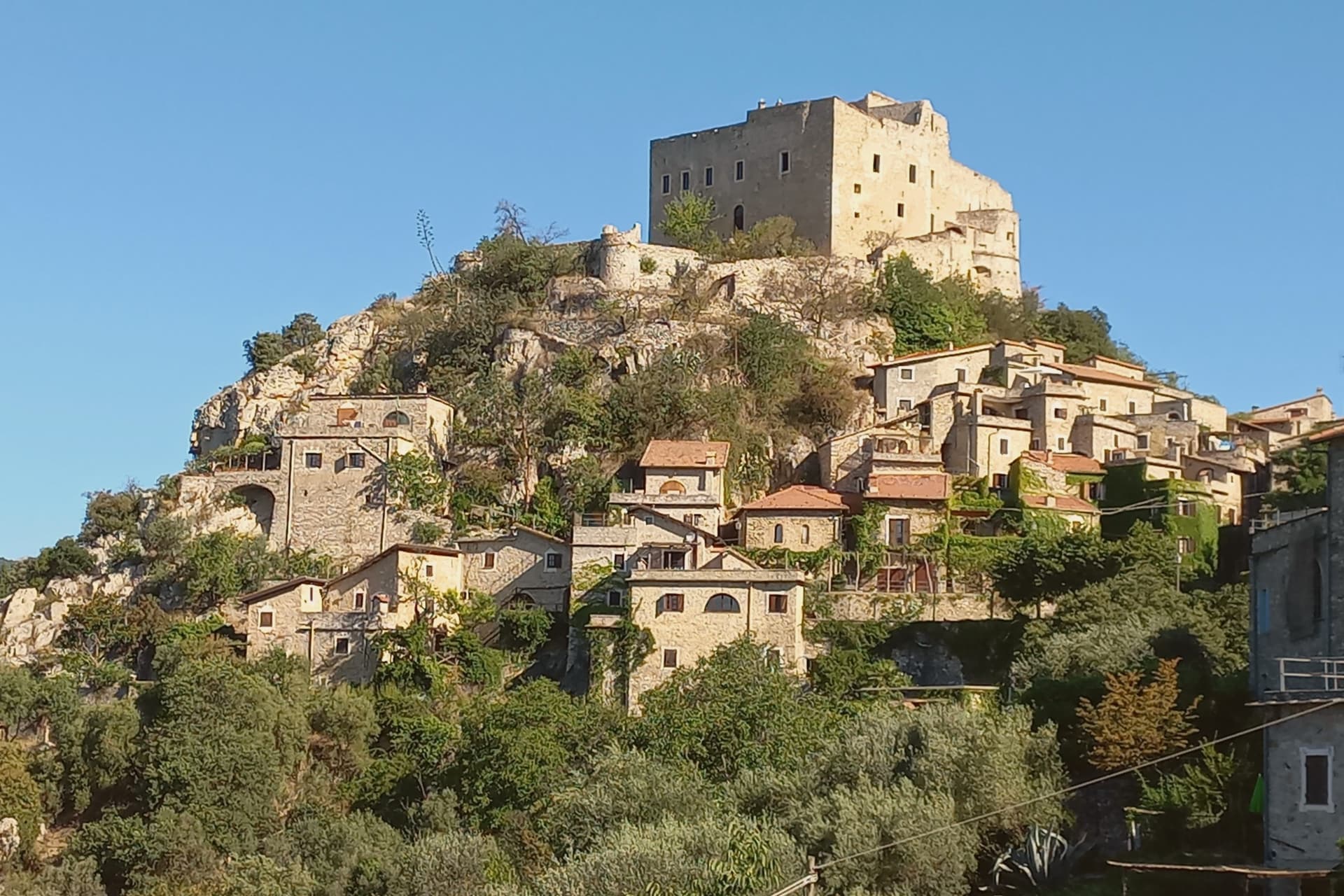
Campo Ligure sits on the right bank of the Stura at 342 meters, twenty-five kilometers north of Genoa where the Apennines start to climb. The Spinola family took the fief in the thirteenth century and built the hexagonal castle on the hill above the village; the cylindrical tower is more than twenty-two metres tall and six across.
The first filigree workshop opened in 1884. Within a generation Campo Ligure had become the national centre for the craft, fine gold and silver threads twisted with pliers called bruscelle and welded under a torch.
It remains the only working filigree centre in Italy. The Museo della Filigrana, founded in 1984 around the Pietro Carlo Bosio collection, holds filigree work from across the world.
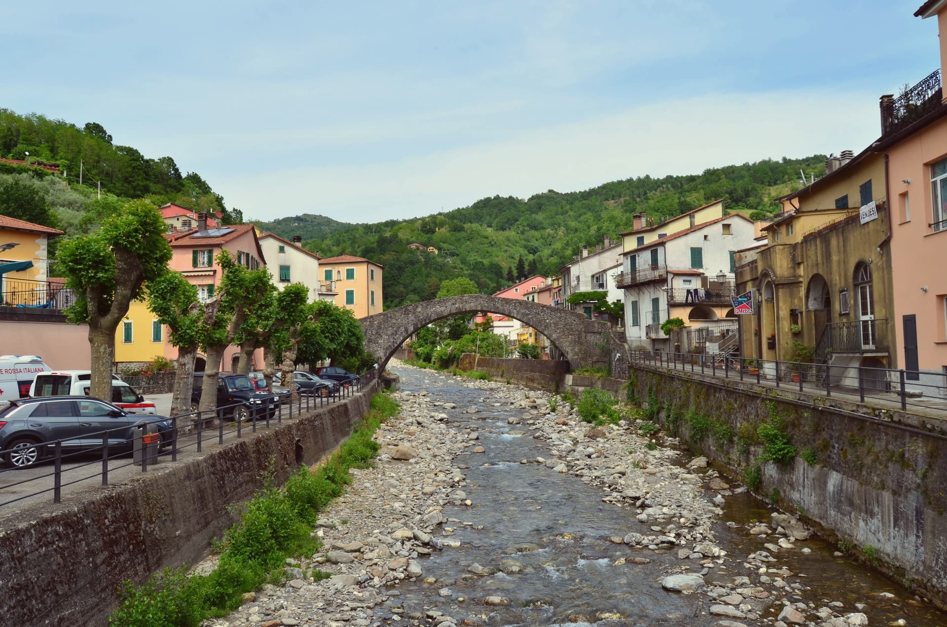
A medieval stone bridge over the Stura, originally ninth-century and rebuilt several times from the eighteenth century onward, anchors the lower end of the borgo.
What to see in Campo Ligure
- Castello Spinola. Twelfth and thirteenth-century hexagonal fortress on the hill above the village, cylindrical tower 22 metres tall, residence of the Spinola fief.
- Museo della Filigrana Pietro Carlo Bosio. Founded 1984 around the Bosio collection, filigree work from across the world, the only museum of its kind in Italy.
- Ponte medievale sullo Stura. Stone bridge over the Stura with ninth-century origins, rebuilt several times from the eighteenth century, marks the southern entrance to the borgo.
How to get to Campo Ligure
There is a railway station in the town, so you can arrive without a car and never need one while you are here. Genova is roughly 41 minutes away by road.
Our tip
May through October is the working window: the Stura runs clear, the trail network up into the Parco del Beigua opens, the filigree workshops keep their doors open for visitors. The Mostra della Filigrana in late August is the year's main draw, three days of open studios and demonstrations. July and August can touch 30 degrees in the valley but the 342-metre elevation keeps evenings cool.
Millesimo
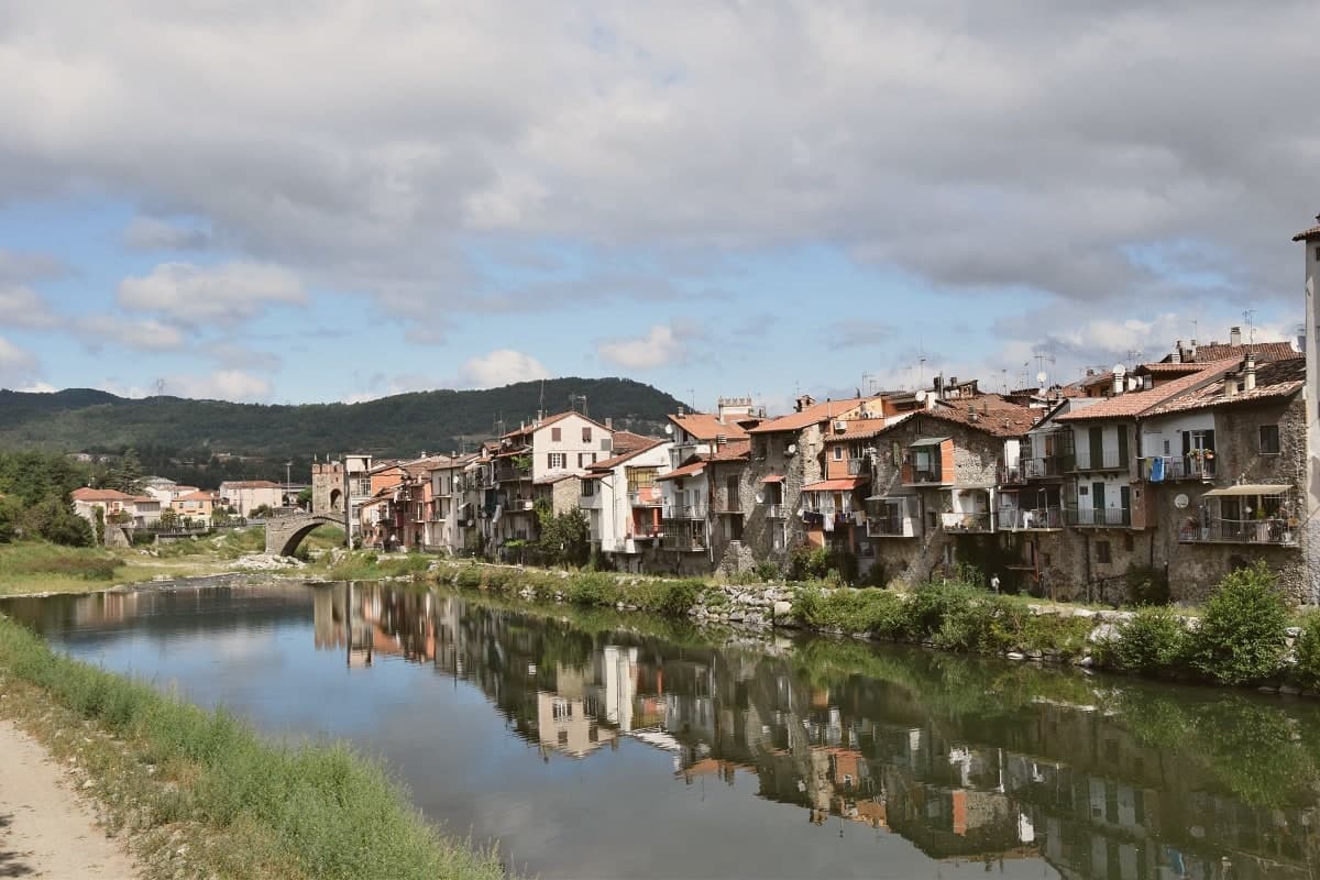
Why visit Millesimo
Millesimo sits sixty kilometers inland from Genoa, over the Apennine watershed, in the upper reaches of the valley that gives the wider area its name. Enrico II Del Carretto turned the village into a fortified borgo in 1206, and his successors raised the castle later in the same century on the high ground above the settlement.
The town itself grew on the right bank of the river below that castle, its stone houses laid out in a triangle around the central piazza, with the fortified bridge carrying the crossing at the valley floor and the pilgrimage sanctuary set apart on the outskirts as the valley's separate religious focus. More than three thousand casualties fell on each side when Napoleon Bonaparte defeated the combined Austro-Sardinian forces here on 13-14 April 1796, directing the campaign from the Del Carretto palazzo on the piazza that now serves as the town hall.
The pattern is one of a small defensive settlement whose river crossing, castle and family seat all sit within sight of each other, later put to use for a battle whose scale had nothing to do with the size of the place that hosted it.
What to see in Millesimo
- Ponte della Gaietta. The old fortified body still spans the river below the village, narrow enough that its defensive purpose is obvious from either bank.
- Castello Del Carretto. Tower, keep and east wall stand above the village on the high ground, the stronghold that gave the marquis line command of the valley approach.
- Palazzo Del Carretto. The family palazzo faces the central piazza and now serves as the town hall, its rooms the setting for the 1796 headquarters rather than a battlefield relic.
How to get to Millesimo
Genova is roughly 73 minutes away by road.
Our tip
April through June and September through October are the dry months in the upper Val Bormida. The interior of Liguria runs cooler than the coast at this elevation, with mild days and chilly evenings; the rivers run higher in spring after the watershed melt. July and August warm up but Millesimo's 429 meters stay tolerable. XXXIV Festa nazionale del tartufo della Val Bormida a Millesimo falls in October.
Gavi
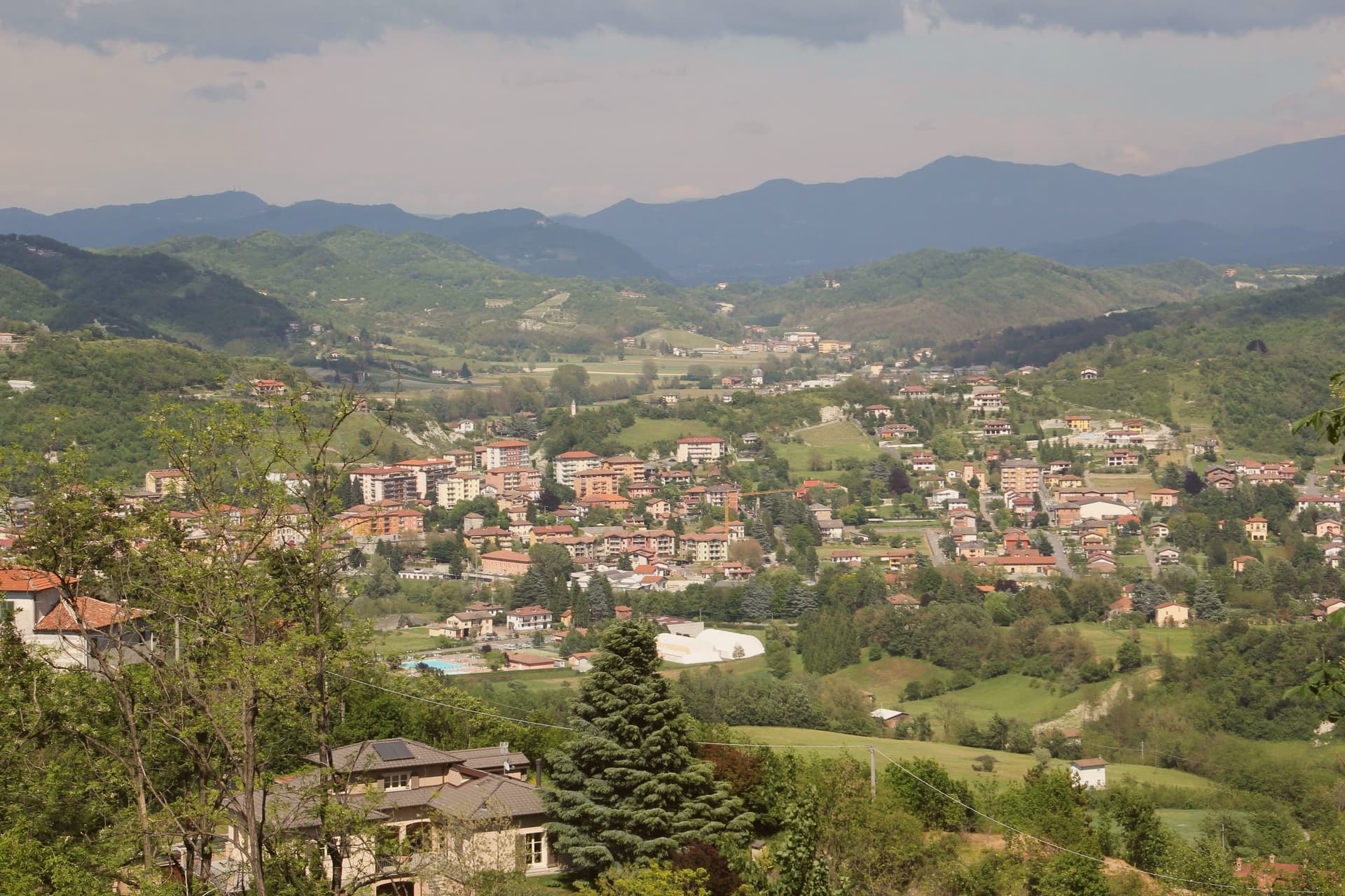
Why visit Gavi
Gavi sits at 233 meters where the Lemme stream meets the Rio Neirone, the southern edge of Piemonte before the Apennines drop to Genova. The first record of vines here is a 972 tribute paid to the Republic of Genoa, three Genoese pounds of wine.
The medieval town clusters along the narrow valley below the Forte di Gavi, a polygonal star fortress built and expanded by the Genoese between 1540 and 1673 on the foundations of a tenth-century castle. The fort fell to French-Savoyard troops in 1625 and was retaken in twenty-one days; under the Savoy it became a prison, then a prisoner-of-war camp for Austro-Hungarian and later Allied soldiers in both world wars.
Cortese di Gavi was made DOC in 1974 and DOCG in 1998. Wine from vines inside the commune may be labeled Gavi di Gavi, and the consortium maintains a separate denomination for grapes grown in the historic center.
What to see in Gavi
- Forte di Gavi. Polygonal star fortress on the hill above the town, built by the Genoese 1540 to 1673, later a Savoy prison and WWI/WWII POW camp.
- Chiesa di San Giacomo Maggiore. Romanesque parish church in the medieval center, with twelfth-century stonework and a baroque interior.
- Centro storico. Stone-house old town along the Lemme stream, arcaded streets and small piazzas framed by terraced vineyards.
How to get to Gavi
Genova is roughly 54 minutes away by road.
Our tip
April through October is the year. May and June bring green hills and the Lemme running clear; September and October are dry, with the harvest and the first cool nights. July and August touch the high twenties; the Forte di Gavi closes its tower walks in the afternoon heat. Gavi sotto il Forte falls in July.
Ovada
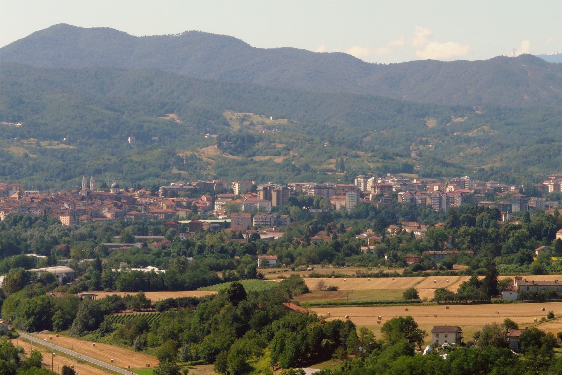
Why visit Ovada
Ovada sits at 186 meters at the confluence of the Orba and the Stura, in the southern Monferrato hills, 35 kilometres north of Genova on the old salt road between the port and the Po plain. The painted façades and the tall narrow houses still show the imprint of the Republic of Genoa, which held the town through the Middle Ages alongside the Marquises of Monferrato.
Dolcetto from the Ovadese hills was already commercialised in the Lombard period (seventh and eighth century) and was the first Dolcetto in Piemonte to win DOC status, in 1972; the DOCG for Ovada Superiore came in 2008. The Chiesa Parrocchiale di Nostra Signora Assunta, with its two twin bell towers, was designed by Gio Antonio Delfrate after the Genoese Basilica di Santa Maria delle Vigne, built from 1772 to 1781 and consecrated in 1801.
The Capuchin church was built from 1640 after a plague vow of 1631 and suppressed under Napoleon in 1810. Ovada carries Città del Vino.
What to see in Ovada
- Chiesa Parrocchiale di Nostra Signora Assunta. Twin-bell-tower parish church built 1772–1781 by Gio Antonio Delfrate, modelled on Santa Maria delle Vigne in Genova, consecrated 1801.
- Loggia di San Sebastiano. Medieval loggia, the original parish church of Ovada dedicated to Santa Maria, now used as a venue for cultural events.
- Chiesa dell'Immacolata Concezione (Cappuccini). Capuchin church begun in 1640 after a 1631 plague vow, single nave with two side chapels, suppressed in 1810 under Napoleon's ecclesiastical decree.
How to get to Ovada
There is a railway station in the town, so you can arrive without a car and never need one while you are here. Genova is roughly 47 minutes away by road.
Our tip
April through June is the green window in the Ovadese hills, vines breaking bud and the rivers running off the Ligurian Apennines. July and August touch the mid-thirties; the centro storico thins after lunch and the Orba pools become bathing spots for residents. September and October are the harvest months, the entire Ovada DOCG zone working through vendemmia, and the cantine open for tasting.
More from Anywhere Italy
 The 10 best hill towns within 90 minutes of Genova
 The best small towns inside a nature park in Liguria
 The 6 best hill towns in the province of Alessandria
 The best hill towns within 90 minutes of Milan
- The prettiest villages inside a nature park in Liguria
 The best towns known for their meat within two hours of Genoa