
Mountain towns
Mountain towns in Basilicata
13 towns
Towns inside a named range: the Alps, the Dolomites, the Apennines, the Pollino, the Aspromonte. Around 800 metres and up, where the season decides the trip.
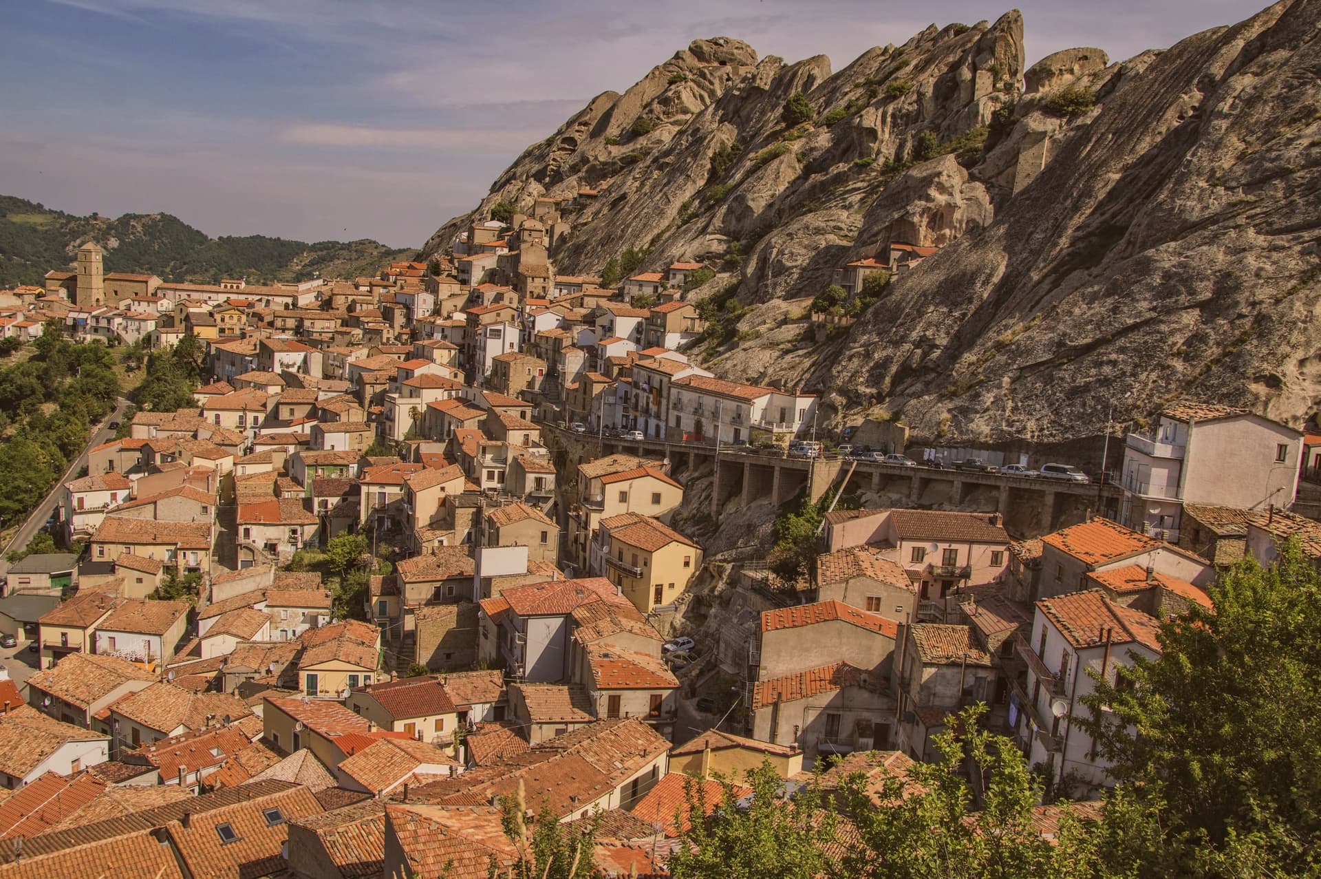
Pietrapertosa
Province: Potenza · 1,088 m
Basilicata's highest commune at 1,088 meters, built into the Lucanian Dolomites with a Saracen rock-cut fortress and a 1,400-meter zipline to Castelmezzano.
Viggiano
Province: Potenza · 975 m
A 975-meter Val d'Agri ridge town, home of the Black Madonna of Lucania and the Italian folk harp, on Europe's largest onshore oil field.
Sasso di Castalda
Province: Potenza · 949 m
A 949-meter village in the Lucanian Apennines whose emigrants produced the engineer who launched Apollo 11, now crossed by a 300-meter Tibetan footbridge.
Terranova di Pollino
Province: Potenza · 926 m
At 926 meters on the Lucanian side of the Pollino, the gateway into Italy's largest national park, home of the Sarmento red potato.
Latronico
Province: Potenza · 888 m
A mountain town at 888 meters on the northern edge of the Pollino, with two prehistoric thermal springs at the Calda hamlet below.
San Fele
Province: Potenza · 872 m
A stone village at 872 meters between two peaks, where a 969 fortress and ten waterfalls along the Bradano still define the place.
Acerenza
Province: Potenza · 833 m
A walled ridge town at 833 meters in the north Lucanian hills, archbishopric since 1068 under a Romanesque cathedral begun in 1080.
Accettura
Province: Matera · 770 m
A 770-meter village in the Gallipoli Cognato park where, each Pentecost, a Turkey oak is married to a holly tree.
Castelmezzano
Province: Potenza · 750 m
A medieval village wedged into sandstone teeth at 750 meters, linked to Pietrapertosa by a 1,452-meter zipline since 2007.
Calvello
Province: Potenza · 730 m
A 730-meter ceramic town working clay since 1200, when Benedictines from Faenza brought the wheel south.
Guardia Perticara
Province: Potenza · 678 m
The stone village at 678 meters above the Sauro valley, rebuilt block by block in Gorgoglione sandstone after the 1980 earthquake.
Lagonegro
Province: Potenza · 666 m
A 666-meter town founded by Byzantine monks on a defensive promontory, split between a medieval castle village and a modern square below.
Rotonda
Province: Potenza · 626 m
The Pollino park's Lucanian gateway: a 3,171-resident borgo at 626m on the Basilicata/Calabria border, headquarters for the Parco Nazionale del Pollino, Italy's largest national park, with the Loricato pine forests immediately above town.
The slow-trip planner
Plan a slow trip across the towns travelers skip.
Answer five questions. We will shape a geographically coherent slow trip from the 1,000 Italian towns most travelers skip. Yours to save and share.
From elsewhere in Italy
Five more towns to discover
Visso
Province: Macerata
The northern Sibillini gate at 607 meters where the Nera meets the Ussita, holding one of two surviving manuscripts of Leopardi's L'Infinito.
Goriano Sicoli
Province: L'Aquila
At 720 meters in the Subequana valley, a medieval village drawn by M.C. Escher in 1929 keeps a May ritual folklorists trace to Demeter.
Ugento
Province: Lecce
A Messapian-Roman town five kilometers from the Ionian, where a Baroque castle sits on the walls of the ancient city of Ozan.
Fontanellato
Province: Parma
A Parma-plain town built around the Rocca Sanvitale, the moated fortress at its center.
Pescina
Province: L'Aquila
A Marsica town at 735 meters, on the rim of the drained Fucino basin, that lost five thousand of six thousand people in a single morning in 1915.