The best wine towns within an hour of Brescia
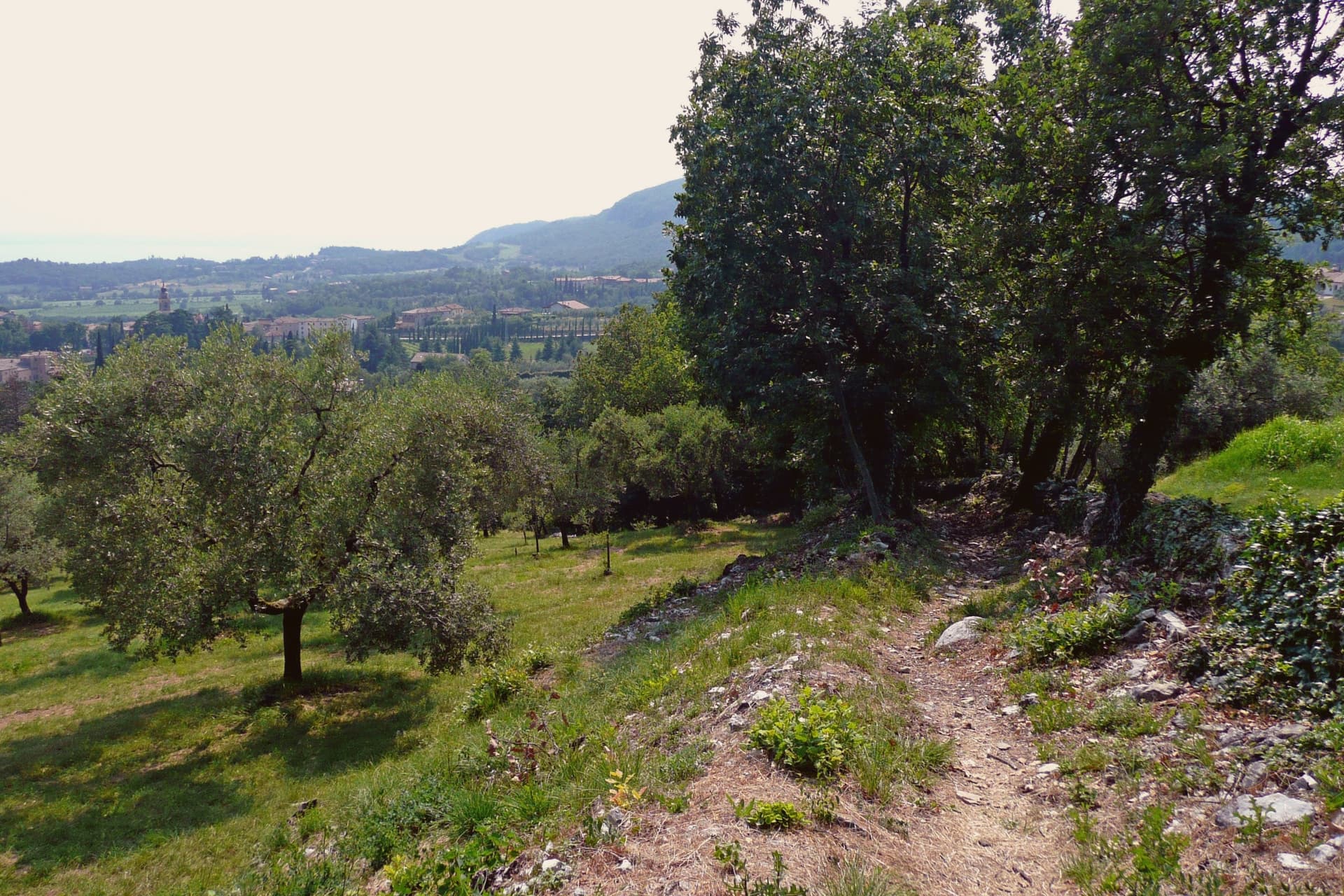
The land east and south of Brescia rises in low glacial hills, gravel and moraine left behind by the ice, and it turns out to be very good for vines. Bardolino comes off these slopes pale and cherry-scented, drunk cold in summer with lake fish; Custoza is the white grown further inland towards the Mincio, and above Lake Iseo the bottle-fermented sparkling wine of Franciacorta ages in cellars cut into the hillside. Autumn is the season to come, when the vendemmia empties the villages into the rows and the cantine open their doors to anyone who knocks. The old houses here are built of pale local stone and river cobble, roofed in curved tiles the colour of terracotta pots, with cypresses marking the drive up to each estate.
Most people arriving on this stretch of Garda go to Sirmione, out along its narrow peninsula, for the Scaliger castle and the Roman ruins at the tip. It is a fine place and thoroughly known, which means the causeway backs up from mid-morning, the lakefront tables are booked, and the walk to the Grotte di Catullo becomes a queue in July and August. Verona, less than an hour away, sends coach parties in both directions all summer.
The vineyards do not stop where the crowds do. The same moraine hills carry on north along the Garda shore, west towards the Franciacorta cellars, and south into the flat fields around the Mincio, and the towns that sit in those production zones see far fewer visitors than the peninsula does. These are the places where the wine is made rather than simply poured, and they are worth the detour inland.
Of the 26 communes we have mapped in a one-hour drive of Brescia, 6 qualify as wine towns: each sits inside the production zone of a protected wine. The smallest, Costermano sul Garda, has 3,974 residents.
Elsewhere in the catalogue: The best wine towns within 75 minutes of Trento and The best wine towns within two hours of Bolzano.
Costermano sul Garda
Why visit Costermano sul Garda
The commune sits on a moraine amphitheater twenty-five kilometers northwest of Verona. The hills were a feud of the Brescia monastery of Santa Giulia in the early Middle Ages, then passed through Scaliger and Venetian rule before joining Italy in 1866; the name sul Garda was added only in 2018, to anchor the town's tourism identity to the water it sits above rather than on.
That distinction matters here: this is not a lakefront village but a hill settlement looking down at the shore, its center, its cemetery hill, and its vineyard slopes arranged around the belvedere at Marciaga rather than around a harbor. The economy runs on olive oil and hillside vines, and on the holiday accommodation that has filled these slopes since the 1970s, but the single largest reason people come here is not agricultural.
The cemetery holds the dead of a war fought decades after the monastery's feud and centuries after the Scaliger lords, and it sits on the same morainal hill as the sanctuary, the parish church, and the vine rows, a place where the working landscape and the memorial landscape occupy the same short walk rather than separate zones.
La Casa degli Spiriti, Osteria dai Coghi have been named by a guide.
What to see in Costermano sul Garda
- Santuario della Madonna del Castello. Sanctuary on the spur of Marciaga, its fifteenth-century frescoes intact, with a terrace looking over Lake Garda and the eastern shore.
- Deutsche Soldatenfriedhof. The graves cover the hillside above the lake, laid out since 1967 for the dead of the Second World War, a place kept in silence rather than commentary.
- Chiesa di San Siro. Parish church rebuilt in the nineteenth century in the center of the village, its freestanding campanile visible from the surrounding slopes, with a sightline to Monte Baldo across the water.
How to get to Costermano sul Garda
There is a railway station in the town, so you can arrive without a car and never need one while you are here. Verona is roughly 34 minutes away by road.
Our tip
April through October is the working window. April and May bring the lake back to swimming temperature on the shore four kilometers below, and the morainal hills into wildflower. June through August fills the holiday rentals and the lakefront day-traffic from Garda and Bardolino; the hills stay a few degrees cooler than the shore.
Lazise
Why visit Lazise
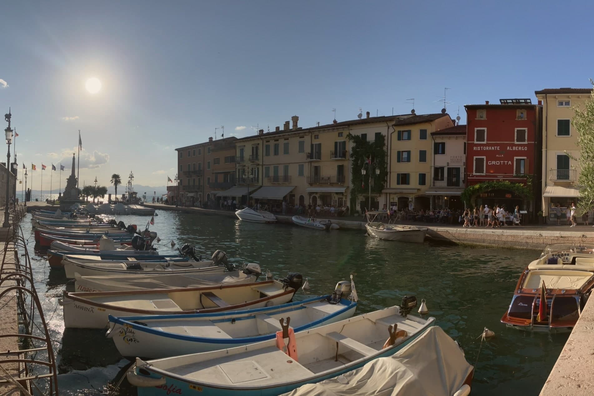
Lazise sits at 76 meters on the southeastern shore of Lake Garda, twenty kilometers northwest of Verona. The first walls went up shortly after the 983 charter; Venice took the town in 1405 and held it until Napoleon arrived in 1796, and Porta Lion, on the south, still carries the winged lion of Saint Mark from that period of rule.
The castle anchors the southern corner of the fortifications while the harbor sits enclosed within their reach, and the church and the customs house both face onto that same stretch of water, one built for worship and later pressed into use as a warehouse, the other built outright for Venice to tax what passed through the port. Behind the town, the morainic hills carry the vines of the Bardolino DOC, and Lazise counts itself among the Veneto's wine and honey communes.
The town reads, in short, as a small fortified port whose walls, harbor and customs works were all built to serve and guard the same trade on the same shore.
What to see in Lazise
- Castello Scaligero. Rectangular fortress at the south corner of the walls, with five square towers and a fortified dock built for the lake galleys, facing Lake Garda.
- Mura medievali. Thirteen surviving towers and three gates, San Zeno, Nuova and Lion, ring the old town along the shore of Lake Garda.
- Chiesa di San Nicolò. Romanesque church on the harbor, with frescoes attributed to the Giotto school and a former function as a customs warehouse.
How to get to Lazise
Verona is roughly 36 minutes away by road.
Our tip
April through June and September through October are the right months for Lazise. The walled centro storico stays cool from the lake breeze, the harbor fills with sailboats, and the Bardolino hills behind the town are green in spring and gold in October. July and August are warm and very crowded: the southern Garda shore concentrates more than half of the lake's tourist beds, and the gates of Lazise queue from morning.
Bardolino
Why visit Bardolino
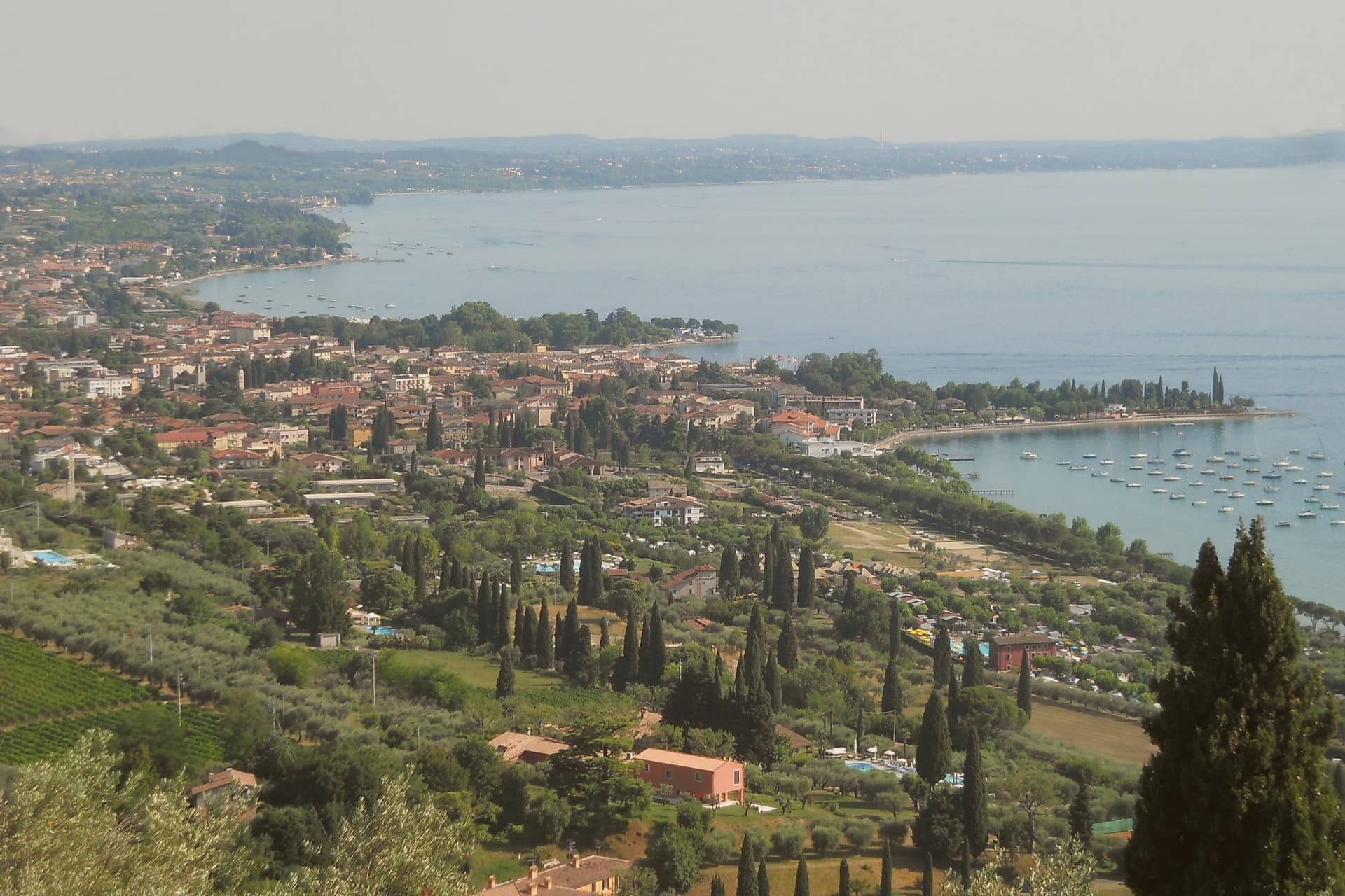
Bardolino sits on the eastern shore of Lake Garda at 65 meters, twenty-five kilometers northwest of Verona. The hills behind town have been planted with vines since the Roman period, and the modern DOC was granted in 1968.
Three grapes do the work: Corvina, Rondinella and Molinara. Long maceration produces Bardolino, the light red the town has lived on since the nineteenth century; short skin contact produces Chiaretto, the rosé that has overtaken the red in current sales.
Two churches hold the medieval line. San Zeno in the centro storico is ninth-century, one of the oldest in the province of Verona.
San Severo, built between the late eleventh and early twelfth centuries on the foundations of an earlier church mentioned in an 893 charter of Berengario, is the town's Romanesque anchor. The lakefront has been a tourist promenade since the 1950s.
The Palio del Chiaretto runs the first weekend of June; the Festa dell'Uva e del Vino runs the first week of October.
Il Giardino delle Esperidi, La Veranda del Color have been named by a guide.
What to see in Bardolino
- Chiesa di San Severo. Romanesque church built between the late eleventh and early twelfth centuries on the foundations of a structure mentioned in a 893 charter.
- Chiesa di San Zeno. Ninth-century church in the centro storico, one of the oldest in the province of Verona, on a Latin cross plan with a small apse.
- Centro storico. Walled medieval core around Piazza Matteotti, with arcaded streets dating to the Venetian period from the fifteenth century.
How to get to Bardolino
There is a railway station in the town, so you can arrive without a car and never need one while you are here. Verona is roughly 36 minutes away by road.
Our tip
April through October is the working season. April and May bring the lake back to swimming temperature and the Romanesque churches at their quietest. June through August fills the lungolago with German and Austrian visitors; weekends are crowded, weekday mornings still manageable. Bardolino Freddo falls in August.
Iseo
Why visit Iseo
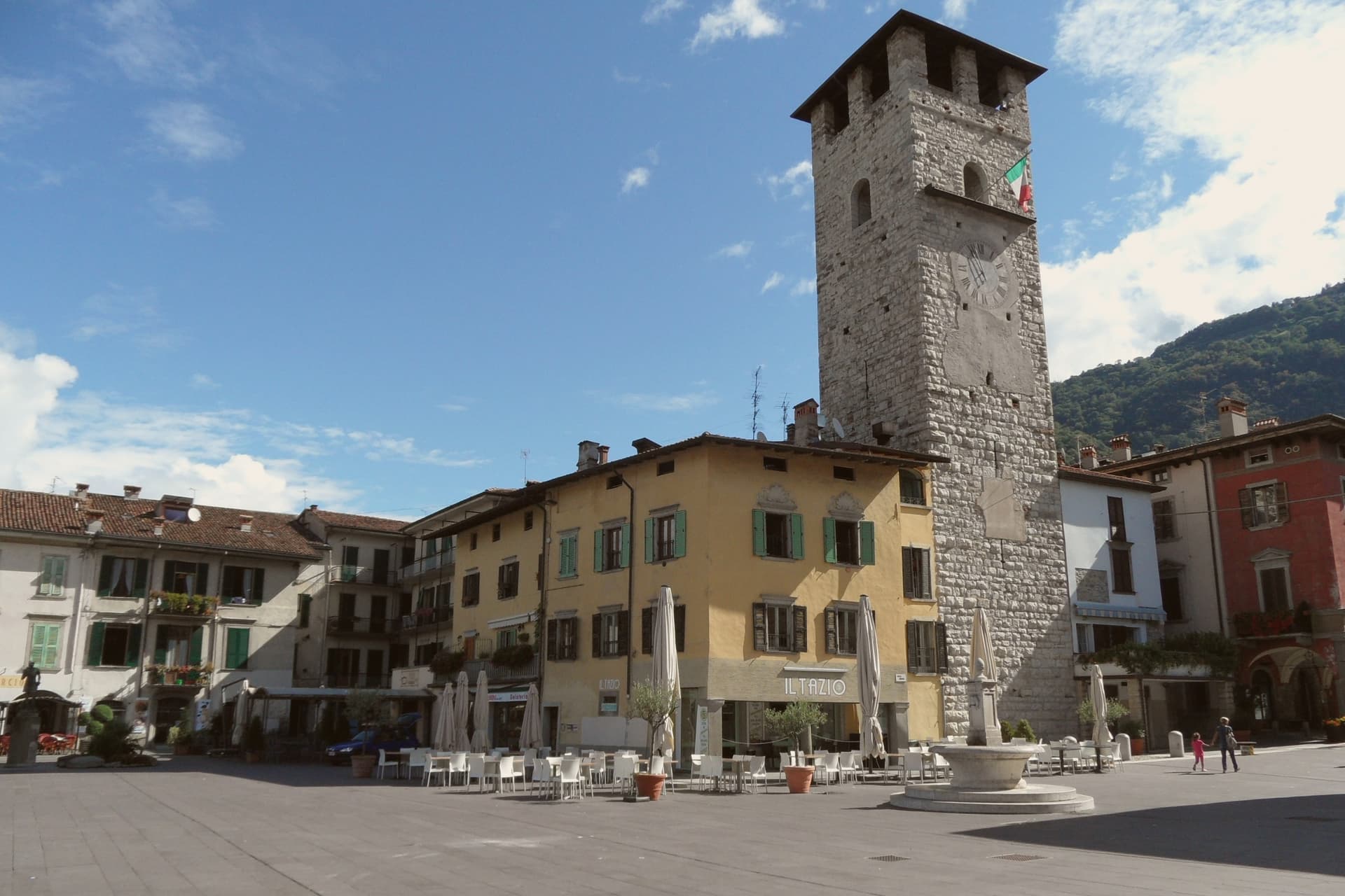
Iseo sits at 198 meters on the southeast shore of Lake Iseo, the fourth-largest lake in Lombardia, fed by the Oglio. The town was founded around a monastery in the 900s and grew under the Sozzi, the Isei, and finally the Oldofredi.
From 1428 to 1797 Iseo was part of the Republic of Venice. The lakefront and the vineyards to the south form the town's two working halves: one facing the water and the ferries that cross it, the other rising into the Franciacorta hills where the metodo classico grapes are grown.
Ferries from the lakefront connect to Monte Isola, the largest lake island in southern Europe, and to Sarnico across the water in Bergamo province. A lake town that turned its inland edge to wine and its waterfront to the island: the two directions, water and vineyard, still define how the town is used.
Radicì, Izé Restaurant dell'Hotel Araba Fenice, Trattoria del Muliner 1964 and 1 more have been named by a guide.
What to see in Iseo
- Castello Oldofredi. The stone fortress stands above the lakefront, its walls facing the water rather than the town center, a reminder that it was built to watch the lake approach.
- Pieve di Sant'Andrea. Founded by Bishop Vigilio, the church keeps its bell tower set into the middle of the façade rather than beside or behind it, an arrangement rare among Lombard Romanesque buildings.
- Piazza Garibaldi. Main lakeside square with the first Italian statue of Garibaldi, erected in 1883, the year after his death.
How to get to Iseo
There is a railway station in the town, so you can arrive without a car and never need one while you are here. Brescia is roughly 28 minutes away by road.
Our tip
April through October runs Iseo's lake season. April and May open the ferries to Monte Isola, the Franciacorta wineries reopen for tastings, and the lakefront fills on weekends. June through August is the peak window: warm enough to swim, hot enough that the centro empties between 14:00 and 17:00, and the lake breeze keeps evenings comfortable.
Peschiera del Garda
Why visit Peschiera del Garda
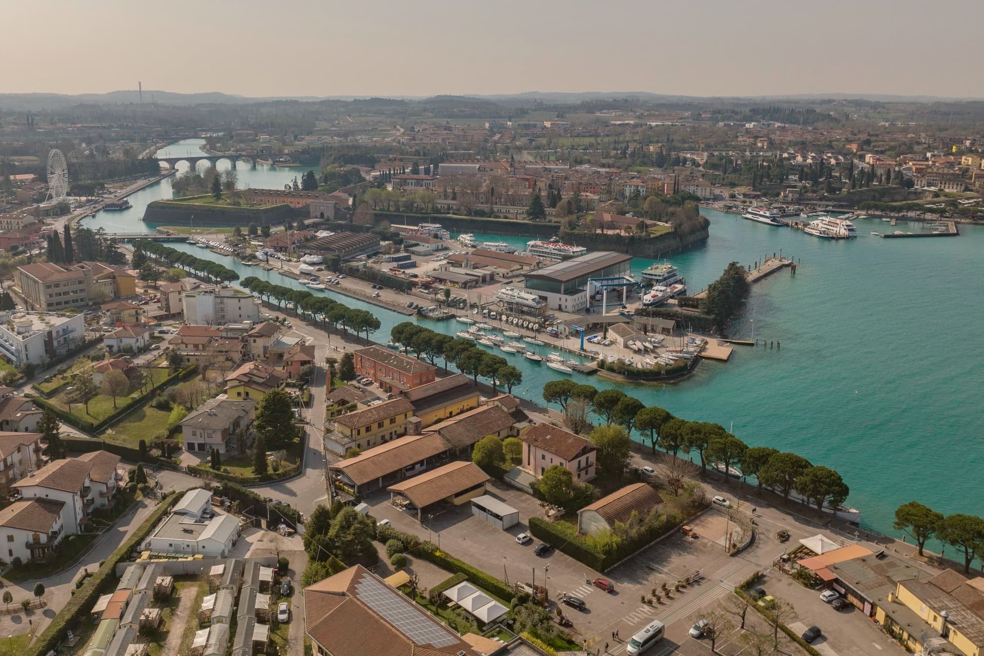
Peschiera sits at 68 meters on the Mincio at the point where the river leaves Lake Garda, twenty-five kilometers west of Verona. The Romans called it Ardelica.
The town the Republic of Venice rebuilt in 1549 was set on the medieval walls' corners, with a moat fed by the river, and the design came from Guidobaldo della Rovere before its execution on site. Austria took the town in 1815 and folded it into a wider system with Verona, Mantua and Legnago, the four together holding Lombardy-Venetia until 1866; Peschiera held the northwest corner of that arrangement, the point closest to the lake.
The fortress and the marsh settlement belong to different periods and different UNESCO listings, one Bronze Age and lakeside, one sixteenth-century and defensive, but both sit on the same stretch of water where the Mincio gathers itself before running south. The river itself is the town's organizing fact: it leaves the lake, splits into three canals to cross the walls, and rejoins below the railway bridge.
What Peschiera adds up to is a place built twice on the same threshold, where a lake becomes a river and a river becomes a border worth fortifying.
Osteria Bakarè have been named by a guide.
What to see in Peschiera del Garda
- Mura veneziane. Pentagonal fortress designed by Michele Sanmicheli for Venice from 1549, with five bastions, a moat fed by the Mincio and three water gates.
- Canali del Mincio. Three canals cross the fortress and rejoin below the railway bridge; the central one runs through the main square inside the walls.
- Piazza Ferdinando di Savoia. Main square inside the walls, bordered by the Palazzo del Comando, the Voltoni arches over the Mincio and the Caserma Catterin.
How to get to Peschiera del Garda
There is a railway station in the town, so you can arrive without a car and never need one while you are here. Verona is roughly 30 minutes away by road.
Our tip
April through June and September through October are the strongest months in Peschiera. The fortress walls, the moat and the Mincio canals are at their clearest in spring and autumn, and the lakefront south of the walls fills with sailing and ferry traffic. July and August push past thirty degrees and the southern Garda concentrates much of the lake's day-trip volume; the parking lots around the railway station queue from midmorning.
Valeggio sul Mincio
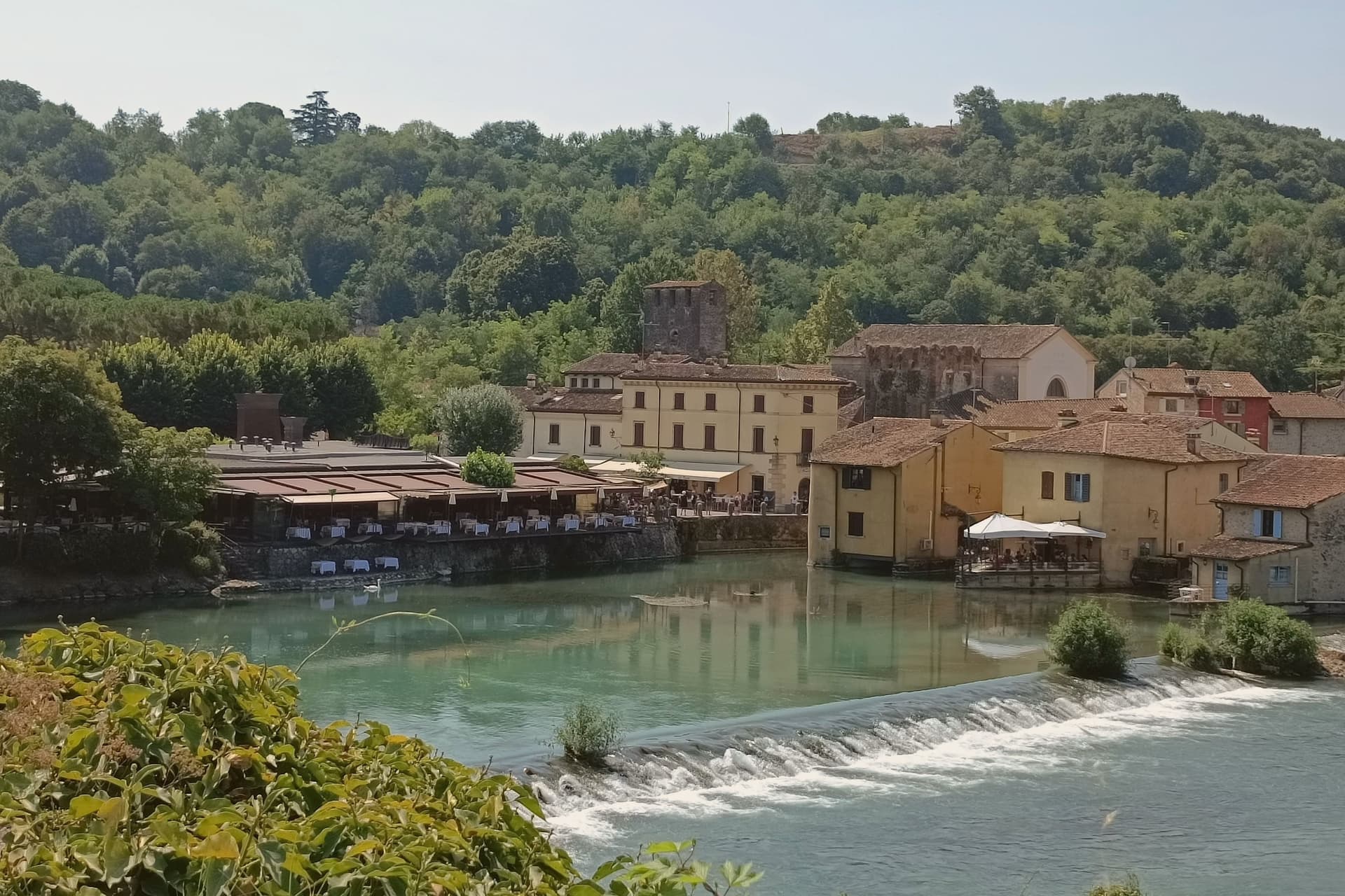
Why visit Valeggio sul Mincio
Valeggio sul Mincio sits at 88 meters on the morainic hills shaped by the Garda glaciers, twenty kilometers southwest of Verona and ten kilometers from the southern end of Lake Garda. The Mincio cuts north-south through the commune and was the Veneto-Lombardy military frontier for centuries.
The frazione of Borghetto on the river is one of I Borghi più belli d'Italia, a single line of houses and water mills along the left bank under the Castello Scaligero. The fortified Ponte Visconteo, built in 1393 by Gian Galeazzo Visconti of Milan as part of the sixteen-kilometer Serraglio defensive line, is 650 meters long and 25 meters wide and still spans the valley above the village.
The local pasta is the Nodo d'Amore, an oversize hand-rolled tortellino with meat filling; the third Tuesday of June it is served to four thousand diners at a single table laid across the Visconti bridge. The Parco Giardino Sigurtà, a sixty-hectare landscape garden two kilometers north, draws over half a million visitors a year, peaking with the Tulipanomania bloom in April.
Ristorante Antica Locanda Mincio, Alla Borsa have been named by a guide.
What to see in Valeggio sul Mincio
- Borghetto sul Mincio. Riverside hamlet on the left bank of the Mincio, one of I Borghi più belli d'Italia, with surviving water mills and a single arcaded line of houses.
- Ponte Visconteo. Fortified bridge-dam built in 1393 by Gian Galeazzo Visconti, 650 meters long and 25 wide, anchor of the Serraglio defensive line.
- Castello Scaligero. Della Scala fortress on the hill above Borghetto, built in the thirteenth century as the southern hinge of the Verona defensive line.
How to get to Valeggio sul Mincio
Verona is roughly 34 minutes away by road.
Our tip
April through June and September through October are the working months. April brings Tulipanomania at Parco Sigurtà and Borghetto on the river at its quietest. May and June fill the gardens and the bridge with weekend visitors; the Festa del Nodo d'Amore on the third Tuesday of June draws four thousand diners onto the Visconti bridge.