
The best wine towns within 90 minutes of Padua
The Veneto grows more protected wine than almost anywhere in Italy, and the landscape shifts every half hour of driving. North of Treviso the glera vines run in steep ribbons over hogback hills, cut by cypress and stone farmhouses, and the spring pruning gives way to a September harvest that fills the lanes with tractors. West, above Verona, the Valpolicella terraces dry their corvina grapes in lofts through the autumn for amarone, and the cooking follows: risotto all'amarone, pastissada, hard grana to chew between glasses. On the Garda shore the soil turns to glacial moraine, the wine goes pale red and pink, and lunch is lake fish grilled plainly with oil and lemon.
Most people arriving in the region make for Verona, then take the lake ferries from Sirmione, and the summer queues along that stretch are long enough to swallow a whole day. The city earns its crowds, but its wine bars pour from a hinterland few of those visitors ever drive into. Weekend cellar-door traffic concentrates on a small number of famous names with car parks and English tasting menus.
The vineyards do not stop where the coach tours turn around. The same protected zones continue up the Soligo valley, along the moraine ridges behind Garda, and into the hills below the Piave, and that is where the towns in this list sit. Each one falls inside the production area of a named wine, which means growers, cooperatives and osterie that serve the local bottle as the house pour. From Padua, all of them are within a morning's drive.
Of the 38 communes we have mapped in a 90-minute drive of Padua, 13 qualify as wine towns: each sits inside the production zone of a protected wine. This list is 10 of them. The smallest, Follina, has 3,535 residents.
Two more lists worth reading alongside this one: The best towns with a World Heritage site in the province of Treviso and The best wine towns within 75 minutes of Venice.
Follina
Why visit Follina
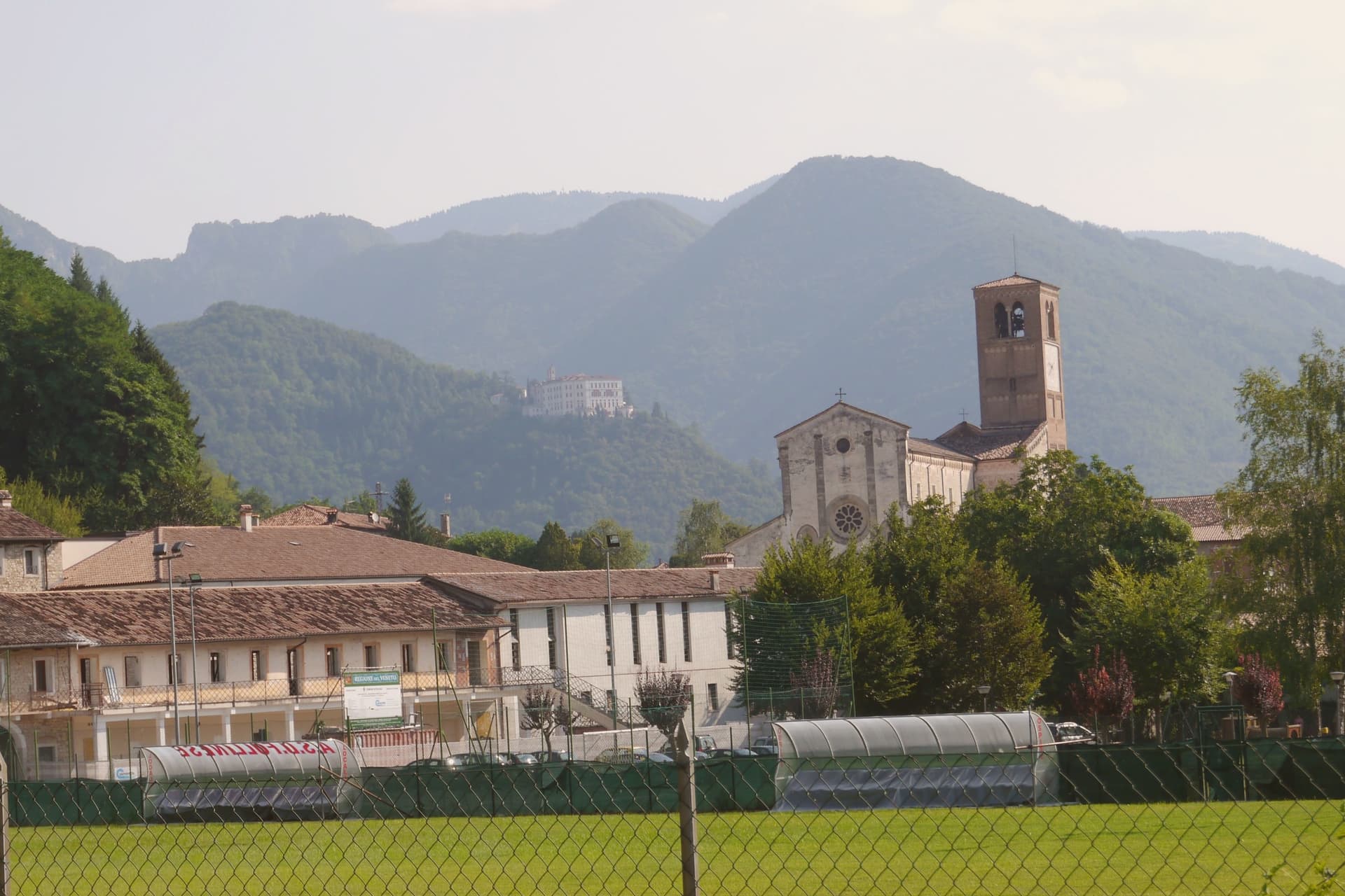
Follina sits at 191 meters where a stream cuts out of the Treviso Prealps into the upper Prosecco hills, sixty-five kilometers northwest of Padova. The name comes from follare, to full wool, and the Sanavalle stream powered fulling mills here from antiquity through the nineteenth century.
A monastic complex existed before the Cistercians arrived in the mid-twelfth century, likely a Benedictine house dependent on San Fermo di Verona. The Cistercians built the Abbey of Santa Maria from 1170; the cloister was completed in 1268.
The abbey is now a minor basilica and parish seat, a national monument since 1921, with frescoes of the Veneto-Byzantine school in the chapter house and a thirteenth-century stone Madonna inside the church. The Brandolini family, lords of nearby Cison di Valmarino, used Follina as a textile center through the Venetian period.
The borgo carries five institutional signals at once. The frazione of Pedeguarda holds the older parish church; the centro of Follina runs along the abbey wall and the stream that powered the mills.
La Corte, Osteria dai Mazzeri, Al Castelletto have been named by a guide.
What to see in Follina
- Abbazia di Santa Maria. Cistercian abbey built from 1170, with the cloister completed in 1268, raised to minor basilica and a national monument since 1921.
- Chiostro dell'Abbazia. Cistercian cloister of 1268, with twin colonnettes, sculpted capitals and a central well, intact in its medieval form.
- Sala del Capitolo. Abbey chapter house with frescoes of the Veneto-Byzantine school from the late thirteenth and early fourteenth centuries.
How to get to Follina
Venezia is roughly 73 minutes away by road.
Our tip
April through October is the working season. April and May bring the abbey gardens into bloom and the Prosecco hills into green; September and October bring harvest and the gold light the Rive belt is built on. July and August push into the low thirties and the centro empties in the afternoon, though the cloister stays cool.
Costermano sul Garda
Why visit Costermano sul Garda
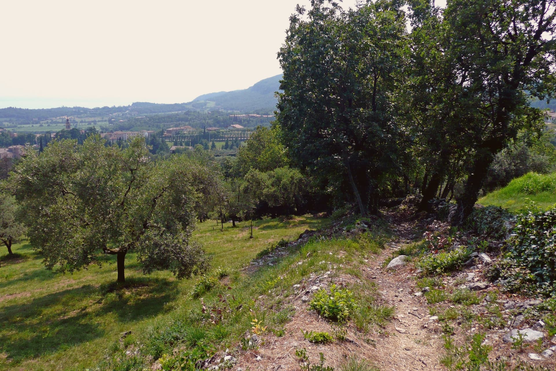
The commune sits on a moraine amphitheater twenty-five kilometers northwest of Verona. The hills were a feud of the Brescia monastery of Santa Giulia in the early Middle Ages, then passed through Scaliger and Venetian rule before joining Italy in 1866; the name sul Garda was added only in 2018, to anchor the town's tourism identity to the water it sits above rather than on.
That distinction matters here: this is not a lakefront village but a hill settlement looking down at the shore, its center, its cemetery hill, and its vineyard slopes arranged around the belvedere at Marciaga rather than around a harbor. The economy runs on olive oil and hillside vines, and on the holiday accommodation that has filled these slopes since the 1970s, but the single largest reason people come here is not agricultural.
The cemetery holds the dead of a war fought decades after the monastery's feud and centuries after the Scaliger lords, and it sits on the same morainal hill as the sanctuary, the parish church, and the vine rows, a place where the working landscape and the memorial landscape occupy the same short walk rather than separate zones.
La Casa degli Spiriti, Osteria dai Coghi have been named by a guide.
What to see in Costermano sul Garda
- Santuario della Madonna del Castello. Sanctuary on the spur of Marciaga, its fifteenth-century frescoes intact, with a terrace looking over Lake Garda and the eastern shore.
- Deutsche Soldatenfriedhof. The graves cover the hillside above the lake, laid out since 1967 for the dead of the Second World War, a place kept in silence rather than commentary.
- Chiesa di San Siro. Parish church rebuilt in the nineteenth century in the center of the village, its freestanding campanile visible from the surrounding slopes, with a sightline to Monte Baldo across the water.
How to get to Costermano sul Garda
There is a railway station in the town, so you can arrive without a car and never need one while you are here. Verona is roughly 34 minutes away by road.
Our tip
April through October is the working window. April and May bring the lake back to swimming temperature on the shore four kilometers below, and the morainal hills into wildflower. June through August fills the holiday rentals and the lakefront day-traffic from Garda and Bardolino; the hills stay a few degrees cooler than the shore.
Farra di Soligo
Why visit Farra di Soligo
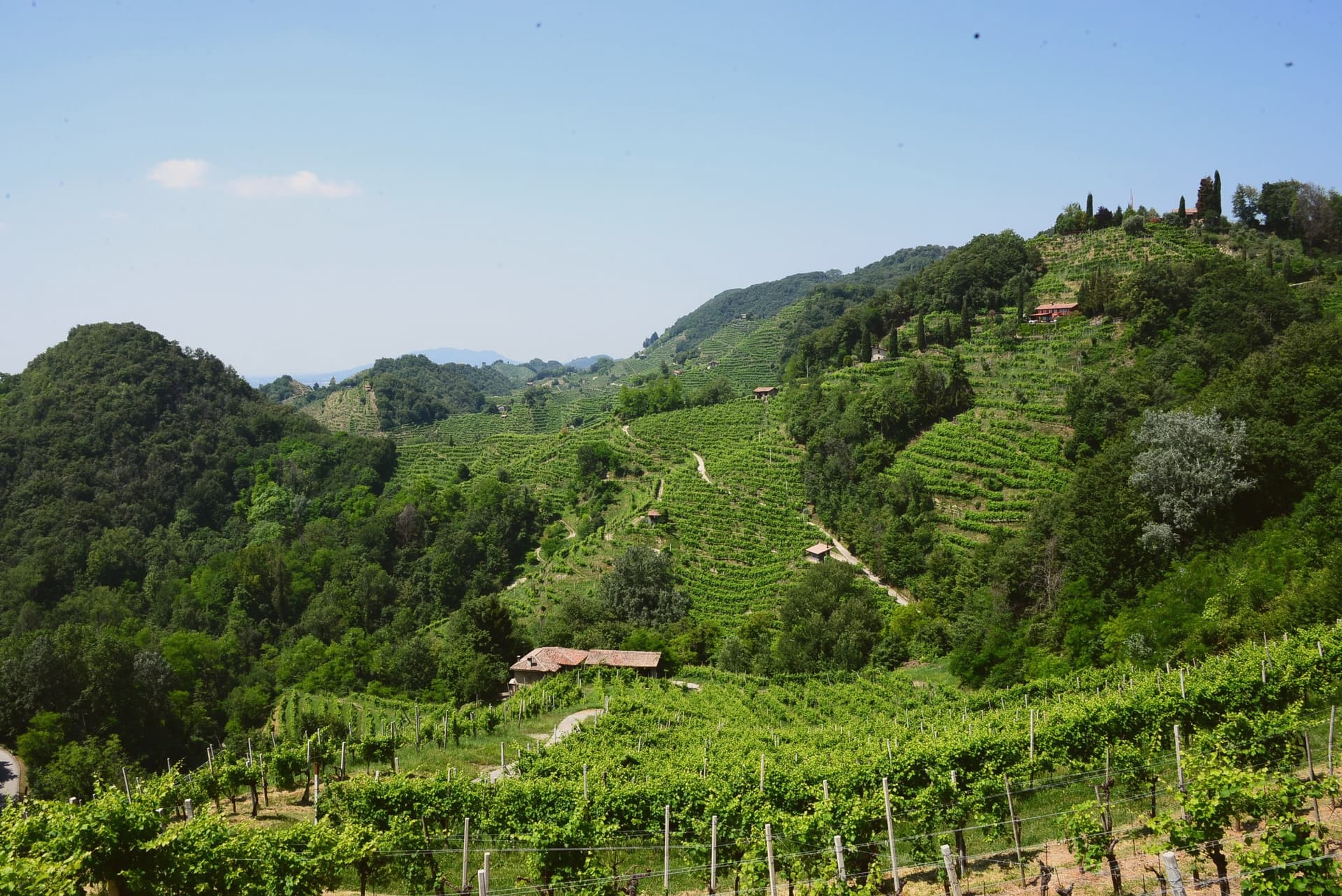
The Conegliano-Valdobbiadene Prosecco Hills take their local name, rive, from the steep hogback ridges that corrugate the landscape, terraced by hand over more than a thousand years and planted almost entirely to Glera. The whole landscape was inscribed as 'Le Colline del Prosecco di Conegliano e Valdobbiadene' in 2019, recognizing both the vineyard cultivation system and the long history of hillside terracing behind it.
Farra di Soligo sits at the literal centre of this territory, one of 15 comuni inside the inscribed area, an 8,477-resident commune at 161m altitude positioned between Conegliano (10 km east) and Valdobbiadene (5 km west), with the most-photographed stretch of the rive running through its own ground. Soligo, the frazione that gives the comune its name, holds the hilltop site of the triple watchtower ensemble above it, reached by marked paths climbing directly from the village rather than by road.
Beyond the towers and the vineyards, the territory holds two Romanesque parish churches, one in Farra itself with its campanile standing detached from the main body, another at Col San Martino with later frescoes added to its 12th-century fabric, and a working wooden watermill on the Lierza river, its wheel still turning, the photogenic centrepiece of a Sunday walking circuit that closes vineyard roads to cars between April and October. The Cistercian abbey at Follina extends the same religious-medieval layer 4 km to the southeast, ranking among the more important monastic ensembles in the Veneto.
The comune also carries the Cittaslow and Città del Vino marks alongside the UNESCO inscription, a rare triple signal for a town this size. Wine production runs through all of it: over 200 producers work the DOCG zone across the comune and its immediate neighbours, making the extra-dry Prosecco Superiore, the dry Cartizze grand-cru, and the rarer col fondo, unfiltered and naturally cloudy, the traditional version before the modern method took over.
Food follows the same prealpine register: spaghetti with duck ragù, baccalà alla vicentina, formaggio di Malga, tiramisù, invented 30 km south at Treviso. The Festa del Vino in May and the Sagra dell'Uva in October mark the calendar's two fixed points.
What holds the place together is the terracing itself: a landscape shaped by a single, continuous agricultural practice long enough that the medieval towers, the parish churches, and the working mill all read as features of one worked hillside rather than separate monuments set into it.
Locanda da Condo, Seda, Tino Gourmet dell'Hotel Villa Soligo have been named by a guide.
What to see in Farra di Soligo
- Conegliano-Valdobbiadene Prosecco Hills (UNESCO). The corrugated rive landscape of steep hogback ridges with Glera vineyards, inscribed as UNESCO World Heritage in 2019. Farra sits centrally in the inscribed area, with the most-photographed stretch running through its territory.
- Torri di Credazzo. The towers stand above Soligo, a frazione of Farra, reached by marked paths climbing from the village itself rather than by road.
- Molinetto della Croda. The mill's wheel still turns on the Lierza river, its wooden works exposed to view. It anchors the Rive Vive walking route, when vineyard roads nearby close to cars.
How to get to Farra di Soligo
Venezia is roughly 68 minutes away by road.
Our tip
Farra di Soligo is best April–June and September–October. The Rive Vive Sunday walks (April-October) close vineyard roads to cars and open them to cellar-hopping walkers — the signature local activity. October is harvest; the air smells of fermentation across the whole comune.
Valdobbiadene
Why visit Valdobbiadene
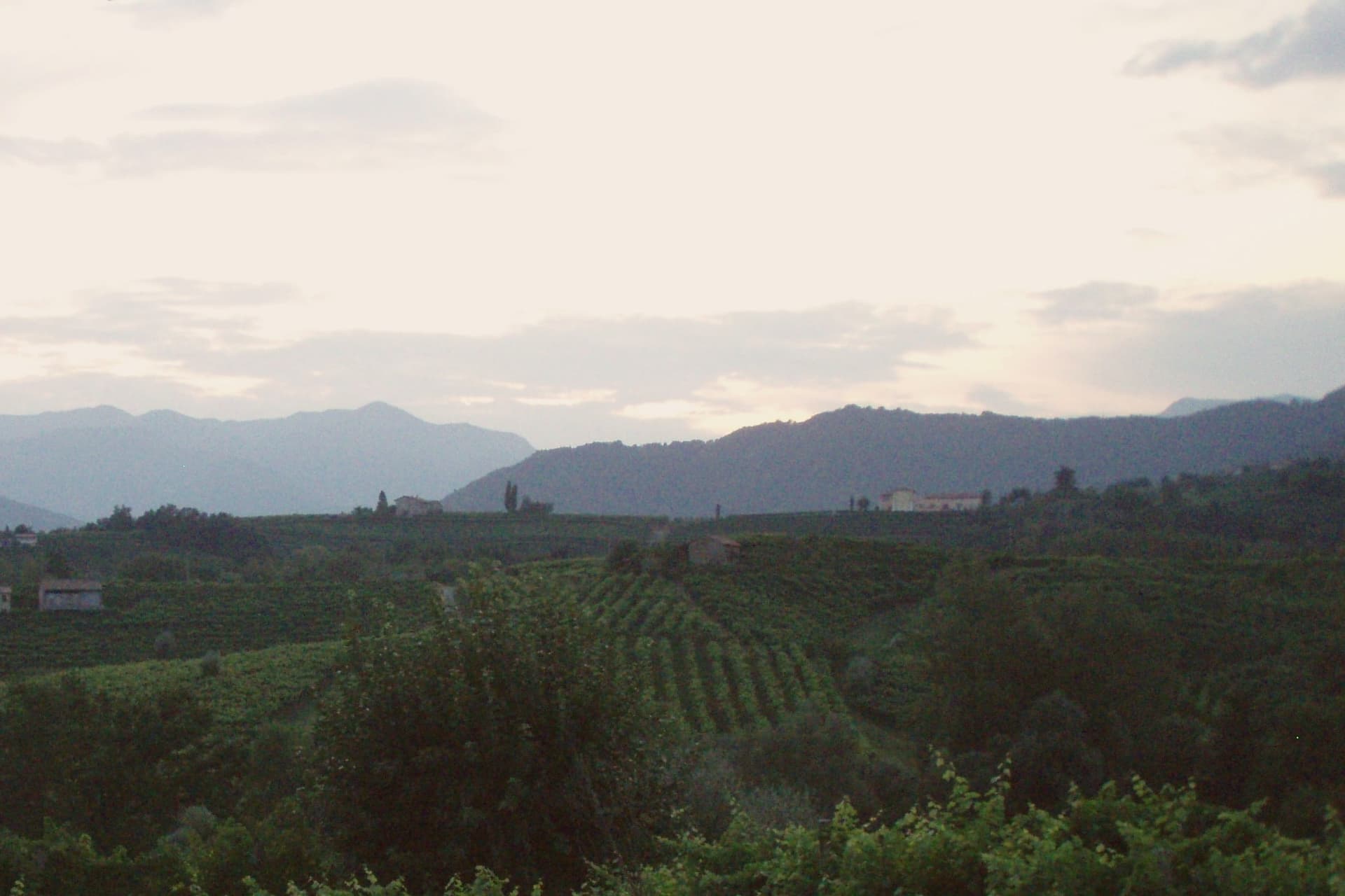
Valdobbiadene sits at 253 meters in the Treviso Prealps, fifty-five kilometers northwest of Venice, on the western edge of the Conegliano-Valdobbiadene UNESCO landscape inscribed in 2019. The town gives its name to the Conegliano Valdobbiadene Prosecco Superiore DOCG, and its own centro storico sits above a cluster of frazioni, among them the hilltop parcel that ranks as the zone's peak cru and the hamlet of Colderove with its sixteenth-century church.
Producers work these slopes on a shared calendar: the Antica Fiera di San Gregorio opens the working year on the second Monday of March, Villa dei Cedri hosts its own DOCG exhibition each spring, and cellar doors along the signed wine route stay open through the warm months as the harvest advances. The rhythm of the town follows the vine from one edge of the appellation to the other, with the hilltop parcel standing as the point the whole zone is measured against.
Tre Noghere, Alla Cima, Locanda Sandi have been named by a guide.
What to see in Valdobbiadene
- Cartizze. Rocky, south-facing hilltop with vineyards from 200 to 350 meters, worked in classified parcels above San Pietro di Barbozza.
- Duomo di Santa Maria Assunta. Neoclassical cathedral on Piazza Marconi, the civic anchor of the centro storico.
- Villa dei Cedri. Nineteenth-century villa and park at the foot of the centro storico, host of the Mostra del Cartizze e Valdobbiadene DOCG each spring.
How to get to Valdobbiadene
Venezia is roughly 85 minutes away by road.
Our tip
April through October is the working season. April and May bring vine flowering on the Cartizze and the Rive parcels and the Mostra del Cartizze opens at Villa dei Cedri in late April. June through August pushes into the low thirties on the lower slopes; the hilltop parcels stay cooler with the breeze off the Prealps. Mostra del Vin col Fondo a Valdobbiadone falls in July.
Peschiera del Garda
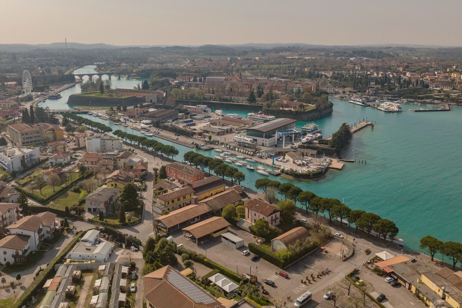
Why visit Peschiera del Garda
Peschiera sits at 68 meters on the Mincio at the point where the river leaves Lake Garda, twenty-five kilometers west of Verona. The Romans called it Ardelica.
The town the Republic of Venice rebuilt in 1549 was set on the medieval walls' corners, with a moat fed by the river, and the design came from Guidobaldo della Rovere before its execution on site. Austria took the town in 1815 and folded it into a wider system with Verona, Mantua and Legnago, the four together holding Lombardy-Venetia until 1866; Peschiera held the northwest corner of that arrangement, the point closest to the lake.
The fortress and the marsh settlement belong to different periods and different UNESCO listings, one Bronze Age and lakeside, one sixteenth-century and defensive, but both sit on the same stretch of water where the Mincio gathers itself before running south. The river itself is the town's organizing fact: it leaves the lake, splits into three canals to cross the walls, and rejoins below the railway bridge.
What Peschiera adds up to is a place built twice on the same threshold, where a lake becomes a river and a river becomes a border worth fortifying.
Osteria Bakarè have been named by a guide.
What to see in Peschiera del Garda
- Mura veneziane. Pentagonal fortress designed by Michele Sanmicheli for Venice from 1549, with five bastions, a moat fed by the Mincio and three water gates.
- Canali del Mincio. Three canals cross the fortress and rejoin below the railway bridge; the central one runs through the main square inside the walls.
- Piazza Ferdinando di Savoia. Main square inside the walls, bordered by the Palazzo del Comando, the Voltoni arches over the Mincio and the Caserma Catterin.
How to get to Peschiera del Garda
There is a railway station in the town, so you can arrive without a car and never need one while you are here. Verona is roughly 30 minutes away by road.
Our tip
April through June and September through October are the strongest months in Peschiera. The fortress walls, the moat and the Mincio canals are at their clearest in spring and autumn, and the lakefront south of the walls fills with sailing and ferry traffic. July and August push past thirty degrees and the southern Garda concentrates much of the lake's day-trip volume; the parking lots around the railway station queue from midmorning.
Pieve di Soligo
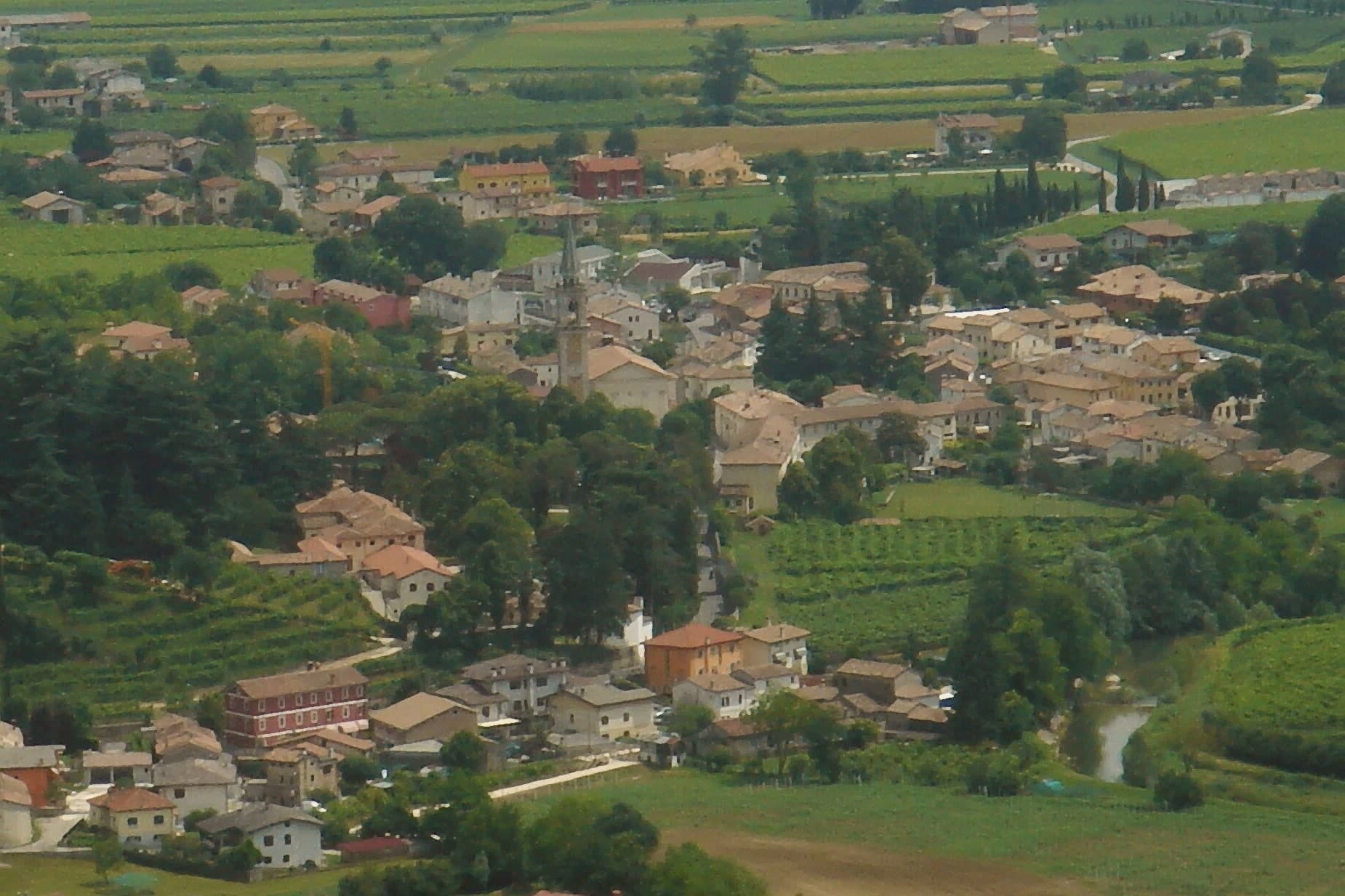
Why visit Pieve di Soligo
Pieve di Soligo sits at 132 meters, fifty-five kilometers north of Venice, where the Soligo and Lierza rivers meet on the commune's flat valley floor. The territory splits roughly two-thirds level ground to one-third hillside, the lower edge of a hogback landscape that rises toward the vineyard slopes to the north.
The market town occupies the flat stretch between the two watercourses; the upper village, where the old paved street of Cal Santa runs, sits apart from the newer centro that has grown around the cathedral and its campanile. An eighteenth-century country estate on the edge of town, with Venetian stuccoes and a private chapel, now serves an administrative function tied to the wine that covers the northern hills, while the Solighetto frazione keeps its own smaller eighteenth-century parish church, campanile detached from the nave, with a garden that shares the Brandolini name.
The poet born and later died in the town gave his late work a mapped version of the upper village, renaming its street in verse. Between the rivers below and the vineyard hills above, the commune reads as a working valley floor with a market town at its center, its administrative reach over regional wine production and its literary claim both rooted in the same small geography.
Da Lino have been named by a guide.
What to see in Pieve di Soligo
- Villa Brandolini. Eighteenth-century country estate with Venetian stucco interiors and a private chapel, now headquarters of the Consorzio di Tutela del Prosecco Superiore DOCG.
- Duomo di Santa Maria Assunta. Neo-Romanesque cathedral with neo-Gothic elements designed by Domenico Rupolo, consecrated in 1924, with a 75-meter campanile over the centro.
- Colline del Prosecco. UNESCO World Heritage hogback hills on the northern edge of the commune, inscribed in 2019, with Prosecco Superiore DOCG vineyards between 150 and 300 meters.
How to get to Pieve di Soligo
Venezia is roughly 64 minutes away by road.
Our tip
April through June and September through October are the working months for Pieve di Soligo. The vineyards open in spring with the Primavera del Prosecco events from March through June, and the harvest from late August into October keeps the town busy. The Premio Pieve Zanzotto poetry prize runs in October. Pieve di Sera falls in July.
Susegana
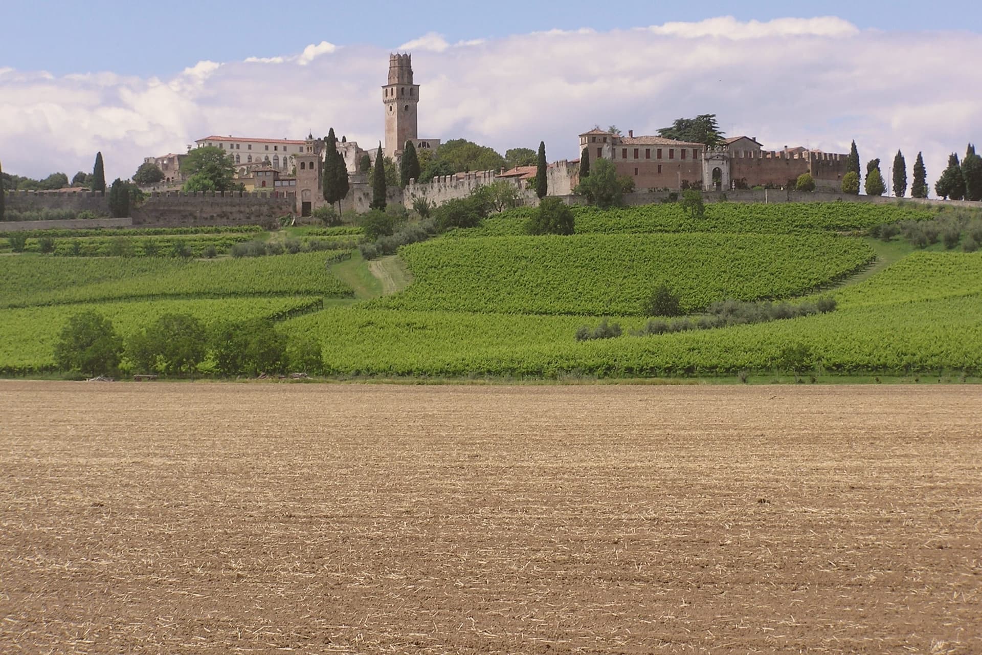
Why visit Susegana
Susegana lies twenty kilometers north of Treviso, at the point where the Piave leaves the Prealps and turns south toward the lagoon. The commune stretches from a hilly northern strip, holding the frazioni of Colfosco and Collalto, down to Ponte della Priula on the plain, where the river is crossed rather than skirted.
The older castle was founded by Ensedisio I in 1110, passed to the Republic of Venice as a Franciscan house, and was suppressed under Napoleon. The younger, Rambaldo III's foundation of 1323, grew into the larger fortress that still stands.
The Collalto counts, lords of the river crossing since the twelfth century, tie both hilltops and the plain below to a single dynasty that farms the southern vineyards to this day. What the two castles and the bridge below them add up to is a town organized by its geography: a family seated on the high ground for defense of the crossing, its wealth still rooted in the slopes it once ruled.
What to see in Susegana
- Castello di San Salvatore. Set on its own hill, the double walls still stand around what remains one of the largest fortified perimeters in the region, and the estate below is worked as a winery by the same family that built the walls.
- Castello di Collalto. The older of the two strongholds, founded on the Colle Alto, passed from fortress to Franciscan monastery and stands now as ruins above the village that took its name.
- Colline del Prosecco. The commune's share of the Valdobbiadene UNESCO slopes, given over to Glera vines producing DOCG Prosecco Superiore.
How to get to Susegana
Venezia is roughly 57 minutes away by road.
Our tip
April through June and September through October are the working months. Vine flowering runs into late May, harvest from mid-August into September, and the gold light over the Conegliano-Valdobbiadene hills draws photographers in October. July and August push past thirty degrees and the centro storico empties in the afternoon. Millenaria Festa in Tombola a Susegana falls in September.
Valeggio sul Mincio
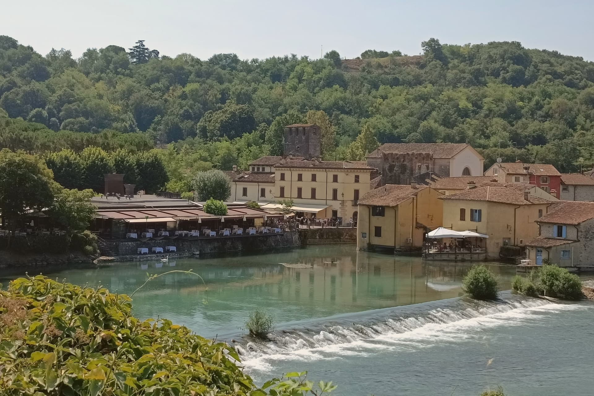
Why visit Valeggio sul Mincio
Valeggio sul Mincio sits at 88 meters on the morainic hills shaped by the Garda glaciers, twenty kilometers southwest of Verona and ten kilometers from the southern end of Lake Garda. The Mincio cuts north-south through the commune and was the Veneto-Lombardy military frontier for centuries.
The frazione of Borghetto on the river is one of I Borghi più belli d'Italia, a single line of houses and water mills along the left bank under the Castello Scaligero. The fortified Ponte Visconteo, built in 1393 by Gian Galeazzo Visconti of Milan as part of the sixteen-kilometer Serraglio defensive line, is 650 meters long and 25 meters wide and still spans the valley above the village.
The local pasta is the Nodo d'Amore, an oversize hand-rolled tortellino with meat filling; the third Tuesday of June it is served to four thousand diners at a single table laid across the Visconti bridge. The Parco Giardino Sigurtà, a sixty-hectare landscape garden two kilometers north, draws over half a million visitors a year, peaking with the Tulipanomania bloom in April.
Ristorante Antica Locanda Mincio, Alla Borsa have been named by a guide.
What to see in Valeggio sul Mincio
- Borghetto sul Mincio. Riverside hamlet on the left bank of the Mincio, one of I Borghi più belli d'Italia, with surviving water mills and a single arcaded line of houses.
- Ponte Visconteo. Fortified bridge-dam built in 1393 by Gian Galeazzo Visconti, 650 meters long and 25 wide, anchor of the Serraglio defensive line.
- Castello Scaligero. Della Scala fortress on the hill above Borghetto, built in the thirteenth century as the southern hinge of the Verona defensive line.
How to get to Valeggio sul Mincio
Verona is roughly 34 minutes away by road.
Our tip
April through June and September through October are the working months. April brings Tulipanomania at Parco Sigurtà and Borghetto on the river at its quietest. May and June fill the gardens and the bridge with weekend visitors; the Festa del Nodo d'Amore on the third Tuesday of June draws four thousand diners onto the Visconti bridge.
Vittorio Veneto
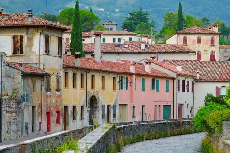
Why visit Vittorio Veneto
Vittorio Veneto sits at 138 meters at the foot of the Cansiglio plateau, seventy-five kilometers north of Padova. The commune was formed in 1866 by merging Ceneda, on the plain, with Serravalle, in the narrow valley above, and named for King Vittorio Emanuele II.
The two centers kept their own identities rather than blending into one. Serravalle is the older, walled district, set higher in the valley, with its cathedral holding the altarpiece of the Virgin with two saints.
Ceneda lies lower down on the plain, holding the Loggia of the Comunità and an eighteenth-century cathedral of its own alongside the castle ruins on the hill above it. In July 1923 the town took the name it carries now, after the battle that had taken its name from it three years earlier: the offensive of 24 October 1918 broke the Austro-Hungarian line, and the Armistice of Villa Giusti, effective 4 November, closed the war on this front.
The renaming fixed a wartime event permanently onto a place that had, until then, been two separate medieval settlements sharing a valley. What stands today is that same double structure, upper town and lower town, walled district and plain, still legible as two places joined by one name.
Le Macine have been named by a guide.
What to see in Vittorio Veneto
- Duomo di Serravalle. Rebuilt cathedral in the upper walled centro storico, holding the altarpiece of the Virgin with Saints Peter and Andrew in continuous liturgical use since it was painted.
- Museo della Battaglia. In the Loggia of the Comunità di Ceneda, built 1534-1538, with relics and documents of the offensive that ended the war on this front.
- Serravalle. Northern walled district above Ceneda, with sixteenth-century arcaded houses along the Meschio and the 1462 Loggia Serravallese.
How to get to Vittorio Veneto
There is a railway station in the town, so you can arrive without a car and never need one while you are here. Venezia is roughly 59 minutes away by road.
Our tip
April through October is the working season. April and May bring the Cansiglio plateau into play with walking weather and the upper Meschio at full flow. June through August stays cooler than the plain, with the narrow Serravalle valley holding shade through midday; the lower part around Ceneda pushes into the low thirties. Festa della Val Lapisina falls in July.
Conegliano
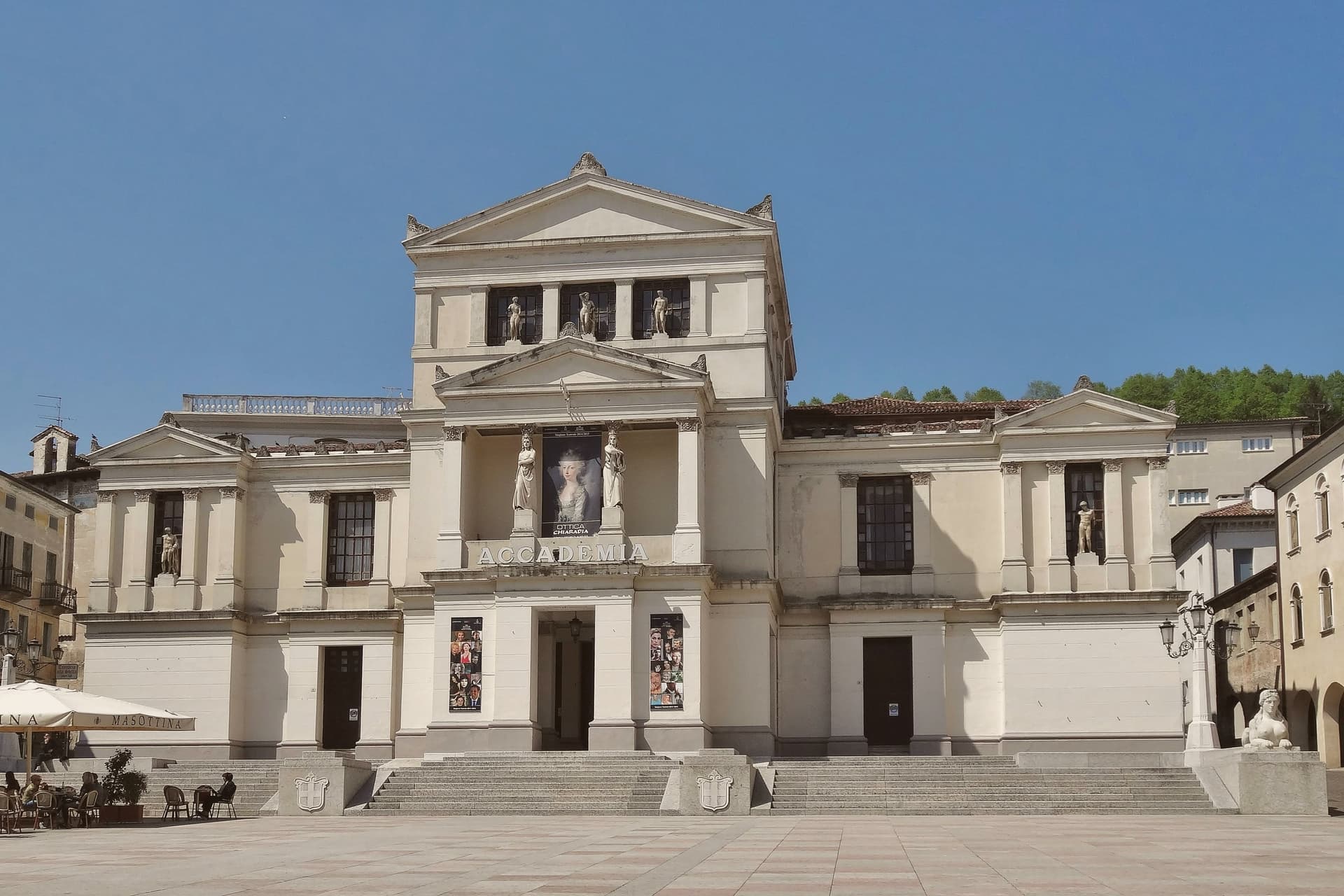
Why visit Conegliano
Conegliano sits at 65 meters where the Veneto plain meets the Prealps, fifty kilometers north of Venice. A tenth-century castle on the hill above the town still holds its bell tower and outer walls and now houses a small museum.
The painter Giambattista Cima was born here around 1459; his altarpiece for the Duomo, dated 1492, hangs in the cathedral and stays in continuous use. The Contrada Granda, the arcaded main street that runs below the castle, holds the medieval and Venetian-period layout intact.
The defining contemporary fact is Prosecco. In 1876 the Scuola Enologica opened on Via XX Settembre, the first oenology school in Italy, and it has trained the producers who built the Glera-based wine into a global category.
The Conegliano-Valdobbiadene DOCG was created in 2009 and the surrounding hills were inscribed by UNESCO in 2019. The town runs a working economy of agriculture, food processing and tertiary services, and the railway station puts Venice forty minutes south and Belluno forty minutes north.
What to see in Conegliano
- Duomo di Conegliano. Fourteenth-century cathedral with a façade hidden behind the arcaded Scuola dei Battuti, housing the 1492 altarpiece by Cima da Conegliano.
- Castello di Conegliano. Tenth-century castle on the hill above the town, with bell tower and outer walls preserved; the tower houses the Museo Civico.
- Contrada Granda. Arcaded main street running below the castle, the spine of the centro storico, intact since the Venetian period.
How to get to Conegliano
There is a railway station in the town, so you can arrive without a car and never need one while you are here. Venezia is roughly 53 minutes away by road.
Our tip
April through June and September through October are the months Conegliano is built for. The hills are green in spring and gold in autumn; the Prosecco vineyards flower in late May and harvest runs from mid-August into September. July and August push into the low thirties and the centro storico empties in the afternoon. Campolongo in Festa a Conegliano falls in August.
More from Anywhere Italy
 The best towns with a World Heritage site in the province of Treviso
- The best wine towns within 75 minutes of Venice
- The 7 best hidden towns with a World Heritage site in Veneto
- The best towns with a World Heritage site that eat well in Veneto
- The best towns with a World Heritage site within 75 minutes of Venice
- The best towns with a World Heritage site within two hours of Udine