
The best hidden hill towns within 90 minutes of Firenze
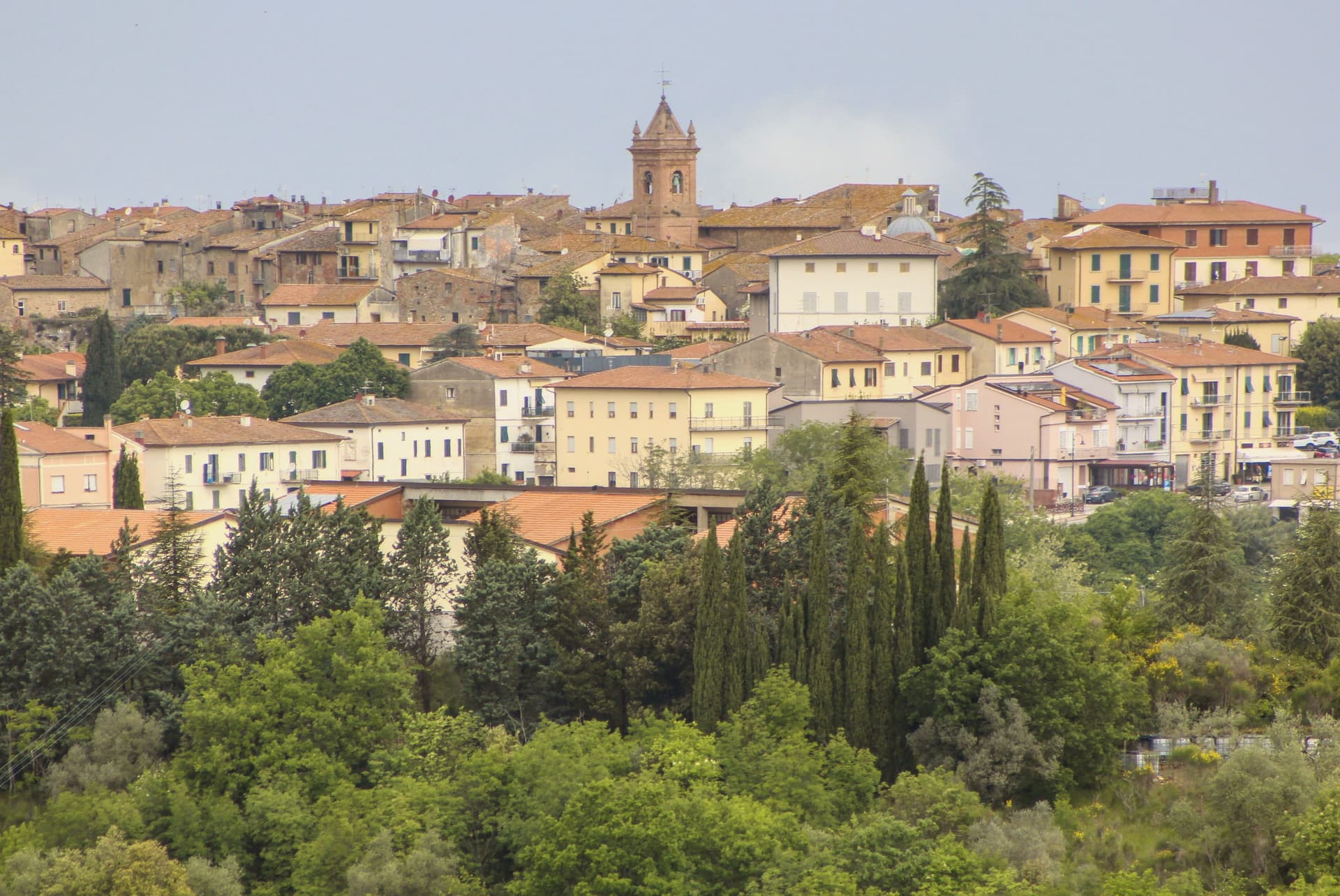
The hills around Florence are built from what is under them: pietra serena, grey and cool, quarried and cut into doorframes, church steps and the arcades of market squares. Vines and silver-leaved olives run up to the walls, then stop where the chestnut woods begin, and in autumn the whole thing smells of fermenting must and woodsmoke. This is bistecca country and wild boar country, with pici and pappa al pomodoro on the same handwritten menu, and cellars where the wine is poured from a tap in the wall. Spring and late October are the good windows, when the light is long and the terraces are open but the coach parks are not full.
Almost everyone works outward from Florence and then goes to Siena, along the Chiantigiana or down the superstrada, and Siena earns it: the Campo, the cathedral floor, the Palio in high summer. The problem is that the two cities collect nearly all of the traffic that moves through this landscape, so the road between them becomes a corridor rather than a place. Tour buses park at the same tasting rooms. The same hour of the day, the same photograph, the same queue for the same panino.
The hills do not stop where the famous route runs. The same sandstone, the same vineyards and the same cooking continue east into the Valdarno and the Casentino, north to the ridge above the Arno, and west towards the Val d'Elsa, and the towns along those roads keep their weekday markets and their own butchers. Fewer people go, which mostly means you can park, eat at one o'clock without booking, and walk a walled circuit at dusk with the swifts. These are the smaller places, all of them within a comfortable drive of the city.
Of the 12 communes we have mapped within 90 minutes of Firenze, 12 qualify as hill towns: each is an inland hill settlement. This list is the hidden ones, 9 in all, ordered smallest first. The smallest, Castellina in Chianti, has 2,651 residents.
If you are still choosing, we have also written The 9 best towns with a serious restaurant that eat well within 90 minutes of Firenze and The best olive oil towns within 90 minutes of Firenze.
Montaione
Why visit Montaione
Montaione sits at 341 meters on a ridge above the Valdelsa, in the wooded hills west of Florence on the road toward Volterra. Etruscan and Roman finds at Poggio all'Aglione, Bellafonte and Iano confirm continuous occupation across the territory, material now held in the town's archaeological museum.
The medieval castello was the seat of an autonomous comune from 1256 and passed to Florence in 1369. From the early fourteenth century, glassmaking ran in the surrounding woods, and an eighteenth-century decree by the Grand Duke required master glassmakers to teach the craft to their fellow citizens.
The town joined Borghi più belli in 2007. The territory spreads well beyond the ridge itself.
Five kilometers west, a Franciscan convent founded in 1500 stands in the woods, its chapels laid out as a walkable replica of Jerusalem's holy sites. Ten kilometers south, Castelfalfi carries a separate, older Lombard origin, now a resort with its own vineyards and church.
Between them, the centro storico keeps the civic core: the tower, the palace, the parish church rebuilt on twelfth-century foundations. The comune, in effect, holds three distinct centuries of settlement at once: an ancient scatter of finds, a fourteenth-century craft economy, and a devotional complex from the 1500s, spread across ridge, castle and wood rather than gathered in one place.
What to see in Montaione
- Sacro Monte di San Vivaldo. Complex five kilometers west of the borgo. Seventeen chapels stand among oak woods, each holding a scene built as part of the topographical replica, still reached on foot along the paths between them.
- Castelfalfi. Lombard-origin castle and frazione ten kilometers south, restored as a private resort with vineyards and a Romanesque church of San Floriano.
- Centro storico. Medieval grid on the ridge, with the Palazzo Pretorio, the Torre del Cassero and the Chiesa di San Regolo restored after 1118 foundations.
How to get to Montaione
Firenze is roughly 67 minutes away by road.
Our tip
April through June and September into October are the months Montaione shows best, the Valdelsa light low on the wooded ridges and the San Vivaldo chapels in their full October ochre. The Mostra del Tartufo Bianco runs the last weekend of October and the first of November. July and August push past thirty in the valley but the centro storico at 341 meters stays manageable.
Poppi
Why visit Poppi
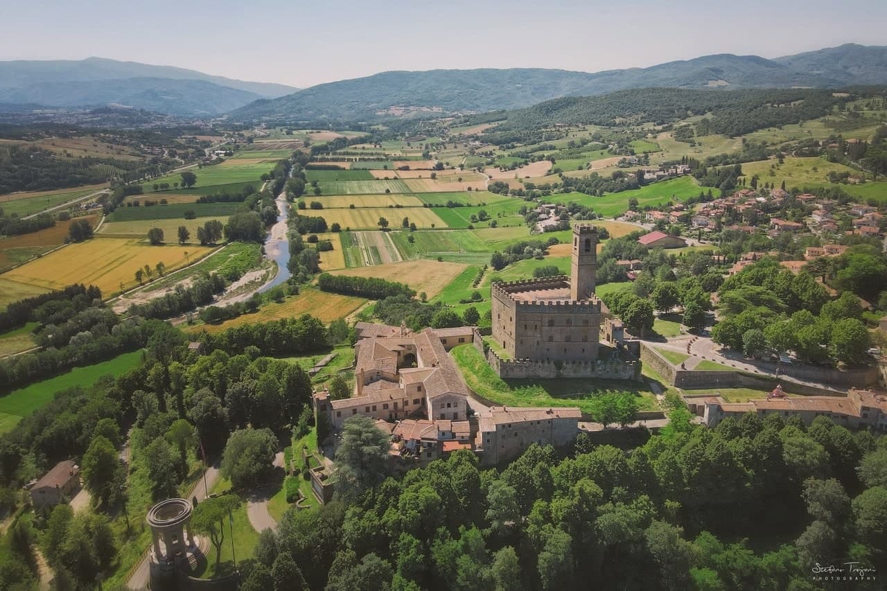
Poppi rises above the upper Arno in the Casentino, the wooded valley set between Pratovecchio and Bibbiena. The Counts Guidi held this hill from at least 1169, and the castle they raised across the late twelfth and thirteenth centuries is attributed in its older part to Lapo di Cambio and in the later upper section to Arnolfo di Cambio.
Dante Alighieri, who fought below the hill as a young man, returned to it later as a guest of the Guidi during his exile, so the borgo held him twice, once as a soldier and once as a household guest. The town itself sits above the battle plain, the abbey church inside the walls, the castle over both.
A further Romanesque pieve stands a short distance off, and the forested ridges of the Apennine watershed rise to the east, the same terrain the Guidi once ruled from their hill. What the place adds up to is a single family's hold on a valley, visible still in the line from castle to plain to church, with the forest marking where their lordship ran out.
What to see in Poppi
- Castello dei Conti Guidi. The castle keeps a working library and a fourteenth-century chapel frescoed by the school of Giotto, along with a hand-painted model of the battle below, more than four thousand tin soldiers set out on the table.
- Piano di Campaldino. The plain sits directly beneath the castle walls, open ground still readable as a battlefield, with nothing built across it since.
- Abbazia di San Fedele. Romanesque abbey church inside the borgo, with single nave and stone façade, dating from the early twelfth century.
How to get to Poppi
There is a railway station in the town, so you can arrive without a car and never need one while you are here. Firenze is roughly 64 minutes away by road.
Our tip
April through June brings the Casentino into clear sun, the beech forests in their first leaf and the upper Arno full from spring rain. July and August are pleasant at 437 meters, never coastal-hot, with the castle and library full of weekend visitors from Florence. September and October are the harvest and chestnut months: the Foreste Casentinesi turn orange in the high cuts above Pratovecchio. Il Casentino nel piatto falls in June.
Loro Ciuffenna
Why visit Loro Ciuffenna
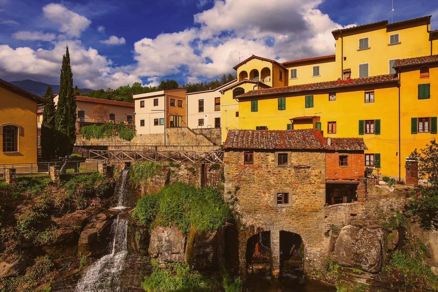
Loro Ciuffenna sits at 330 meters on the western slopes of the Pratomagno, between the Arno valley and the Casentino. The torrent it is named for cuts through the centro storico under a hump-backed stone bridge of Roman origin, remodeled in the Middle Ages.
A water mill on the bank is still in operation, the oldest active mill in Tuscany, dating to the 12th century and used until recently to grind chestnuts into flour. The inhabitants of the castle of Loro were the first to submit to the Florentine Republic in 1306, and the village formed its own statutes as an autonomous comune in 1462.
Two kilometers up the Setteponti road stands the Pieve di San Pietro a Gropina, one of the great Romanesque parish churches of Tuscany, built around the year 1000 over two earlier churches; its circular pulpit, supported by two knotted Lombard columns, is 8th century.
What to see in Loro Ciuffenna
- Pieve di San Pietro a Gropina. Romanesque parish church 2 km south of the village, built around 1000 over a 5th-century church and an 8th-century Lombard one with a knotted-column pulpit.
- Ponte sul Ciuffenna. Hump-backed stone bridge of Roman origin crossing the torrent in the centro storico, heavily remodeled in the medieval period.
- Mulino di Loro Ciuffenna. 12th-century water mill on the Ciuffenna, the oldest active mill in Tuscany, traditionally used to grind chestnut flour.
How to get to Loro Ciuffenna
Firenze is roughly 62 minutes away by road.
Our tip
April through June brings green slopes, mild evenings and water in the Ciuffenna torrent. September and October are the dry months, when the Pratomagno chestnuts ripen and the Setteponti road sees the best light of the year. July and August can push the Valdarno floor into the mid-thirties; the village stays cooler at 330 meters than the plain below, but the centro storico empties in the afternoon hours.
Castellina in Chianti
Why visit Castellina in Chianti
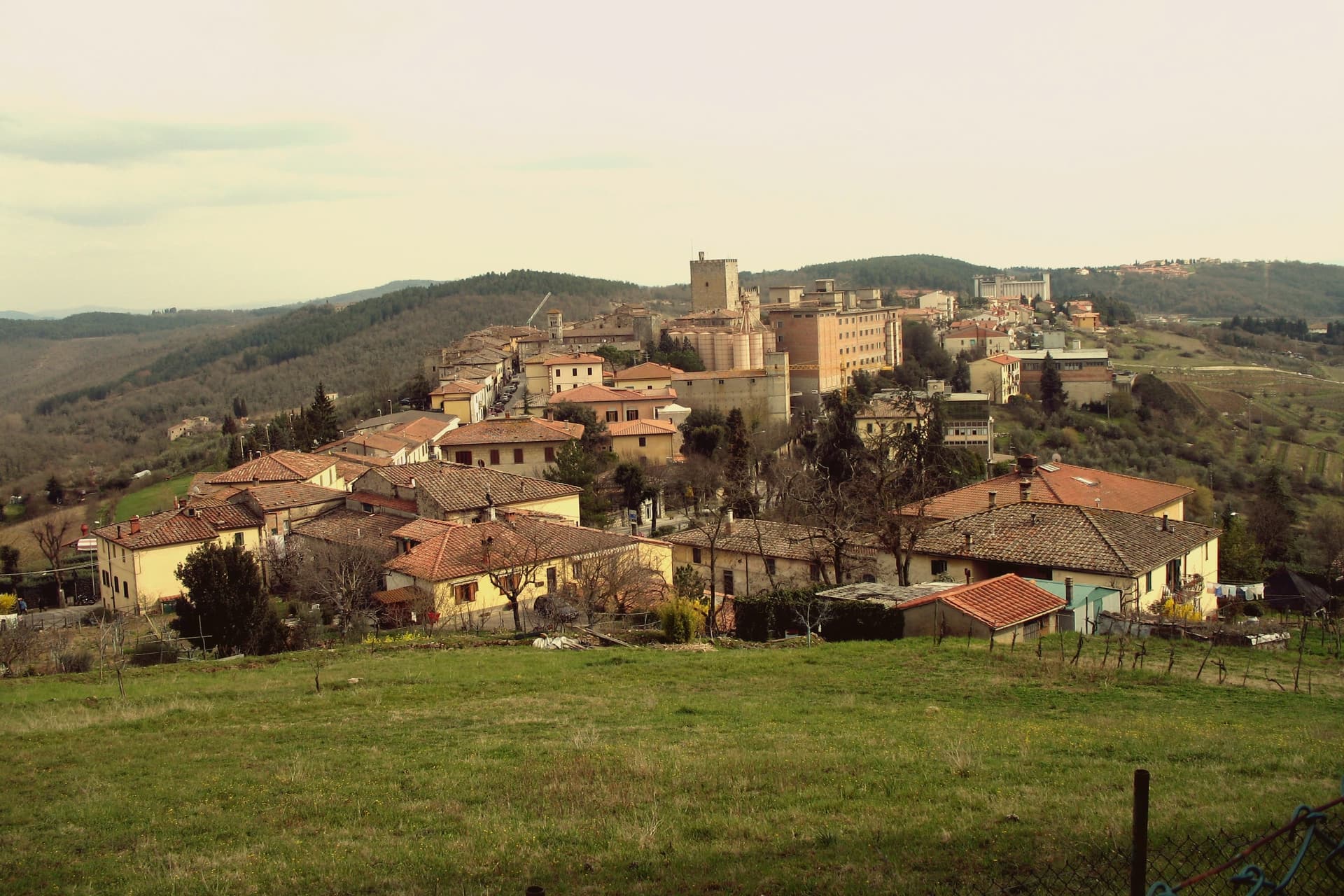
Castellina in Chianti sits at 578 meters on the watershed between the Arno and Ombrone basins, fifteen kilometers northwest of Siena and thirty-five south of Florence. Its position on the historic frontier between the two republics shaped the town: it was a Sienese border fortification reinforced in the fifteenth century by Filippo Brunelleschi and Giuliano da Sangallo against firearm warfare.
The Rocca with its fifteenth-century tower dominates the centro storico and now houses the Museo Archeologico del Chianti Senese, opened in 2006. The Via delle Volte runs the length of the eastern wall: an original ancient pomerium, once open to the sky, gradually built over by private houses against the wall and now a covered arcaded passage lined with workshops and trattorie.
The Tumulo Etrusco di Montecalvario, a sixth-century BC tomb with four burial chambers carved on the cardinal axes, sits a kilometer from the centro storico. The Gallo Nero of Chianti Classico DOCG is grown on the slopes below.
What to see in Castellina in Chianti
- Rocca di Castellina. Fifteenth-century fortification with imposing keep, now housing the Museo Archeologico del Chianti Senese, opened in 2006.
- Via delle Volte. Covered arcaded walkway along the eastern wall, once an open pomerium, built over by houses pressing against the fortifications and now lined with workshops.
- Tumulo di Montecalvario. Sixth-century BC Etruscan tomb a kilometer from town, with four burial chambers carved on the cardinal compass points, excavated in the early 1900s.
How to get to Castellina in Chianti
Firenze is roughly 63 minutes away by road.
✷ We have written about Castellina in Chianti
“The wine is the whole economy of these hills, every village with its own, the region’s name stamped on the most famous red in Italy. Tuscan food runs to cured and roasted meat, so the wine ran red to meet it, lighter than you expect, almost fruity, easy, made to sit beside a steak and not to be lectured about. Here is the only wine knowledge you need on this road: it is all good.”
Read our piece on Castellina in Chianti →Road to Siena | The Long Way Is the Better Way
Our tip
April through June and September into October are the working months on the Chianti watershed: vine work, harvest from mid-September, mild days at 578 meters. The Festa del Vino in the second half of September fills the centro storico for a long weekend. July and August are warmer but stay below the inland Maremma heat, and the Via delle Volte is reliably cool.
San Gimignano
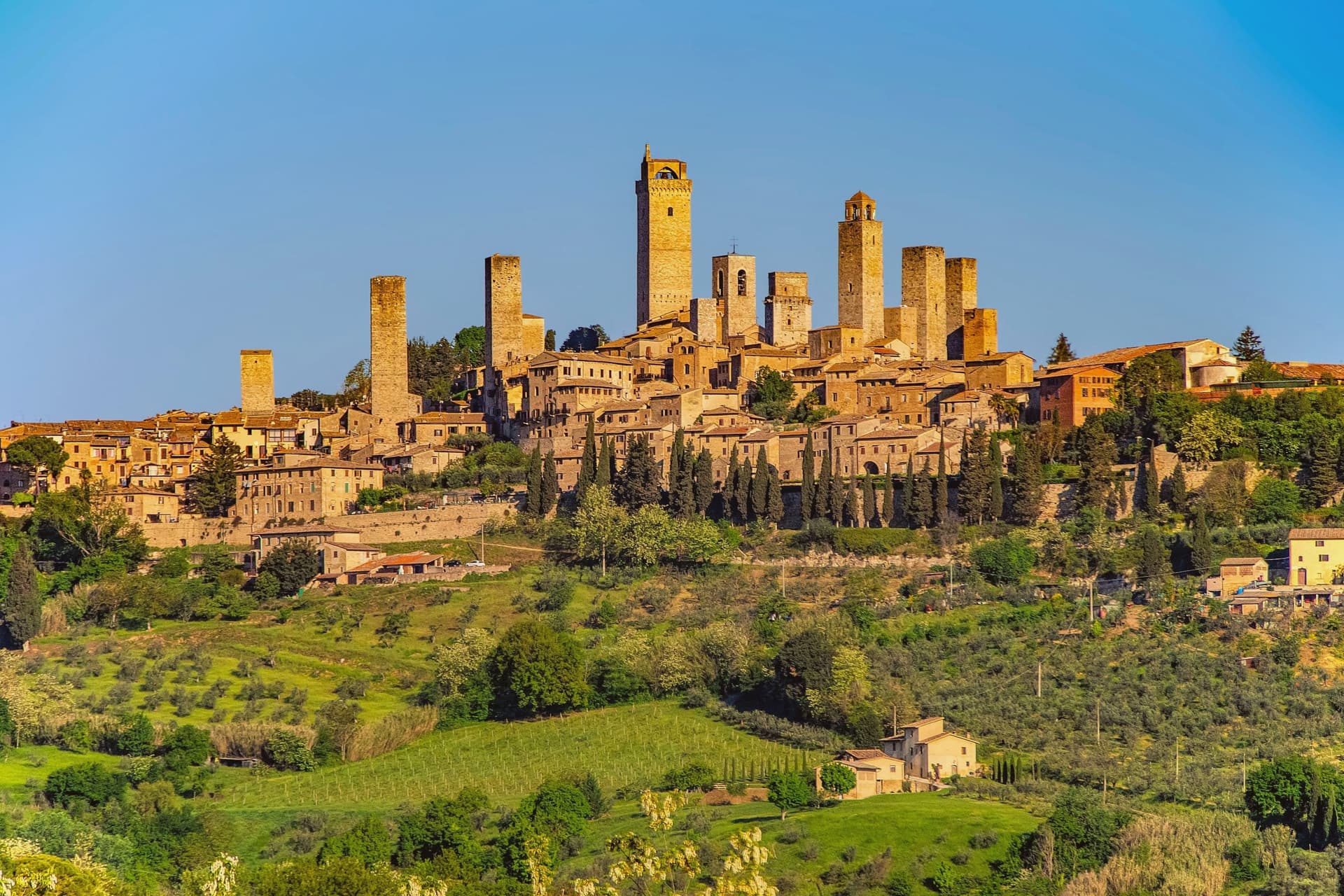
Why visit San Gimignano
San Gimignano sits at 334 meters in the Val d'Elsa, halfway between Firenze and Siena on the medieval pilgrim road to Rome. Patrician families built 72 tower-houses in the twelfth and thirteenth centuries as proofs of wealth and platforms for vendettas; 14 still stand, the tallest being the Torre Grossa at 54 meters.
The town declared independence from the bishops of Volterra in 1199 and grew rich on saffron and Vernaccia, the white wine grown on the surrounding hills and praised since Dante. The Black Death of 1348 broke the boom; San Gimignano lost more than half its population and submitted to Florence.
That collapse is the reason the medieval skyline survived. UNESCO listed the historic centre in 1990 as a complete record of feudal architecture.
Roughly three million visitors come each year, more than 400 times the resident population, and the centro storico empties into the surrounding olive groves once the day-trippers leave.
What to see in San Gimignano
- Torre Grossa. Fifty-four meter civic tower attached to the Palazzo Comunale, the tallest of the surviving 14, open for the climb to the panoramic terrace.
- Piazza della Cisterna. Triangular medieval square paved in brick around an octagonal well of 1287, lined by tower houses and Romanesque palaces.
- Collegiata di Santa Maria Assunta. Romanesque parish church on Piazza Duomo, walls covered by Bartolo di Fredi and Lippo Memmi frescoes of Old and New Testament scenes.
How to get to San Gimignano
Firenze is roughly 61 minutes away by road.
✷ We have written about San Gimignano
“We arrived in the afternoon, into the second half of the day’s crowd. Off-season meant it was groups and guides rather than a flood, but the shops were open and doing their worst, the same garbage souvenirs, the same pasta no one local would eat, and we walked through it the way you walk through a thing you have decided not to let ruin your evening. The towers stood over all of it, indifferent, which is their whole talent.”
Read our piece on San Gimignano →San Gimignano | The Town After Seven
Our tip
April through June and September into October are the months the town is worth a full day rather than three hours. The buses still come, but late afternoon empties the piazzas and lets the towers take their light. July and August push temperatures past thirty and the centro storico becomes uncomfortable between two and six, when the stone radiates heat. Fiere delle Messi di San Gimignano falls in June.
Castelnuovo Berardenga
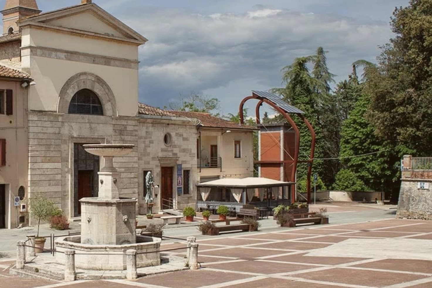
Why visit Castelnuovo Berardenga
The commune sits east of Siena, where the hills give way to the clay swells of the Crete Senesi. The name comes from the Terra Berardinga, the area controlled in the tenth century by a Frankish nobleman named Berardo, and the borgo grew up around the castle walls the Sienese Republic raised against Florence.
The centro storico, the villa and gardens at its heart, and the surrounding zone of vineyards form one continuous pattern rather than separate parts: fortress town above, wine country falling away below it toward the clay hills. Across the wider territory, 13 castles, 70 churches and 200 farms record the medieval pattern of the Sienese contado, a scatter of small fortified points and parish churches administering land rather than one dominant center.
The place reads as a border post that outlived its military purpose and settled into agriculture and the arts, its castle now a clock tower, its noble villa now a music foundation, its walls now overlooking rows of Sangiovese.
What to see in Castelnuovo Berardenga
- Villa Chigi Saracini. Eighteenth-century villa and Italian garden inside the centro storico, its park designed by the Sienese composer Guido Chigi Saracini, whose family foundation still runs the Accademia Musicale Chigiana in Siena.
- Torre dell'Orologio. Surviving tower of the fortress, now bearing the civic clock, the highest visible point of the centro storico.
- Chiesa dei Santi Giusto e Clemente. Eighteenth-century parish church with a neoclassical façade, built on the site of an earlier Romanesque pieve.
How to get to Castelnuovo Berardenga
There is a railway station in the town, so you can arrive without a car and never need one while you are here. Firenze is roughly 77 minutes away by road.
Our tip
April through June and September into October are the months Chianti Classico shows best, the green hills moving toward the gold of harvest. The Sagra del Vino runs the second weekend of September. July and August push past thirty and the centro storico empties between two and six; the cellars on the surrounding hills offer cool tastings and longer rentals.
Greve in Chianti
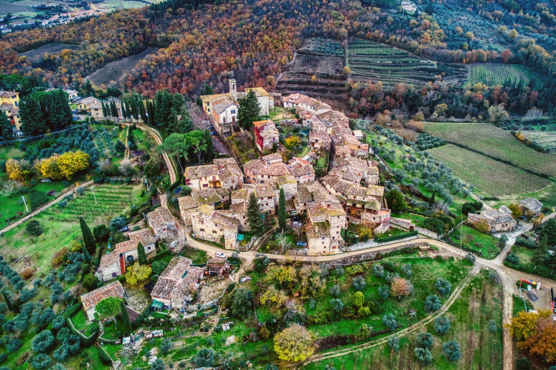
Why visit Greve in Chianti
Greve sits at 236 meters in the Val di Greve, thirty-one kilometers south of Firenze and forty-two north of Siena, on the small fast river that gave the town its name. The valley narrows here enough that the road to Firenze runs past the castle estates on the slopes to the north before dropping into the town itself, and the walled hamlet above Greve looks down on the piazza from its kilometer of higher ground, a settlement some centuries older than the square below it, its tenth-century walls predating the piazza's sixteenth-century arcades.
The piazza is the point around which the rest of the town organizes itself: shops and a market under the arcades, a rebuilt church closing its south end, and the roads out toward the castles and the hamlet all beginning at its edges. The Saturday market fills the piazza.
The wine festival in early September empties the surrounding cellars into glasses for three days. What holds the place together is the geography more than any single monument: a market town at a river crossing, ringed by the vineyard slopes and the older hill settlement that all feed into the same triangular square.
What to see in Greve in Chianti
- Piazza Matteotti. The arcades shelter wine shops, butchers and pasticcerie, wrapped around the irregular triangle of paving with the navigator's bronze figure watching the center.
- Chiesa di Santa Croce. Neoclassical parish church on the south point of the piazza, rebuilt in the nineteenth century after earthquake damage.
- Castello di Verrazzano. Vineyard estate on the hills north of town, producing Chianti Classico on slopes tied to the family name that reached New York Bay.
How to get to Greve in Chianti
Firenze is roughly 44 minutes away by road.
Our tip
April through June and September into October are the months when the Chianti hills are at their best, green or gold depending on the harvest. July and August push past thirty degrees and the piazza empties between two and five. The wine harvest runs late September and the cellars open in turns. Expo Chianti Classico falls in September.
Cerreto Guidi
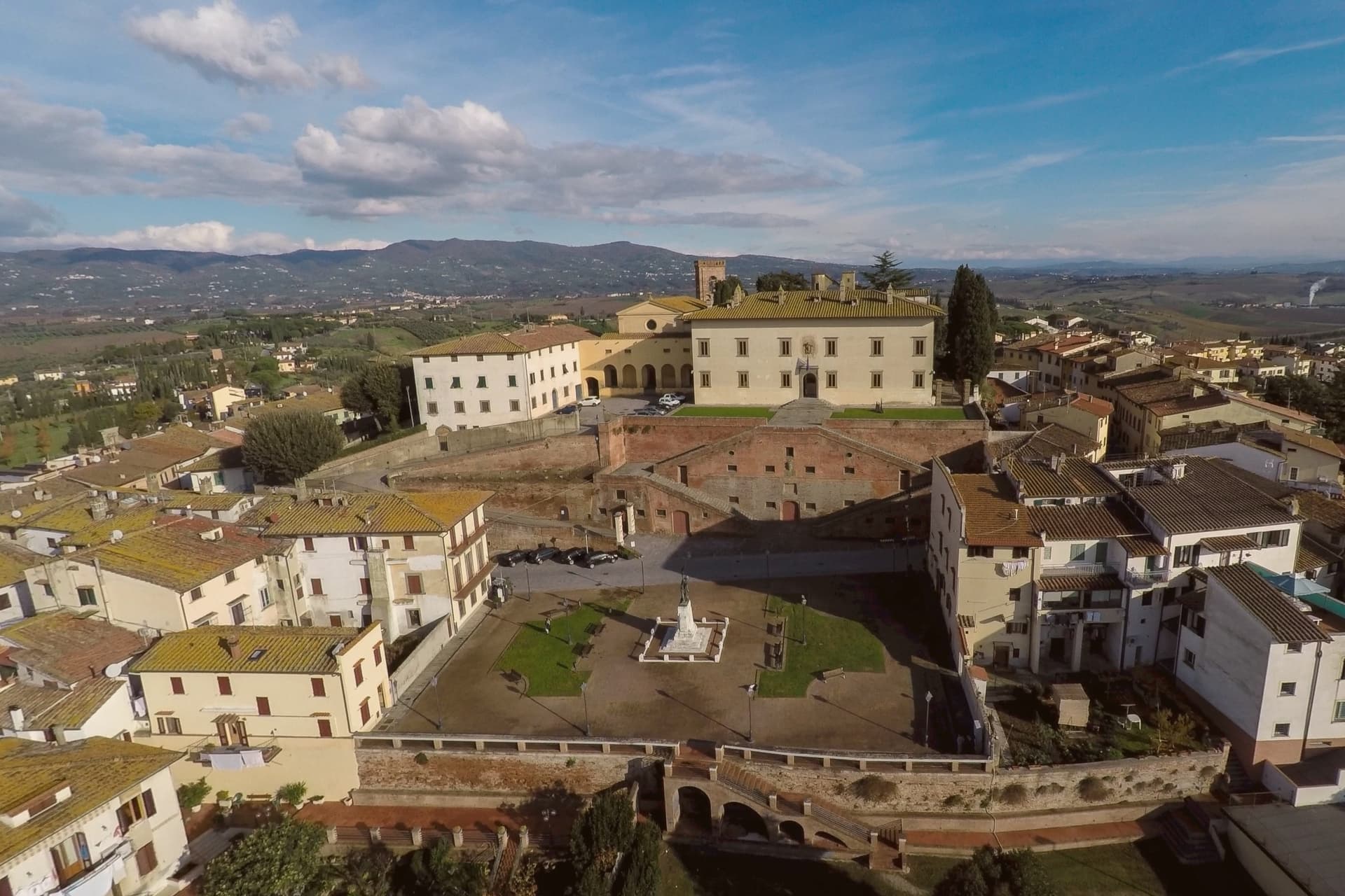
Why visit Cerreto Guidi
Cerreto Guidi sits at 123 meters above the Padule di Fucecchio, thirty kilometers west of Florence, on the old hunting grounds of the Counts Guidi and later the Medici. Cosimo I commissioned the Villa Medicea here between 1564 and 1567 as a hunting lodge and territorial outpost over the marsh.
The villa is mounted on a scenographic base of four symmetrical ramps of stairs, the ponti medicei, traditionally attributed to Bernardo Buontalenti, designed to raise the perspective plane and the level of the entrance. In 2013 the villa entered the UNESCO list of Medici Villas and Gardens of Tuscany along with twelve others, and it remains one of the few permanently open as a museum, housing the Museo Storico della Caccia e del Territorio since 2002.
The Via Francigena passes a few kilometers south. Isabella de' Medici, daughter of Cosimo I, was strangled in this villa by her husband Paolo Giordano Orsini in July 1576.
What to see in Cerreto Guidi
- Villa Medicea di Cerreto Guidi. Hunting villa built for Cosimo I de' Medici between 1564 and 1567, UNESCO World Heritage since 2013, holding the Museo Storico della Caccia.
- Ponti Medicei. Four symmetric ramps of stairs attributed to Buontalenti, supporting the villa above the village and forming its scenographic base.
- Museo Storico della Caccia e del Territorio. Hunting and local history museum housed in the villa since 2002, with weapons, prints and documents from the Medici hunting grounds.
How to get to Cerreto Guidi
Firenze is roughly 50 minutes away by road.
Our tip
April through June is the easiest time to walk the village and the villa garden, with the Padule di Fucecchio at its greenest. September and October dry the marsh, the harvest in the surrounding Chianti Montalbano vineyards runs through late September. July and August are hot in the lower Arno plain and the villa is the cool place to be; visitor numbers peak around mid-August. Palio del Cerro falls in September.
Fiesole
Why visit Fiesole
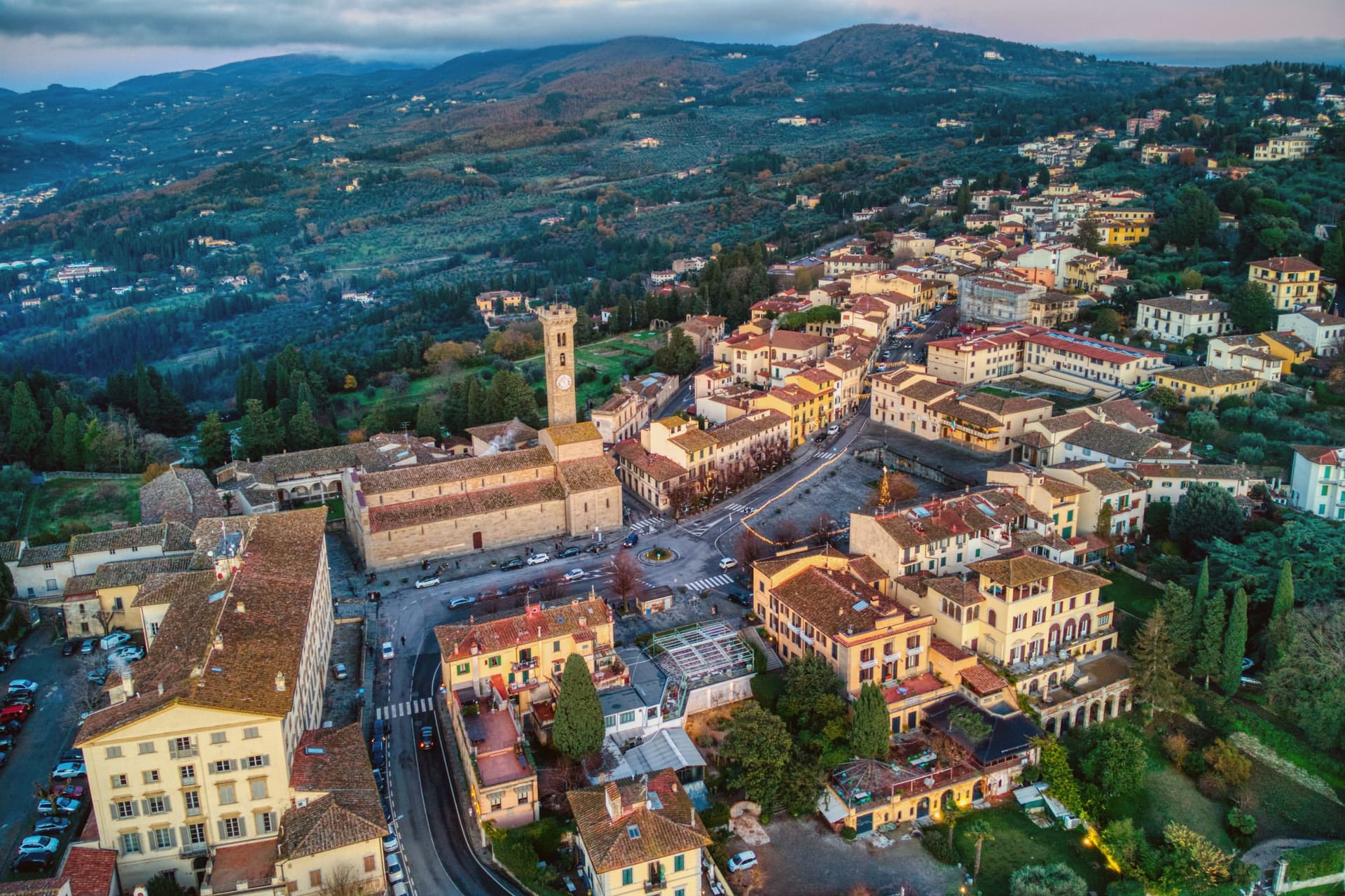
Fiesole was Viesul to the Etruscans and Faesulae to the Romans, who took it in 283 BC. Florence claimed it in 1125 and never let it go, which is the reverse of the usual order: the hill town came first, the valley city second, and the ridge has watched its own successor grow across the centuries since.
The convent that crowns the highest point, at 345 meters, sits at the same height Boccaccio gave the brigata in the Decameron's frame story, a detail that ties the summit to the plague-fleeing storytellers rather than to any building fact already given. Today the town functions as the hill seat of Florentine villas, the Villa Medici among them, so the relationship between Fiesole and Florence is not just historical but residential: those with means built upward, toward the older settlement, to look down on the newer one.
The panorama from the piazza is the view that supplies the standard image of Florence from above, which means the town that Rome conquered has ended up owning the picture of the city that conquered it back.
What to see in Fiesole
- Teatro Romano. Stone tiers set into the hillside below the cathedral, still used each summer for the Estate Fiesolana, so the seats fill for performances the way they once did in antiquity.
- Cattedrale di San Romolo. Romanesque cathedral founded in 1028, flanked by a 42-meter bell tower, with a marble altar from 1273 and two Pietro Perugino frescoes.
- Convento di San Francesco. Romanesque-Gothic Franciscan convent at the ridge's highest point, 345 meters, with cloisters and a panoramic view back over Florence.
How to get to Fiesole
There is a railway station in the town, so you can arrive without a car and never need one while you are here. Firenze is roughly 24 minutes away by road.
Our tip
April through June and September through October are the months Fiesole was built for: the air cooler than Florence by three to five degrees, the cypress alleys clean of haze, and the Roman theatre season runs through July and early August with concerts under the open sky. July and August push the day temperature high enough that even the hilltop feels heavy at midday, though the evenings come back. November through March is quiet, light hits the cathedral late and low, and the wood-burning trattorias around Piazza Mino do their best work. Sagra del Tartufo falls in September.
More from Anywhere Italy
- The 9 best towns with a serious restaurant that eat well within 90 minutes of Firenze
- The best olive oil towns within 90 minutes of Firenze
- The best hill towns worth staying overnight within 90 minutes of Firenze
- The best hill towns in the province of Firenze
- The best hill towns you can reach by train within 90 minutes of Firenze
 The best wine towns within two hours of Pisa