
The best towns with a World Heritage site within two hours of Trieste
The country behind Trieste changes fast. Karst gives way to a flat alluvial plain of maize and vines, then to the moraine hills north of the Piave where the ground folds into steep rows of glera. The houses are rendered brick and river stone, ochre and dust pink, with deep loggias against the August heat. Autumn is the season that repays a drive: fog in the mornings, San Daniele ham and frico on the tables, cellars open for the new wine, and the Roman and Lombard stonework damp and legible in flat light.
Almost everyone arriving in this corner heads for Venice, and it is understandable. The lagoon holds one of the most photographed cityscapes anywhere, and the trains from Trieste run along the coast in under two hours. The result is a canal city absorbing crowds that would strain a place many times its size, with queues at Saint Mark's from spring to late autumn and hotel prices that answer to demand rather than distance.
The listed sites do not stop at the lagoon. The same stretch of Friuli and eastern Veneto holds early Christian mosaics under a basilica floor, a Venetian military town built as a defensive star, a Lombard duchy with its carved temple, and the hillside prosecco landscape recognised for the way the vines are worked. These are the towns that hold those things, and fewer people go.
Of the 27 communes we have mapped in a 120-minute drive of Trieste, 6 qualify as towns with a World Heritage site: each holds a site UNESCO has listed. The smallest, Aquileia, has 3,128 residents.
Two more lists worth reading alongside this one: The best towns with a World Heritage site within two hours of Udine and The best towns with a World Heritage site in the province of Treviso.
Aquileia
Why visit Aquileia
Aquileia sits at five meters above sea level on the Friuli plain, ten kilometers inland from the Adriatic at the head of the Grado lagoon. Rome founded it as a military colony in 181 BC.
By the second century AD it held close to 100,000 people, was the capital of Augustus's Regio X, and ranked among the nine great cities of the empire. Attila's Huns sacked it in 452, the population scattered to the lagoon islands, and the surface town never recovered.
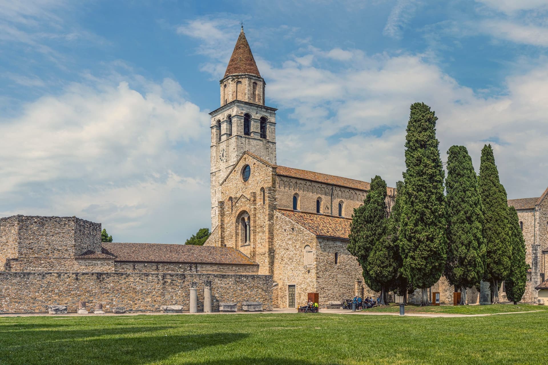
The Roman city below is largely unexcavated, which makes Aquileia, in UNESCO's words, the most complete example of an Early Roman city in the Mediterranean. Above it, Patriarch Poppo rebuilt the basilica in 1031 over a fourth-century church.
Its floor is the largest paleochristian mosaic in the Western world, 760 square meters of fish, birds, jonah and the whale, uncovered by archaeologists in 1909. The 73-meter campanile uses stone quarried from the Roman amphitheater.
The Patriarchate of Aquileia survived until 1751.
What to see in Aquileia
- Basilica di Santa Maria Assunta. Patriarch Poppo's eleventh-century basilica over a fourth-century church, with a 760-square-meter paleochristian mosaic floor uncovered in 1909.
- Campanile di Poppo. Free-standing 73-meter bell tower built in the eleventh century with stone quarried from the Roman amphitheater, raised again in the fourteenth.
- Foro Romano. Excavated section of the Roman forum along the Via Sacra, with the bases of columns and reused capitals from the second century AD.
How to get to Aquileia
There is a railway station in the town, so you can arrive without a car and never need one while you are here. Udine is roughly 43 minutes away by road.
Our tip
May through September is the working season for Aquileia. The basilica is open daily, the archaeological park stays light until late, and the lagoon at Grado five kilometers south is swimmable. July and August are hot and humid on the plain, often pushing above thirty-two degrees, and the mosaic floor is the coolest room in town. Festa dell'Unità falls in July.
Palmanova
Why visit Palmanova
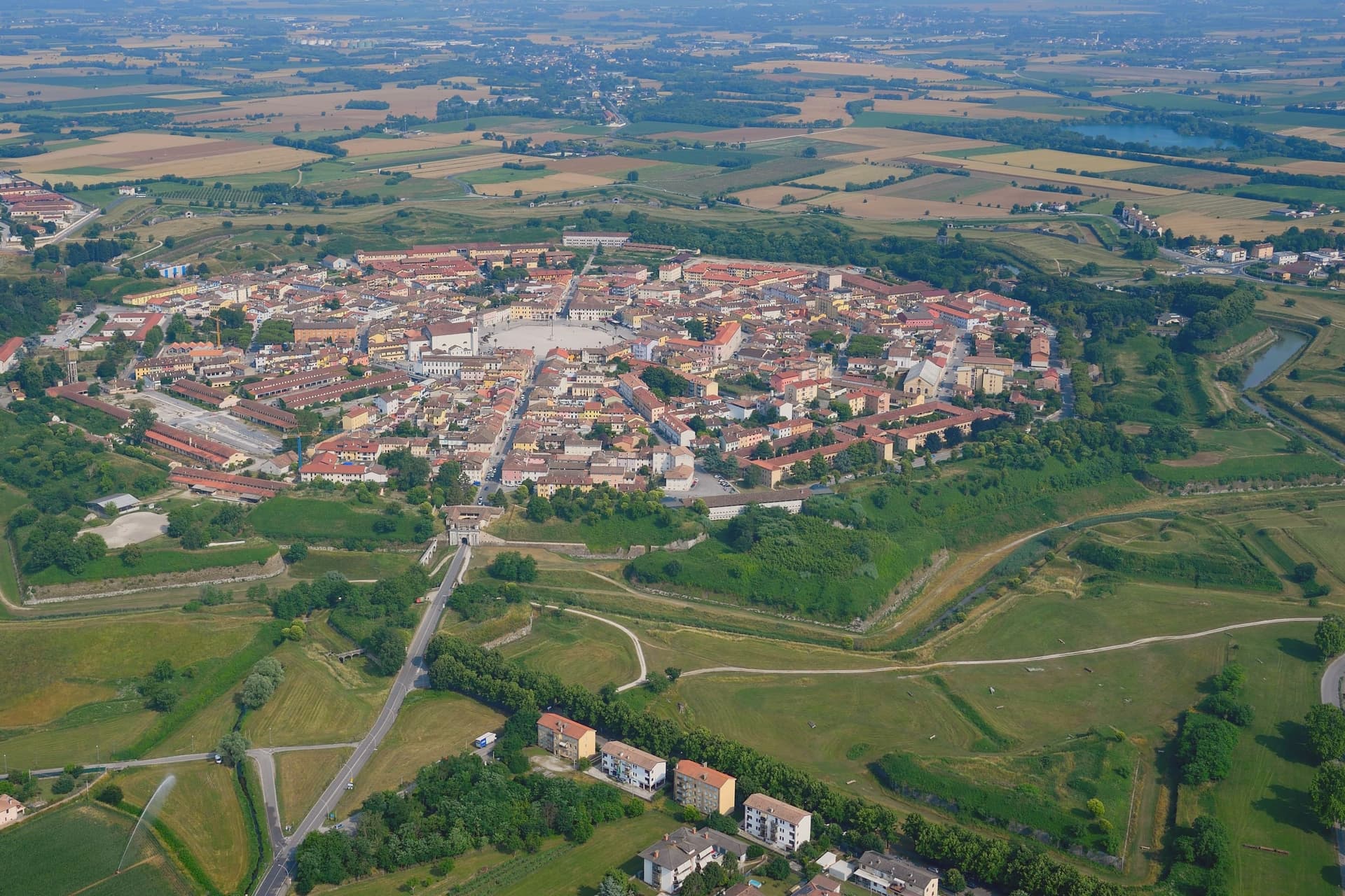
Palmanova stands at 26 meters on the Friuli plain, between Udine and the Adriatic, on ground that in 1593 was open country twenty kilometers from the Habsburg border. The Venetian Republic chose the feast of Santa Giustina to found it, and built the geometry on Marcantonio Barbaro's design: nine points radiating from a six-sided center, three ring streets running concentric to the walls, ramparts angled so each point covers the one beside it.
The town has no separate old and new quarter, no upper and lower half. It is one plan, laid down whole and then filled in slowly: the piazza paved in 1602, the first ring of bastions closed in 1623, the second between 1658 and 1690, the third under a different army entirely between 1806 and 1813.
Venice began the design, an emperor finished it, and the interval between the two is longer than most towns take to form by accident. The city never had to defend itself in earnest.
What was built as a machine for war became, over three centuries and two occupations, simply a shape. Everything the town now shows a visitor, the star, the gates, the ring roads, is the residue of a defense that was never used.
What to see in Palmanova
- Piazza Grande. Hexagonal square laid out in 1602, six sides facing six radiating streets, ringed by the Duomo Dogale, the Loggia della Gran Guardia, and six bronze statues of the founding Provveditori.
- Duomo Dogale. Commissioned 1603, finished 1636, attributed to Scamozzi and Longhena. Baroque facade fronting a single Venetian nave, standing at the piazza's edge.
- Cinta muraria. The rings can still be walked in sequence: the 1623 line, the 1690 line, and the outer 1813 line, each built to a different generation of cannon range.
How to get to Palmanova
There is a railway station in the town, so you can arrive without a car and never need one while you are here. Udine is roughly 29 minutes away by road.
Our tip
April through June and September into October are the months Palmanova rewards. The fortress walls and the glacis around them are walkable in the cool, the Piazza Grande sits in shade by mid-afternoon, and the historical reenactment A.D. 1615 fills the centro in early September with Venetian-era costume drills. July and August push past thirty-three degrees on the open plain and the hexagonal piazza, fully exposed, becomes one of the hotter squares in the region between noon and four. Palmanova torna al 1615 falls in the season.
Cividale del Friuli
Why visit Cividale del Friuli
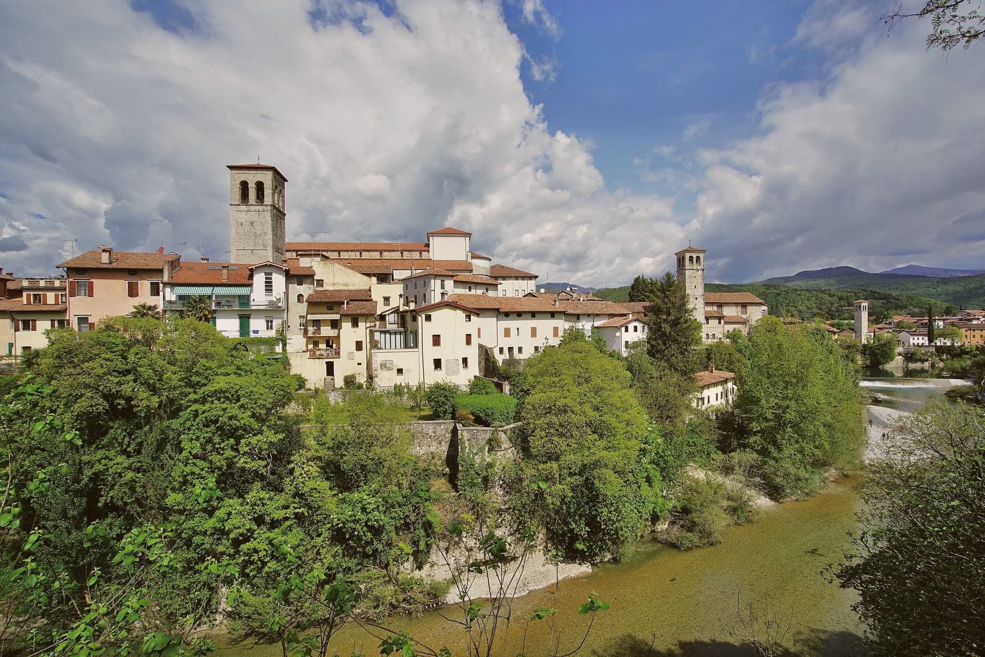
Cividale del Friuli sits at 138 meters on the right bank of the Natisone, fifteen kilometers from Udine and close enough to the Slovenian border that the river marks it. Julius Caesar founded the place as Forum Iulii in the first century BC, the name that eventually gave Friuli its own.
In 568 the Lombard king Alboin made it the capital of his first Italian duchy, and the Patriarchate of Aquileia later moved its seat here for four centuries. The Tempietto Longobardo, an eighth-century palatine chapel, holds six stucco female saints carved around 760, the best-preserved sculpture of the Lombard age in Europe.
It is one of seven sites in the UNESCO serial nomination Longobardi in Italia. The Ponte del Diavolo, begun in 1442, spans the Natisone gorge in two asymmetrical arches.
The Palio di San Donato fills the streets in late August, and Mittelfest brings Central European theater and music to the piazzas every July.
What to see in Cividale del Friuli
- Tempietto Longobardo. Eighth-century palatine chapel in the Monastero di Santa Maria in Valle, with six stucco female saints in high relief, UNESCO-listed since 2011.
- Ponte del Diavolo. Stone bridge over the Natisone gorge, begun in 1442 on two asymmetrical arches resting on a central rock outcrop.
- Duomo di Santa Maria Assunta. Fifteenth-century cathedral with the Pala di Pellegrino II, a twelfth-century gilded silver altarpiece, and an attached Museo Cristiano.
How to get to Cividale del Friuli
There is a railway station in the town, so you can arrive without a car and never need one while you are here. Udine is roughly 26 minutes away by road.
Our tip
April through June and September into October are the months when the Natisone valley shows best, with green hills, mild evenings, and the Slovenian border country open for walking. July brings Mittelfest and August the Palio di San Donato, so the centro storico fills with theater crowds and historical pageant. Both months can push past thirty degrees, though 138 meters of elevation and the river keep nights cooler than the Friulian plain. Palio di San Donato falls in August.
Susegana
Why visit Susegana
Susegana lies twenty kilometers north of Treviso, at the point where the Piave leaves the Prealps and turns south toward the lagoon. The commune stretches from a hilly northern strip, holding the frazioni of Colfosco and Collalto, down to Ponte della Priula on the plain, where the river is crossed rather than skirted.
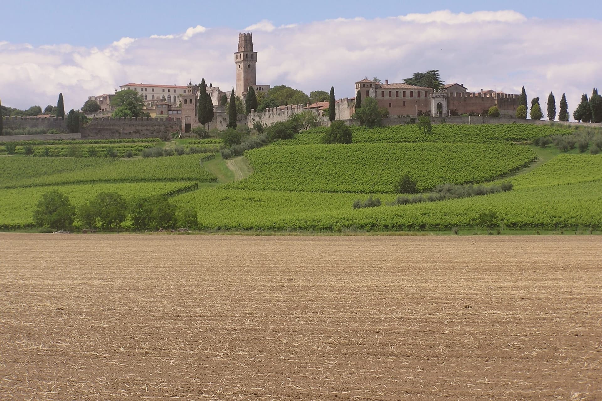
The older castle was founded by Ensedisio I in 1110, passed to the Republic of Venice as a Franciscan house, and was suppressed under Napoleon. The younger, Rambaldo III's foundation of 1323, grew into the larger fortress that still stands.
The Collalto counts, lords of the river crossing since the twelfth century, tie both hilltops and the plain below to a single dynasty that farms the southern vineyards to this day. What the two castles and the bridge below them add up to is a town organized by its geography: a family seated on the high ground for defense of the crossing, its wealth still rooted in the slopes it once ruled.
What to see in Susegana
- Castello di San Salvatore. Set on its own hill, the double walls still stand around what remains one of the largest fortified perimeters in the region, and the estate below is worked as a winery by the same family that built the walls.
- Castello di Collalto. The older of the two strongholds, founded on the Colle Alto, passed from fortress to Franciscan monastery and stands now as ruins above the village that took its name.
- Colline del Prosecco. The commune's share of the Valdobbiadene UNESCO slopes, given over to Glera vines producing DOCG Prosecco Superiore.
How to get to Susegana
Venezia is roughly 57 minutes away by road.
Our tip
April through June and September through October are the working months. Vine flowering runs into late May, harvest from mid-August into September, and the gold light over the Conegliano-Valdobbiadene hills draws photographers in October. July and August push past thirty degrees and the centro storico empties in the afternoon. Millenaria Festa in Tombola a Susegana falls in September.
Vittorio Veneto
Why visit Vittorio Veneto
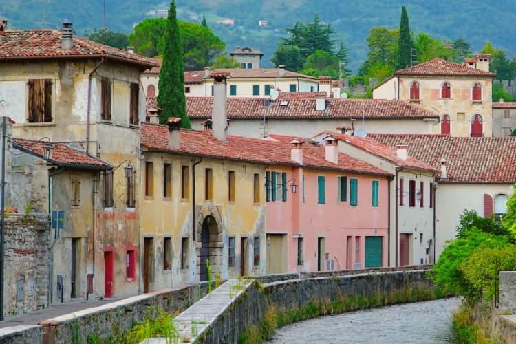
Vittorio Veneto sits at 138 meters at the foot of the Cansiglio plateau, seventy-five kilometers north of Padova. The commune was formed in 1866 by merging Ceneda, on the plain, with Serravalle, in the narrow valley above, and named for King Vittorio Emanuele II.
The two centers kept their own identities rather than blending into one. Serravalle is the older, walled district, set higher in the valley, with its cathedral holding the altarpiece of the Virgin with two saints.
Ceneda lies lower down on the plain, holding the Loggia of the Comunità and an eighteenth-century cathedral of its own alongside the castle ruins on the hill above it. In July 1923 the town took the name it carries now, after the battle that had taken its name from it three years earlier: the offensive of 24 October 1918 broke the Austro-Hungarian line, and the Armistice of Villa Giusti, effective 4 November, closed the war on this front.
The renaming fixed a wartime event permanently onto a place that had, until then, been two separate medieval settlements sharing a valley. What stands today is that same double structure, upper town and lower town, walled district and plain, still legible as two places joined by one name.
What to see in Vittorio Veneto
- Duomo di Serravalle. Rebuilt cathedral in the upper walled centro storico, holding the altarpiece of the Virgin with Saints Peter and Andrew in continuous liturgical use since it was painted.
- Museo della Battaglia. In the Loggia of the Comunità di Ceneda, built 1534-1538, with relics and documents of the offensive that ended the war on this front.
- Serravalle. Northern walled district above Ceneda, with sixteenth-century arcaded houses along the Meschio and the 1462 Loggia Serravallese.
How to get to Vittorio Veneto
There is a railway station in the town, so you can arrive without a car and never need one while you are here. Venezia is roughly 59 minutes away by road.
Our tip
April through October is the working season. April and May bring the Cansiglio plateau into play with walking weather and the upper Meschio at full flow. June through August stays cooler than the plain, with the narrow Serravalle valley holding shade through midday; the lower part around Ceneda pushes into the low thirties. Festa della Val Lapisina falls in July.
Conegliano
Why visit Conegliano
Conegliano sits at 65 meters where the Veneto plain meets the Prealps, fifty kilometers north of Venice. A tenth-century castle on the hill above the town still holds its bell tower and outer walls and now houses a small museum.
The painter Giambattista Cima was born here around 1459; his altarpiece for the Duomo, dated 1492, hangs in the cathedral and stays in continuous use. The Contrada Granda, the arcaded main street that runs below the castle, holds the medieval and Venetian-period layout intact.
The defining contemporary fact is Prosecco. In 1876 the Scuola Enologica opened on Via XX Settembre, the first oenology school in Italy, and it has trained the producers who built the Glera-based wine into a global category.
The Conegliano-Valdobbiadene DOCG was created in 2009 and the surrounding hills were inscribed by UNESCO in 2019. The town runs a working economy of agriculture, food processing and tertiary services, and the railway station puts Venice forty minutes south and Belluno forty minutes north.
What to see in Conegliano
- Duomo di Conegliano. Fourteenth-century cathedral with a façade hidden behind the arcaded Scuola dei Battuti, housing the 1492 altarpiece by Cima da Conegliano.
- Castello di Conegliano. Tenth-century castle on the hill above the town, with bell tower and outer walls preserved; the tower houses the Museo Civico.
- Contrada Granda. Arcaded main street running below the castle, the spine of the centro storico, intact since the Venetian period.
How to get to Conegliano
There is a railway station in the town, so you can arrive without a car and never need one while you are here. Venezia is roughly 53 minutes away by road.
Our tip
April through June and September through October are the months Conegliano is built for. The hills are green in spring and gold in autumn; the Prosecco vineyards flower in late May and harvest runs from mid-August into September. July and August push into the low thirties and the centro storico empties in the afternoon. Campolongo in Festa a Conegliano falls in August.
More from Anywhere Italy
 The best towns with a World Heritage site within two hours of Udine
- The best towns with a World Heritage site in the province of Treviso
- The best towns with a World Heritage site within 75 minutes of Padua
 The best towns with a World Heritage site within 75 minutes of Venice
 The 6 best towns you can reach by train in the province of Udine
- The best hidden towns you can reach by train in Friuli-Venezia Giulia