
The prettiest villages that eat well in Campania
Campania eats on two levels. Up in the Irpinian hills the cooking runs to chestnuts, pork, hand-cut pasta and Aglianico poured dark into thick glasses, in stone villages built from local tufa where the winter comes in properly cold. Down on the coast it is lemons, anchovies, provola, scialatielli and fish grilled plain, in villages of whitewashed vaults and majolica domes stacked above the water. The prettiest of these places have passed the national assessment of Italy's most beautiful villages, and in each one a dining guide has named a table.
Almost everyone arrives through Positano, and the reasons are obvious enough: the pink and ochre facades dropping to the beach, the boats, the light in late afternoon. In high summer the road along the coast slows to walking pace, the restaurants are booked out weeks ahead, and the price of a plate of pasta reflects the view rather than the kitchen. It is a fine place. It is also the single most photographed stretch of shoreline in southern Italy, and it behaves like it.
The same cliffs continue east and west, and the same volcanic soil climbs inland behind them towards Avellino. Fishing coves, lemon terraces, ceramic workshops and wine villages carry on well past the point where the coach tours turn around, and the cooking does not get worse for the lack of an audience. The villages here are smaller, quieter in shoulder season, and easier to eat well in without booking in advance.
Of the 66 communes we have mapped in Campania, 6 qualify as prettiest villages that eat well: each has passed the national assessment of Italy's most beautiful villages, and a dining guide has named a table in each. The smallest, Conca dei Marini, has 664 residents.
Two more lists worth reading alongside this one: The prettiest villages inside a nature park within 90 minutes of Salerno and The best coastal towns within an hour of Naples.
Conca dei Marini
Why visit Conca dei Marini
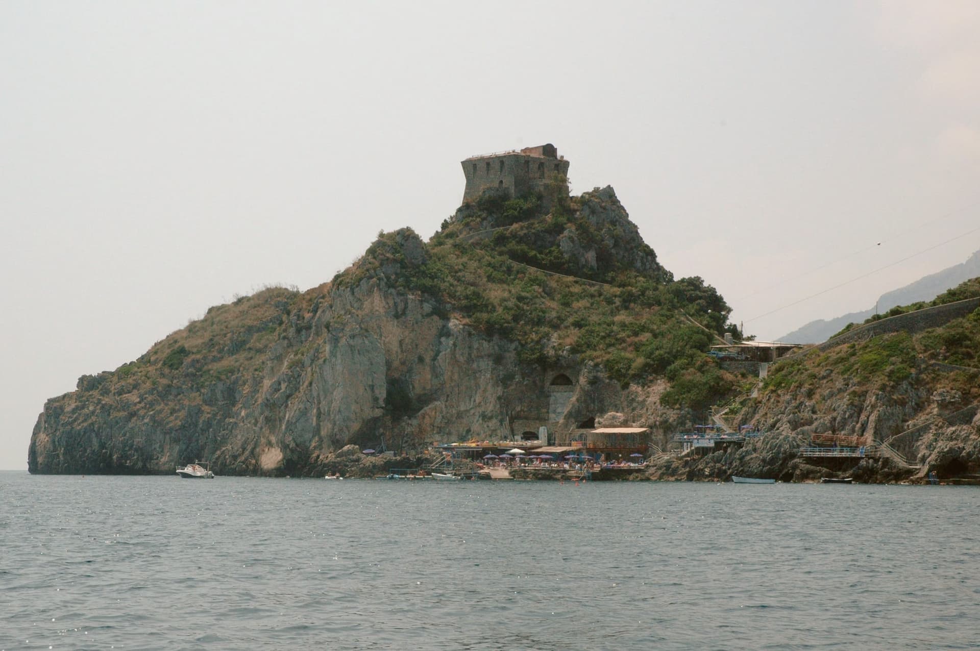
Conca dei Marini sits between Amalfi and Furore on the Tyrrhenian coast, a fold of stone houses around the marina and the promontory above it. According to local tradition the settlement was founded as Cossa by the Etruscans and taken by Rome in 272 BC.
The village divides between the clifftop, where the watchtower and the former monastery stand on their spur, and the water's edge, where the parish chapel sits on a rocky outcrop above the fishing cove. Below the road, accessible by stairs or by boat, the sea cave glows green from an underwater fissure.
The village has 664 residents and stays cooler than Amalfi in August. What holds the place together is the drop from cliff to water: a settlement built in a fold of stone that turned its isolation into a pantry, a lookout, and a hiding place for a green cave, and stayed small enough that all three remain within reach of each other.
Il Refettorio have been named by a guide.
What to see in Conca dei Marini
- Grotta dello Smeraldo. 45 by 32 meters of water surface, reached by stairs from the road or by boat from the marina below the village.
- Torre di Capo di Conca. On the promontory above the marina, part of the coastal defense network commissioned by the viceroy of Naples.
- Monastero di Santa Rosa. Former Dominican convent on a clifftop spur, founded 1681; the building is now a luxury hotel.
How to get to Conca dei Marini
Salerno is roughly 34 minutes away by road.
Our tip
May, June, September and October are the months to come. The sea is warm enough for the grotto boats to run reliably, the coastal road is open, and the Santa Rosa is celebrated on 2 August with a new sfogliatella reinterpretation each year by a guest pastry chef. July and August push the SS163 coastal road into single-file traffic from morning to night; locals walk between the marina and the upper village rather than driving.
Furore
Why visit Furore
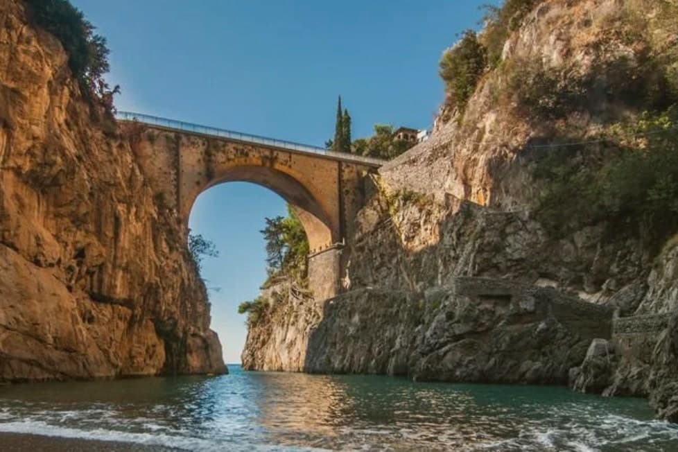
Furore stretches up the cliff between Praiano and Conca dei Marini on the UNESCO-listed Costiera Amalfitana, six hundred and eighty-eight people across houses that don't share a single piazza. The main settlement sits at 300 meters in the upper Vallone del Furore; the commune drops to sea level at the Fiordo di Furore, a narrow ria carved by the Schiato torrent that flows down from Agerola at 550 meters.
The historian Matteo Camera traced the name to the roar storms make through the gorge. Since the late 1980s the painter Silvio Vetrano's project Il Paese Dipinto has invited artists each September to paint murals on the village walls, which is why Furore is sometimes called the painted village or the village that doesn't exist.
The commune is a Borgo più bello d'Italia and a Città del Vino: the Fiorduva white from the Marisa Cuomo winery is grown on terraces above the fjord.
Bluh Furore, Hostaria Baccofurore, Melchiò have been named by a guide.
What to see in Furore
- Fiordo di Furore. Narrow ria cut by the Schiato torrent, southern Italy's only fjord, with a stone bridge crossed by the SS163 and a pebble beach below.
- Il Paese Dipinto. Open-air mural circuit started in 1980 by Silvio Vetrano, with new works added each September by invited Italian and international artists.
- Chiesa di Sant'Elia Profeta. Parish church on the upper part of the village, with a majolica-tiled dome and a small square overlooking the terraces below.
How to get to Furore
Salerno is roughly 36 minutes away by road.
Our tip
May, June, September and early October are the strongest months on this stretch of the Amalfi Coast. The sea climbs past twenty degrees, the SS163 buses run on a working timetable, and the Fiordo di Furore beach is accessible without a queue. July and August are full: the day-trippers come up from Amalfi and the small parking pockets on the SS163 fill before nine.
Atrani
Why visit Atrani
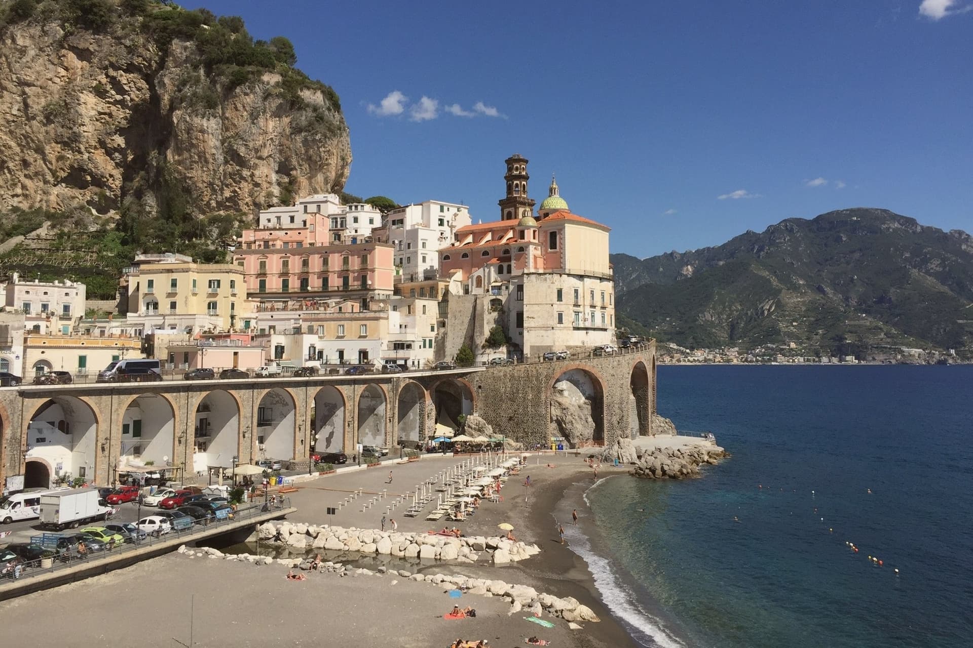
Atrani sits in a narrow ravine between Amalfi and Ravello on the Tyrrhenian coast, twelve hectares total, the smallest commune in Italy by land area. Eight hundred residents live in stone houses stacked up the gorge, connected by stairs and tunnels rather than streets.
The first written record is a letter from Pope Gregory I to the Bishop of Amalfi in 596 AD. Within the maritime Duchy of Amalfi, Atrani was the seat of the aristocracy: the doges were crowned in the Chiesa di San Salvatore de' Birecto, named for the birecto, the cloth cap of office handed to each new ruler.
The piazza, Piazza Umberto I, sits beside the sea behind a low arch. The Dutch graphic artist M.C.
Escher visited in the 1930s and made Atrani the model for the impossible architecture of his Metamorphosis series. The town today survives on day-trippers from Amalfi and a quieter overnight crowd that finds the steps.
A' Paranza have been named by a guide.
What to see in Atrani
- Collegiata di Santa Maria Maddalena. Baroque parish church above the village, with majolica dome and a panoramic terrace overlooking the gorge and the sea.
- Chiesa di San Salvatore de' Birecto. Tenth-century church on Piazza Umberto I where the doges of the Amalfi maritime republic were crowned and invested with the birecto.
- Piazza Umberto I. Small arcaded square behind a sea arch, the social center of the village, served as M.C. Escher's model for several Metamorphosis prints.
How to get to Atrani
Salerno is roughly 26 minutes away by road.
Our tip
May, June, September and October are the months that work. The light is long, the sea is warm enough for swimming, and the tunnel down to the beach doesn't bottleneck. July and August push thirty degrees and the day-tripper traffic from Amalfi spills into the piazza after lunch.
Gesualdo
Why visit Gesualdo
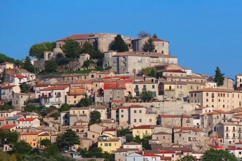
Gesualdo sits at 676 meters in central Irpinia, between the Fredane and Ufita valleys, 35 kilometers from Avellino. The castle on the hill is the reason the town exists in its present form: a Norman fortress raised in the 12th century, later rebuilt as a Renaissance court with frescoed apartments and an interior chapel.
The medieval village wraps around that hill, its stone houses set on the slopes above the two river basins, so the town reads as a single unit with the fortress at its head and the lower parish, home to the Chiesa del Santissimo Rosario, gathered below. The 1980 Irpinia earthquake damaged the castle severely, and reconstruction has been partial since the 2010s.
What stands today is a village still organized around a court that Carlo Gesualdo built for music and is remembered for a killing: the layout of Gesualdo, upper castle and lower village, mirrors the split in his own reputation, prince and composer above, the scandal that never left him below.
La Pergola have been named by a guide.
What to see in Gesualdo
- Castello di Gesualdo. Norman fortress of the 12th century, damaged in the 1980 earthquake and partly reopened in 2015 with restricted access. Carlo Gesualdo's frescoed apartments survive within, the rooms where the madrigals were composed and where Tasso and Marenzio were once received.
- Cappella di Santa Maria delle Grazie. Sixteenth-century chapel inside the castle complex, its frescoes commissioned by Carlo Gesualdo after his second marriage to Eleonora d'Este, a private space attached to the court rather than the parish.
- Centro storico di Gesualdo. Medieval village wrapped around the castle hill, stone houses on the slopes of the Fredane and Ufita basins, partly rebuilt after the 1980 earthquake.
How to get to Gesualdo
Salerno is roughly 80 minutes away by road.
Our tip
May through October is the comfortable window at 676 meters. June and September are the prime months: the temperature sits in the low twenties, the castle and the centro storico are walkable without summer heat, and the Gesualdo Festival of early music plays inside the castle complex on summer weekends. July and August run warmer at midday but the ridge cools after sundown.
Frigento
Why visit Frigento
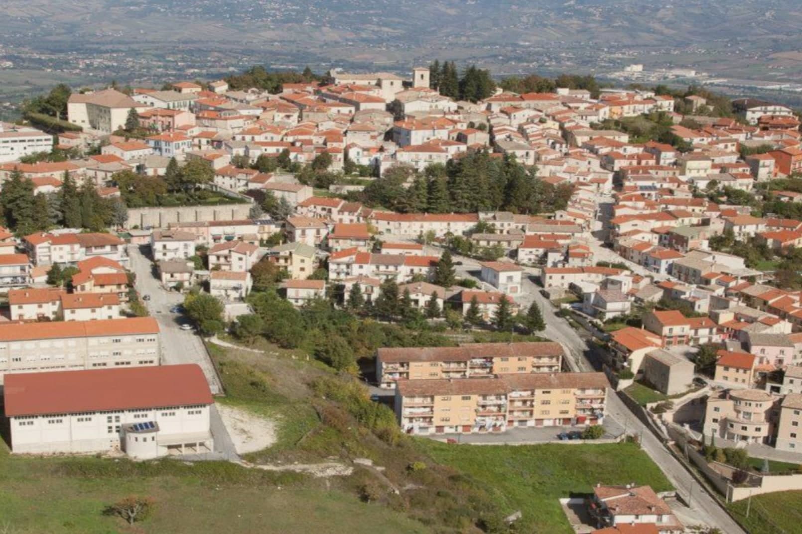
Frigento sits at 911 meters on a ridge in central Irpinia, 40 kilometers from Avellino, on a hill that overlooks the Ufita valley to the north, the Fredane to the south, the Ansanto to the east and the Calore to the west. The summit holds an opus incertum water complex from the 1st century BC, the Cisterne Romane, a vaulted chamber system probably built to serve a cluster of rustic villas linked to nearby Aeclanum on the Via Traiana.
The medieval village grew on top of the same ridge in the late Lombard period as a defensive site between the bishoprics of Benevento and Conza. The 1980 Irpinia earthquake hit the centro storico hard; reconstruction has been slow but most of the old village still stands in stone above the cisterns.
From the summit the view runs from the Apennines to the Daunia hills on a clear day. The commune is a Borgo più Bello d'Italia and a hazelnut and grain area, with cheese from the surrounding pastures.
Fontana Madonna have been named by a guide.
What to see in Frigento
- Cisterne Romane. Opus incertum water complex from the 1st century BC at the highest point of the village, the largest preserved Republican cistern in Irpinia.
- Centro storico di Frigento. Medieval stone village on the summit ridge, partly rebuilt after the 1980 Irpinia earthquake, with the four-valley panorama from the upper streets.
- Chiesa di Santa Maria Assunta. Former cathedral of the Diocese of Frequentum, reconstructed after the 1980 earthquake, with a Renaissance baptismal font and a crypt.
How to get to Frigento
Salerno is roughly 84 minutes away by road.
Our tip
May through October is the comfortable window at 911 meters. June and September are the prime months: the temperature sits in the low twenties when Avellino below pushes the upper twenties, the four-valley views are clear, and the cistern site stays accessible. July and August can run warm at midday but the ridge cools off after sundown. Cicerchiamo falls in the season.
Vietri sul Mare
Why visit Vietri sul Mare
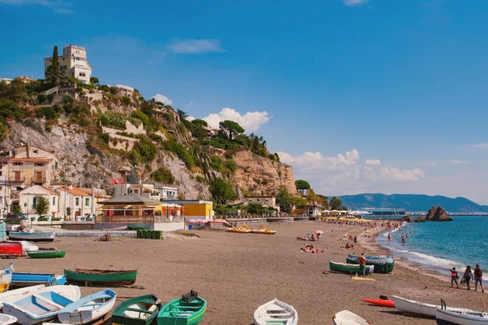
Vietri sul Mare sits at 80 meters at the eastern end of the Costiera Amalfitana, the most populous commune of the UNESCO-listed coastline, separated from the port of Salerno by a single harbour wall. The polychrome ceramics tradition is documented from the ninth century, with a generally agreed start around the fifteenth, and the industrial scale-up came in the 1920s and 1930s when a small group of German émigré artists settled in the workshops and brought the bestiary-and-floral pottery the town still produces.
The Chiesa di San Giovanni Battista, sixteenth century, has a green-and-yellow majolica dome that has become the town's signature image. Vietri is the only Amalfi Coast commune that holds Borghi più belli d'Italia and UNESCO together, and is a member of the Città della Ceramica network.
The marina at Marina di Vietri and the cliffside frazione of Raito and Albori sit below and above the centro on the same slope.
Volta del Fuenti by Michele De Blasio, Pascalò have been named by a guide.
What to see in Vietri sul Mare
- Chiesa di San Giovanni Battista. Sixteenth-century parish church with a green-and-yellow majolica dome and a bell tower of polychrome tiles, the most photographed image of the town.
- Museo Provinciale della Ceramica. Ceramic museum in Villa Guariglia at Raito, with Vietri pieces from the seventeenth century through the German-period 1920s and after.
- Albori. Cliffside frazione above the centro, also a Borgo più bello d'Italia, with stone houses, lanes, and views over the Gulf of Salerno.
How to get to Vietri sul Mare
There is a railway station in the town, so you can arrive without a car and never need one while you are here. Salerno is roughly 16 minutes away by road.
Our tip
May, June, September and early October are the strongest months. The water along the Marina di Vietri climbs past twenty degrees, the SS163 west to Cetara and Maiori runs without the gridlock of high summer, and the ceramic workshops keep their full hours. July and August are full: day-trippers arrive from Salerno on the local train and the Marina parking fills before mid-morning.
More from Anywhere Italy
- The prettiest villages inside a nature park within 90 minutes of Salerno
- The best coastal towns within an hour of Naples
- The best towns known for what they grow within an hour of Naples
- The best towns with a World Heritage site within an hour of Naples
- The best wine towns that eat well in Campania
 The best small mountain towns in Campania