
The prettiest villages inside a nature park within 90 minutes of Salerno
The land behind Salerno rises fast. Within an hour you can go from a beach of dark volcanic sand to beech and chestnut forest on the Irpinian ridges, where the air smells of woodsmoke by October and the local table runs to pork, wild greens, hard sheep's cheese and chestnuts roasted in perforated pans. On the coastal side the houses are lime-washed and vaulted, built for heat, stacked along terraces held up by dry stone walls that have carried lemon trees for centuries. Inland the building material changes to grey stone and the roofs steepen for snow. Both sides fall inside regional parks, which is why the ridgelines above them are still trees rather than villas.
People come to this stretch of Campania for Positano and Amalfi, and the reasons are obvious enough: the vertical town, the cathedral steps, the boats. In high summer the coast road becomes a single slow queue, and parking costs more per hour than lunch. The famous names absorb almost everyone who arrives, which leaves the rest of the map comparatively quiet.
The same coast keeps going, and the same mountains keep going behind it. Ravines, ceramic kilns, monastery paths and park boundaries carry on past the point where the tour buses turn around, and that is where these villages are. Each has passed the national assessment of Italy's most beautiful villages, and each sits inside a regional nature park, which means the walking starts at the edge of the houses. Fewer people go, and the difference shows in August.
Of the 33 communes we have mapped within 90 minutes of Salerno, 6 qualify as prettiest villages inside a nature park: each has passed the national assessment of Italy's most beautiful villages, and each sits inside a regional nature park. The smallest, Conca dei Marini, has 664 residents.
Two more lists worth reading alongside this one: The prettiest villages that eat well in Campania and The best coastal towns within an hour of Naples.
Conca dei Marini
Why visit Conca dei Marini
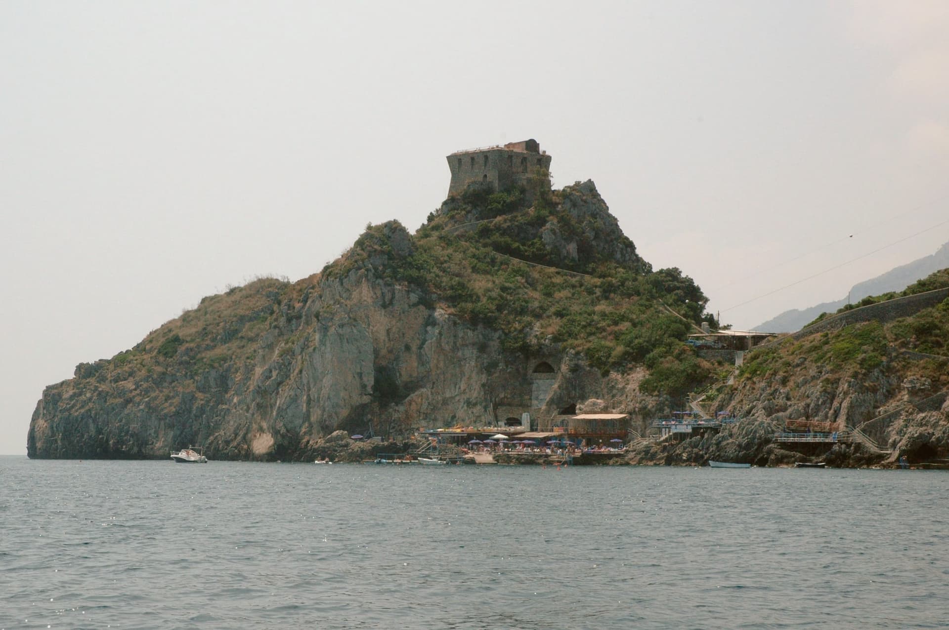
Conca dei Marini sits between Amalfi and Furore on the Tyrrhenian coast, a fold of stone houses around the marina and the promontory above it. According to local tradition the settlement was founded as Cossa by the Etruscans and taken by Rome in 272 BC.
The village divides between the clifftop, where the watchtower and the former monastery stand on their spur, and the water's edge, where the parish chapel sits on a rocky outcrop above the fishing cove. Below the road, accessible by stairs or by boat, the sea cave glows green from an underwater fissure.
The village has 664 residents and stays cooler than Amalfi in August. What holds the place together is the drop from cliff to water: a settlement built in a fold of stone that turned its isolation into a pantry, a lookout, and a hiding place for a green cave, and stayed small enough that all three remain within reach of each other.
What to see in Conca dei Marini
- Grotta dello Smeraldo. 45 by 32 meters of water surface, reached by stairs from the road or by boat from the marina below the village.
- Torre di Capo di Conca. On the promontory above the marina, part of the coastal defense network commissioned by the viceroy of Naples.
- Monastero di Santa Rosa. Former Dominican convent on a clifftop spur, founded 1681; the building is now a luxury hotel.
How to get to Conca dei Marini
Salerno is roughly 34 minutes away by road.
Our tip
May, June, September and October are the months to come. The sea is warm enough for the grotto boats to run reliably, the coastal road is open, and the Santa Rosa is celebrated on 2 August with a new sfogliatella reinterpretation each year by a guest pastry chef. July and August push the SS163 coastal road into single-file traffic from morning to night; locals walk between the marina and the upper village rather than driving.
Furore
Why visit Furore
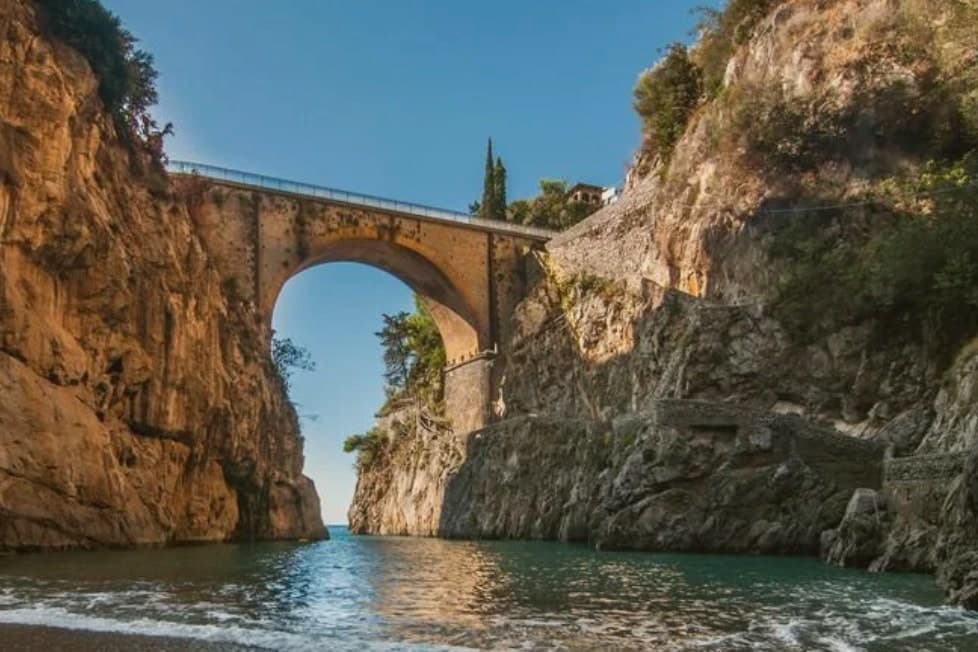
Furore stretches up the cliff between Praiano and Conca dei Marini on the UNESCO-listed Costiera Amalfitana, six hundred and eighty-eight people across houses that don't share a single piazza. The main settlement sits at 300 meters in the upper Vallone del Furore; the commune drops to sea level at the Fiordo di Furore, a narrow ria carved by the Schiato torrent that flows down from Agerola at 550 meters.
The historian Matteo Camera traced the name to the roar storms make through the gorge. Since the late 1980s the painter Silvio Vetrano's project Il Paese Dipinto has invited artists each September to paint murals on the village walls, which is why Furore is sometimes called the painted village or the village that doesn't exist.
The commune is a Borgo più bello d'Italia and a Città del Vino: the Fiorduva white from the Marisa Cuomo winery is grown on terraces above the fjord.
What to see in Furore
- Fiordo di Furore. Narrow ria cut by the Schiato torrent, southern Italy's only fjord, with a stone bridge crossed by the SS163 and a pebble beach below.
- Il Paese Dipinto. Open-air mural circuit started in 1980 by Silvio Vetrano, with new works added each September by invited Italian and international artists.
- Chiesa di Sant'Elia Profeta. Parish church on the upper part of the village, with a majolica-tiled dome and a small square overlooking the terraces below.
How to get to Furore
Salerno is roughly 36 minutes away by road.
Our tip
May, June, September and early October are the strongest months on this stretch of the Amalfi Coast. The sea climbs past twenty degrees, the SS163 buses run on a working timetable, and the Fiordo di Furore beach is accessible without a queue. July and August are full: the day-trippers come up from Amalfi and the small parking pockets on the SS163 fill before nine.
Atrani
Why visit Atrani
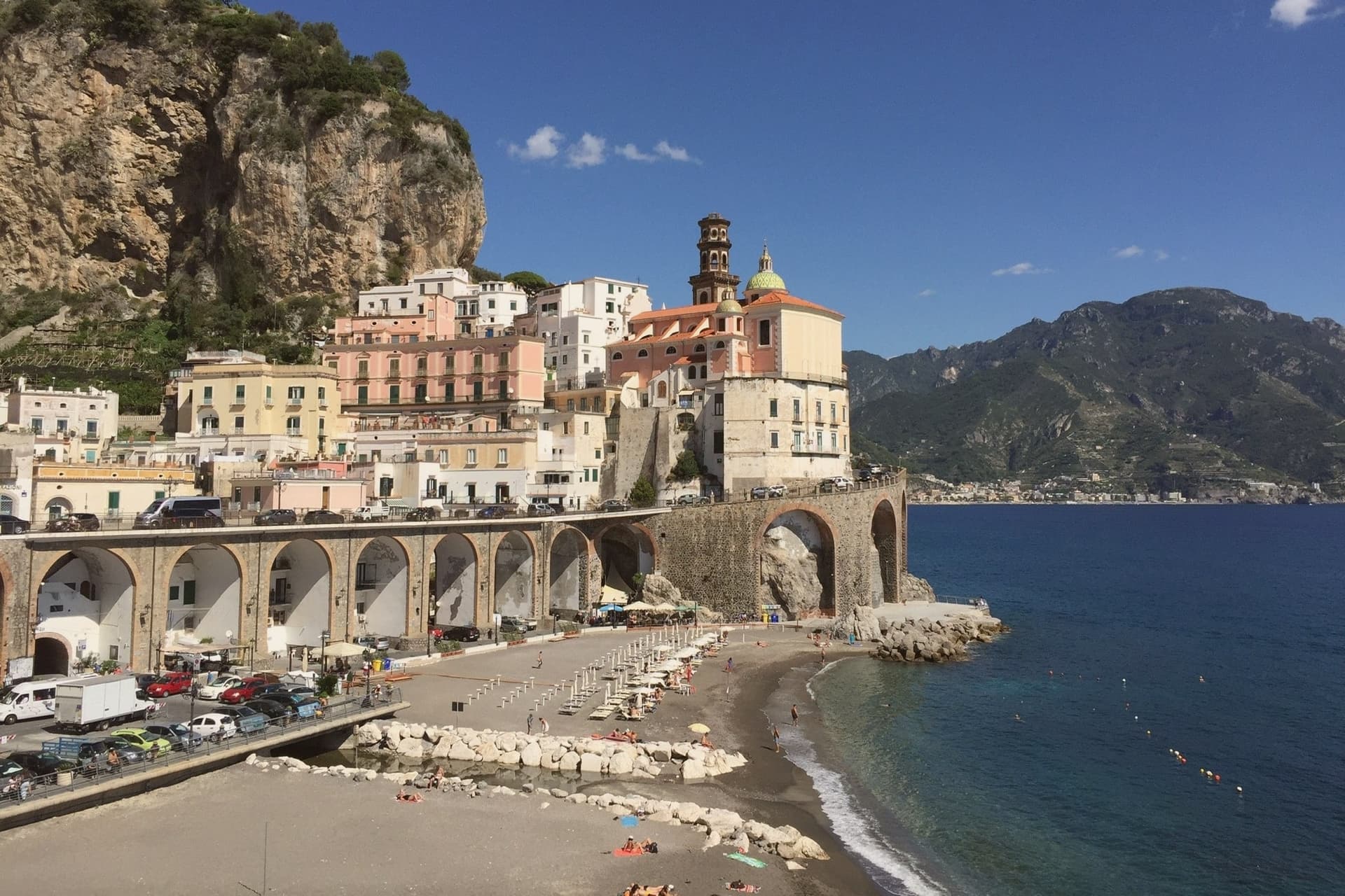
Atrani sits in a narrow ravine between Amalfi and Ravello on the Tyrrhenian coast, twelve hectares total, the smallest commune in Italy by land area. Eight hundred residents live in stone houses stacked up the gorge, connected by stairs and tunnels rather than streets.
The first written record is a letter from Pope Gregory I to the Bishop of Amalfi in 596 AD. Within the maritime Duchy of Amalfi, Atrani was the seat of the aristocracy: the doges were crowned in the Chiesa di San Salvatore de' Birecto, named for the birecto, the cloth cap of office handed to each new ruler.
The piazza, Piazza Umberto I, sits beside the sea behind a low arch. The Dutch graphic artist M.C.
Escher visited in the 1930s and made Atrani the model for the impossible architecture of his Metamorphosis series. The town today survives on day-trippers from Amalfi and a quieter overnight crowd that finds the steps.
What to see in Atrani
- Collegiata di Santa Maria Maddalena. Baroque parish church above the village, with majolica dome and a panoramic terrace overlooking the gorge and the sea.
- Chiesa di San Salvatore de' Birecto. Tenth-century church on Piazza Umberto I where the doges of the Amalfi maritime republic were crowned and invested with the birecto.
- Piazza Umberto I. Small arcaded square behind a sea arch, the social center of the village, served as M.C. Escher's model for several Metamorphosis prints.
How to get to Atrani
Salerno is roughly 26 minutes away by road.
Our tip
May, June, September and October are the months that work. The light is long, the sea is warm enough for swimming, and the tunnel down to the beach doesn't bottleneck. July and August push thirty degrees and the day-tripper traffic from Amalfi spills into the piazza after lunch.
Summonte
Why visit Summonte
Summonte sits at the foot of the Partenio massif, ten kilometers from Avellino. The name comes from the Latin Submontis, under the mountain.
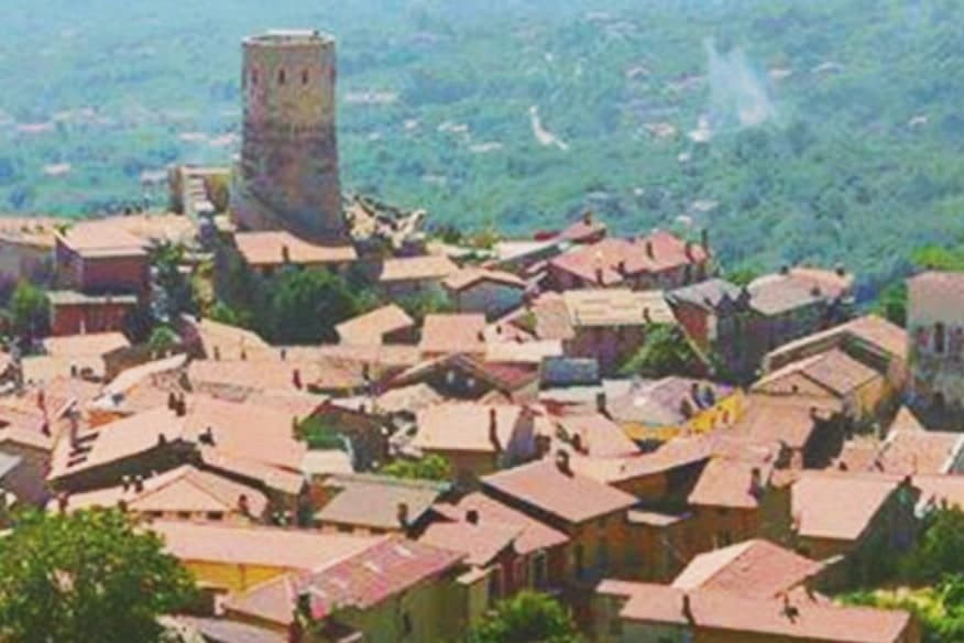
Pre-Roman tombs of the Osci show the slope was inhabited well before the current village, which dates from the 5th century when refugees from Nola, Abella and Abellinum took to the heights to escape the barbarian raids. The borgo grew in concentric arcs around its tower, and the arrangement still reads on the ground: stone houses ring the base of Monte Vallatrone in rising bands, with the old center closest to the summit and the parish church down in the lower village.
The Della Leonessa family held the fief through the late Middle Ages and the Doria del Carretto controlled it for two centuries until feudalism ended in 1806. Hazelnuts from the surrounding slopes feed the Avellino industrial chain that supplies Nutella and the pasticceria of Naples.
The shape of Summonte, refuge above, orchard below, is the same logic repeated twice: the village climbed the mountain for safety, and the economy came back down it for trade.
What to see in Summonte
- Torre Angioina. Built 13th-14th century on the ruins of a Norman-Swabian castle, the tower stands as the centre and emblem of the village on Monte Vallatrone, its cylinder rising clear of the rooftops.
- Centro storico di Summonte. Concentric medieval village wrapped around the tower, stone houses climbing the slope with views across the Partenio.
- Chiesa di Santa Maria Maggiore. Parish church in the lower village, with a Baroque interior reconstructed after the 1980 Irpinia earthquake.
How to get to Summonte
Salerno is roughly 90 minutes away by road.
Our tip
May through October is the comfortable window. June and September are the prime months at 738 meters: the temperature sits in the low twenties even when Avellino below pushes the upper twenties, and the Partenio trails are open without summer haze. July and August can run warm at midday but the upper village stays cool after sundown.
Nusco
Why visit Nusco
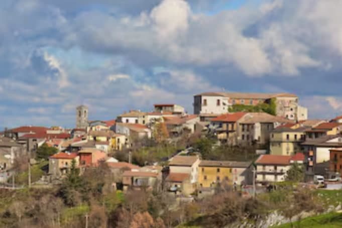
Nusco runs along a narrow ridge at 914 meters between the Ofanto and Calore Irpino river valleys, the watershed of inner Irpinia. The first written record is the 1093 will of bishop Amatus, who described his seat with the word civitas.
He was canonised after his death that year, and the Concattedrale di Sant'Amato in Piazza Vescovado holds his cult and treasury today, its composite stone façade and 33-meter bell tower set on a medieval church dedicated to Saint Stephen. In 1656 the plague killed up to a third of the population.
The streets of the centro storico are still paved in limestone slabs, which gives the town its nickname, the Balcony of Irpinia. Ciriaco De Mita, prime minister from April 1988 to July 1989, was born here and served as mayor until his death in 2022; the crowd applauded as his coffin reached the church.
What to see in Nusco
- Concattedrale di Sant'Amato. Co-cathedral in Piazza Vescovado, composite stone façade and 33-meter bell tower added in 1891, houses the relics and Treasure Room of the patron saint.
- Ruderi del Castello Longobardo. Ruins of the Lombard fortress at the highest point of the ridge, the original strongpoint that anchored the medieval civitas.
- Centro storico. Limestone-paved medieval lanes along the narrow ridge, the source of the Balcony of Irpinia nickname.
How to get to Nusco
There is a railway station in the town, so you can arrive without a car and never need one while you are here. Salerno is roughly 71 minutes away by road.
Our tip
May through October is the open season at 914 meters. Days run warm and dry, nights stay cool, and the limestone ridge gives long views across the Ofanto basin. July and August are tolerable up here while the lower Irpinia valleys bake, and the town fills on the August feasts as the diaspora returns from Avellino, Naples and abroad.
Vietri sul Mare
Why visit Vietri sul Mare
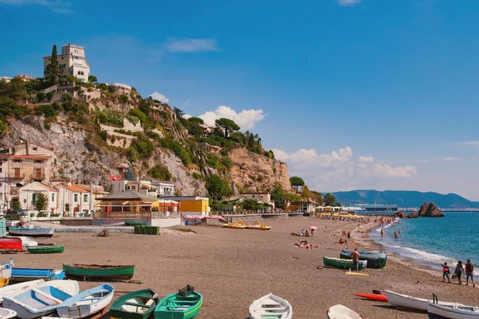
Vietri sul Mare sits at 80 meters at the eastern end of the Costiera Amalfitana, the most populous commune of the UNESCO-listed coastline, separated from the port of Salerno by a single harbour wall. The polychrome ceramics tradition is documented from the ninth century, with a generally agreed start around the fifteenth, and the industrial scale-up came in the 1920s and 1930s when a small group of German émigré artists settled in the workshops and brought the bestiary-and-floral pottery the town still produces.
The Chiesa di San Giovanni Battista, sixteenth century, has a green-and-yellow majolica dome that has become the town's signature image. Vietri is the only Amalfi Coast commune that holds Borghi più belli d'Italia and UNESCO together, and is a member of the Città della Ceramica network.
The marina at Marina di Vietri and the cliffside frazione of Raito and Albori sit below and above the centro on the same slope.
What to see in Vietri sul Mare
- Chiesa di San Giovanni Battista. Sixteenth-century parish church with a green-and-yellow majolica dome and a bell tower of polychrome tiles, the most photographed image of the town.
- Museo Provinciale della Ceramica. Ceramic museum in Villa Guariglia at Raito, with Vietri pieces from the seventeenth century through the German-period 1920s and after.
- Albori. Cliffside frazione above the centro, also a Borgo più bello d'Italia, with stone houses, lanes, and views over the Gulf of Salerno.
How to get to Vietri sul Mare
There is a railway station in the town, so you can arrive without a car and never need one while you are here. Salerno is roughly 16 minutes away by road.
Our tip
May, June, September and early October are the strongest months. The water along the Marina di Vietri climbs past twenty degrees, the SS163 west to Cetara and Maiori runs without the gridlock of high summer, and the ceramic workshops keep their full hours. July and August are full: day-trippers arrive from Salerno on the local train and the Marina parking fills before mid-morning.
More from Anywhere Italy
- The prettiest villages that eat well in Campania
- The best coastal towns within an hour of Naples
- The best towns known for what they grow within an hour of Naples
- The best towns with a World Heritage site within an hour of Naples
 The best mountain towns within 90 minutes of Salerno
 The prettiest villages in the province of Avellino