
The best olive oil towns within 90 minutes of Pisa
Olive oil in this corner of Tuscany and its Ligurian border country tastes of the hills it comes from: sharp and grassy where the groves climb the Apuan slopes, softer and sweeter down towards the sea. The terraces are held up by dry stone walls, the houses are built of the same grey sandstone and, closer to Carrara, of marble offcuts nobody bothered to sell. Harvest runs from the end of October into December, when the frantoi open late and the first pressing is poured over toasted bread with nothing but salt. Eat it here with testaroli, panigacci, chestnut flour and lardo, and the oil stops being a souvenir and becomes lunch.
Most people arriving at Pisa airport point themselves at Florence, or at Chianti for the wine-and-oil estates around Greve and Panzano, where the tasting rooms have card machines, English menus and a coach parked outside by mid-morning. It is good oil and a beautiful landscape, which is exactly why the same roads carry the same traffic every September. The estates that sell most of the region's oil to visitors are the ones easiest to book, so they fill first.
The groves do not stop at the edge of the famous zones. They keep going north, up the Magra and the Aulella into Lunigiana, along the Versilia plain and into the marble country behind the coast, all of it inside the production areas of protected oils and all of it under ninety minutes from Pisa. Fewer people go, the mills are family-run, and the towns are small enough that the oil is sold from the place it was pressed.
Of the 49 communes we have mapped in a 90-minute drive of Pisa, 6 qualify as olive oil towns: each sits inside the production zone of a protected olive oil. The smallest, Fosdinovo, has 4,574 residents.
Elsewhere in the catalogue: The best olive oil towns within two hours of Parma and The best towns known for what they grow within two hours of Pisa.
Licciana Nardi
Why visit Licciana Nardi
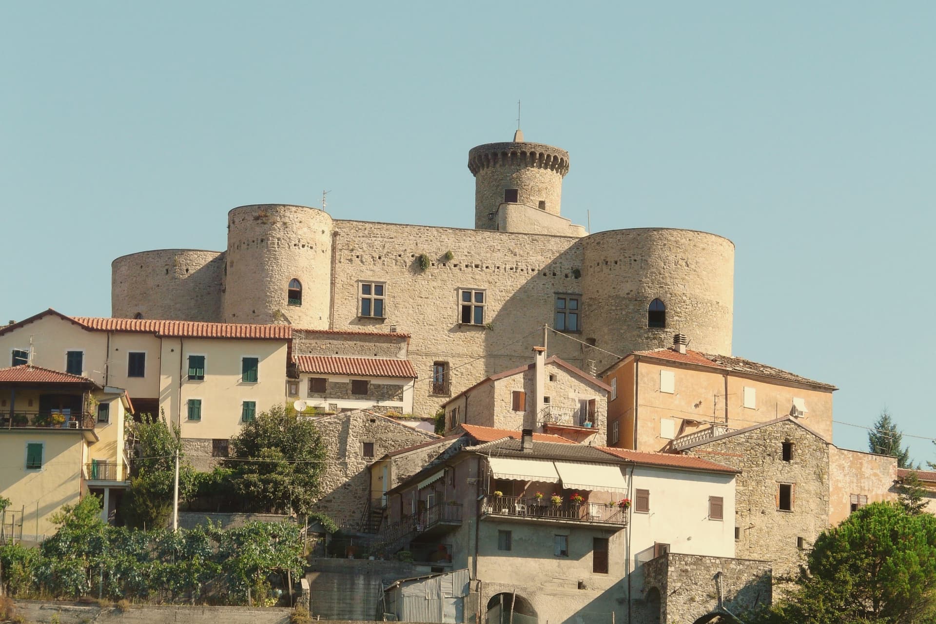
Licciana Nardi sits at 215 meters in the eastern Lunigiana, on the slopes of the Apennino Tosco-Emiliano National Park. The town is one of several Malaspina holdings in the valley, with a castle in the centro storico and another above Bastia, three kilometers up the ridge.
In 1933 the commune added the surname Nardi to its name in honor of Anacarsi Nardi, one of the Bandiera brothers' co-conspirators, shot by Bourbon firing squad in 1844 after the failed insurrection at Cosenza. The Apennine ridge above the town is part of the national park, with chestnut and beech forests, the Lagastrello pass, and trails connecting Lunigiana to the Garfagnana on the other side.
The local plate is panigacci, thin disks of unleavened dough cooked between terracotta plates and eaten with stracchino, salume, or pesto, a Lunigiana tradition shared with Pontremoli and the upper Magra villages.
What to see in Licciana Nardi
- Castello Malaspina di Licciana. Medieval Malaspina fortress in the centro storico, partly inhabited and partly visitable on request.
- Castello di Bastia. Smaller Malaspina castle in the frazione of Bastia, three kilometers up the ridge, with a fourteenth-century keep.
- Parco Nazionale dell'Appennino Tosco-Emiliano. Chestnut and beech forests on the ridge above the town, with the Lagastrello pass and trails into the Garfagnana.
How to get to Licciana Nardi
Pisa is roughly 79 minutes away by road.
Our tip
May through October is the season in the eastern Lunigiana. The ridge stays cooler than the lower valley, the chestnut woods are open, and the trails into the Apennine park run from Apella up to the Lagastrello pass. July and August are warm but breezy at altitude.
Pontremoli
Why visit Pontremoli
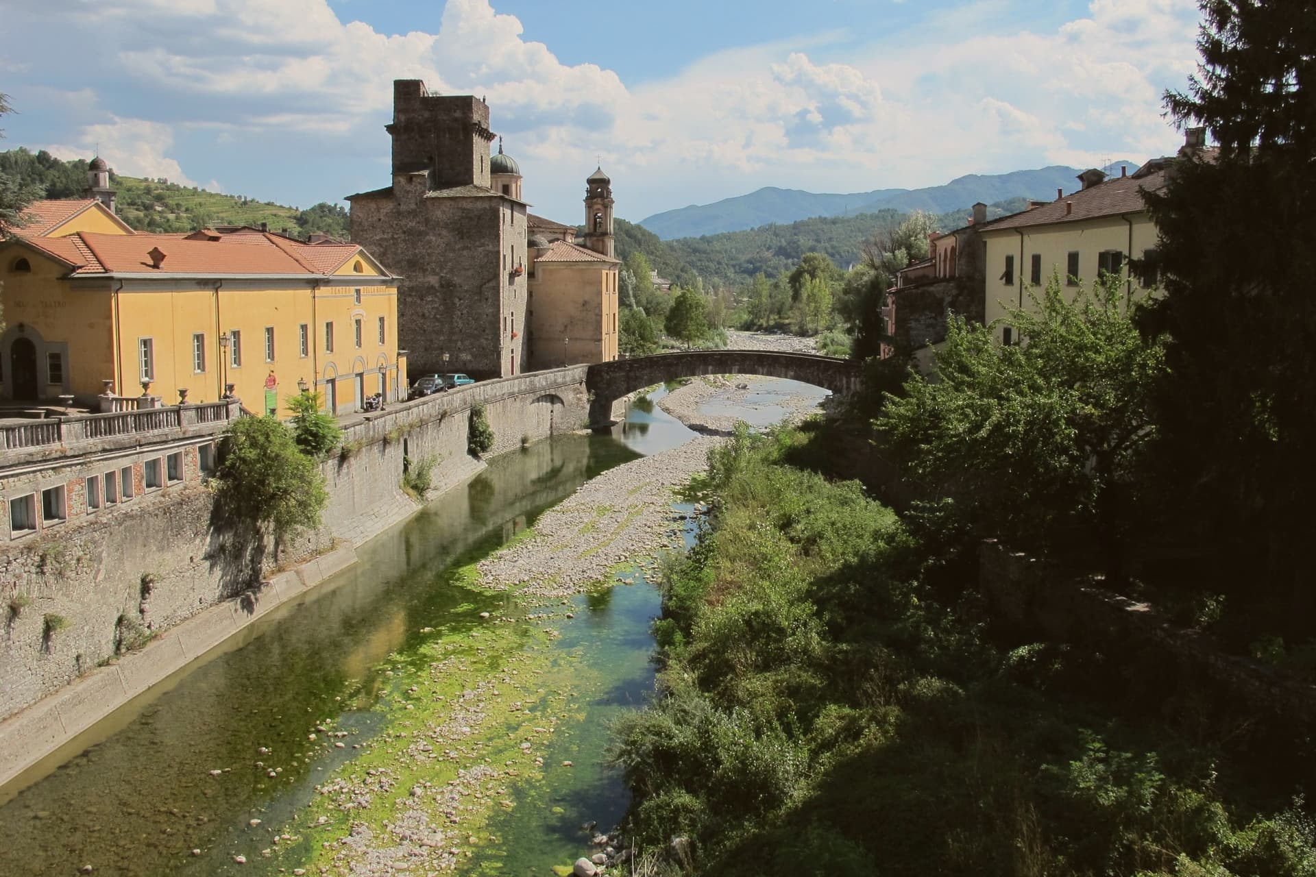
Pontremoli sits at 236 meters where the Magra and the Verde meet, the northern gate of Tuscany and the historic capital of Lunigiana. The Via Francigena crossed here on the descent from the Cisa pass, which is why the town's medieval bridges, the Ponte della Cresa and the Ponte del Casotto, still carry pilgrim traffic eight centuries later.
The Castello del Piagnaro above the centro storico holds the Museo delle Statue Stele Lunigianesi: anthropomorphic sandstone figures carved between 3000 and 200 BC, eighty of them recovered from the surrounding hills, unique to this corner of Italy. The Bancarella Prize, awarded by the town's traveling booksellers since 1953, made Pontremoli the only Italian commune where a literary prize was founded by the people who actually sell books rather than write them.
The local plate is testaroli, a Ligurian-Lunigiana flatbread cut into diamonds and eaten with pesto or olive oil.
What to see in Pontremoli
- Castello del Piagnaro. Tenth-century fortress on the hill above town, named for the slate roof tiles (piagne), housing the Museo delle Statue Stele.
- Museo delle Statue Stele Lunigianesi. Eighty anthropomorphic stone figures carved between 3000 and 200 BC, the densest concentration of Copper Age stele in Europe.
- Concattedrale di Santa Maria Assunta. Seventeenth-century baroque cathedral with a single nave and a domed presbytery, on Piazza del Duomo.
How to get to Pontremoli
There is a railway station in the town, so you can arrive without a car and never need one while you are here. Parma is roughly 81 minutes away by road.
Our tip
April through June brings the rivers full and the chestnut woods green. The Premio Bancarella runs in late July on Piazza della Repubblica, the busiest week of the year. August is hot but cooler than the coast, with festivals across the Lunigiana valley. Medievalis a Pontremoli falls in August.
Montignoso
Why visit Montignoso
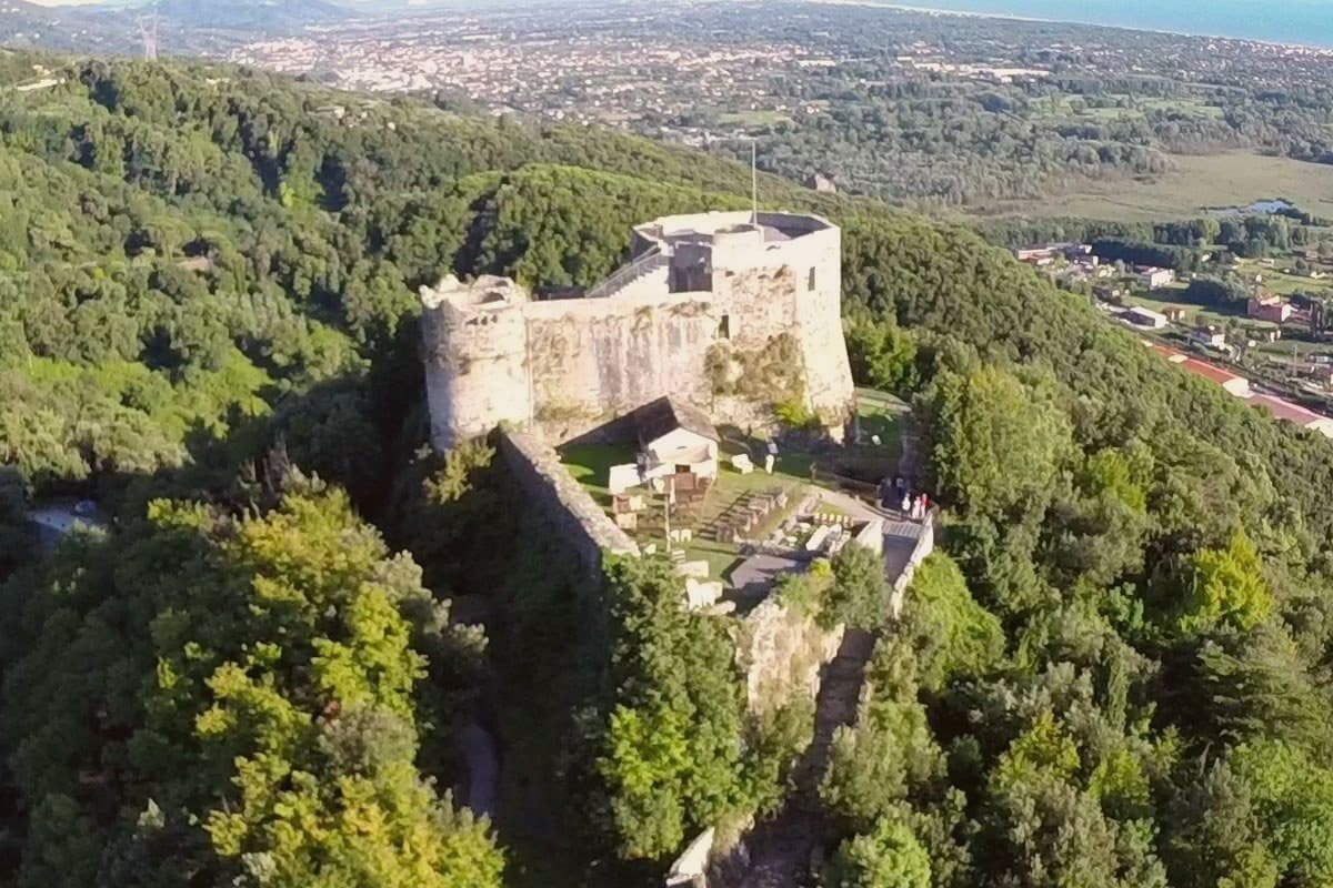
Montignoso sits at 132 meters at the foot of the Apuan Alps, between Massa and Pietrasanta, in the corner where Massa-Carrara province meets Versilia. Inland, the hill village stands under the castle's rise; the coastal frazione lies well apart from it, opening onto the Versilia beach, so the commune is really two settlements, one on the slope and one on the sand, with the wetland reserve filling the plain between them.
The town declined through the sixteenth century because of coastal malaria, which explains the gap between the fortified hill and the later life of the shore: the two halves of Montignoso grew up in different centuries for the same reason, one retreating from the coast, the other only possible once that reason had passed. The thermal signal comes from a small spring on the Pasquilio side of the commune.
Read together, Montignoso is a place defined less by any single site than by the line running from mountain to marsh to sea, each part settled on its own schedule.
What to see in Montignoso
- Castello Aghinolfi. The castle stands on an isolated rise above the village. What remains is the strongpoint that once taxed and watched the road below, not a ruin left to itself but a position, still legible as one.
- Lago di Porta. The reserve covers the coastal plain, flat water against the line of the Apuan Alps. The gate it is named for is gone; the wetland it left behind is not.
- Cinquale. Fine sand with the Apuan Alps rising directly behind it, a seafront quieter than its better-known neighbor and shaped by that comparison rather than by its own crowds.
How to get to Montignoso
There is a railway station in the town, so you can arrive without a car and never need one while you are here. Pisa is roughly 52 minutes away by road.
Our tip
May through September brings the Cinquale beach into use and the trails to the Castello Aghinolfi clear of winter rain. June and September are the cleanest weather. July and August fill the seaside parking and push the Pasquilio uplands into wildfire-risk hours.
Fosdinovo
Why visit Fosdinovo
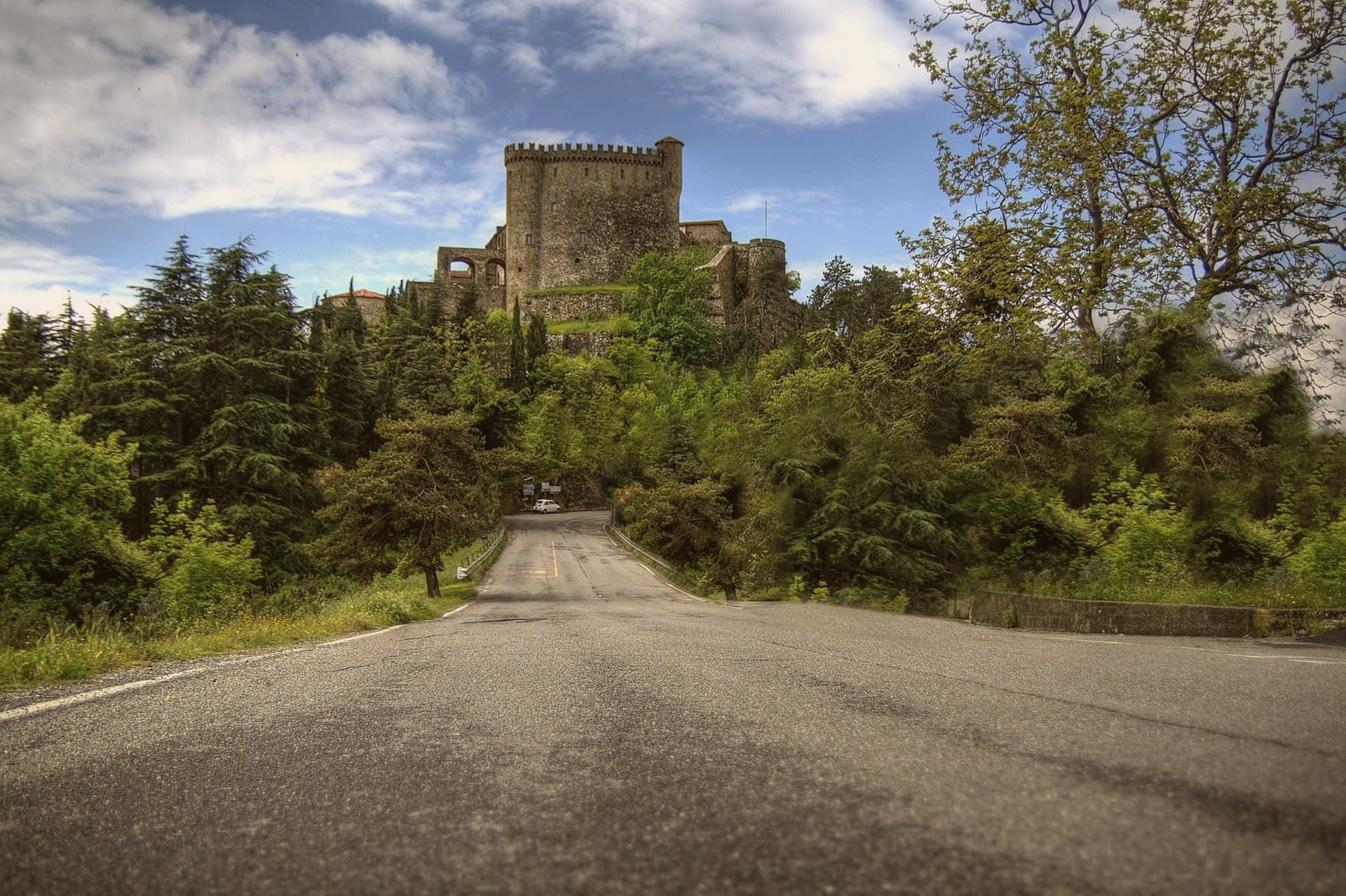
Fosdinovo sits at 500 meters on a ridge between the Apuan Alps and the Magra valley, with the Tyrrhenian visible on a clear day. The Castello Malaspina dominates the village: a fourteenth-century fortress on earlier foundations, continuously inhabited by the same family branch from 1340 until 1916, one of the longest unbroken castle dynasties in Europe.
Dante took shelter here in 1306, hosted by Moroello Malaspina, and the encounter became Canto VIII of the Purgatorio. The current owner is the same Malaspina line; the castle is open for guided tours that include the room where the poet is said to have slept.
The town sits at the southern edge of the Lunigiana, with the marble peaks of the Apuane behind and the Versilia coast in front. The Linea Gotica ran through these hills in 1944, and the Museo Audiovisivo della Resistenza in the centro storico documents what happened to the villages below.
What to see in Fosdinovo
- Castello Malaspina. Fourteenth-century fortress on earlier foundations, held by the same Malaspina branch from 1340 to 1916, with the Dante room open on guided tours.
- Museo Audiovisivo della Resistenza. Documentation center on the Gothic Line and the partisan war in the Apuane and Lunigiana, with films and oral histories.
- Centro storico. Walled village climbing the ridge below the castle, with stone houses and steep lanes between gardens facing the sea.
How to get to Fosdinovo
Pisa is roughly 70 minutes away by road.
✷ We have written about Fosdinovo
“We chose it the way you choose a card from a deck. We pulled up the map, ignored everything we recognized, scrolled north until the roads thinned out and the names stopped meaning anything to us, and there, behind the marble of Carrara, in a fold of the Apuane I had never heard of, was a borgo called Marciaso. There was one Airbnb.”
Read our piece on Fosdinovo →The Lunigiana | The Real Off the Beaten Path Italy
Our tip
April through June is the dry green window, with the Apuane still snow-streaked and the coast already warm below. July and August push the lowlands into the thirties; Fosdinovo at 500 meters stays a few degrees cooler and the breeze off the ridge holds. September and October are the second window, with the new oil from the lower slopes and the chestnuts higher up.
Sestri Levante
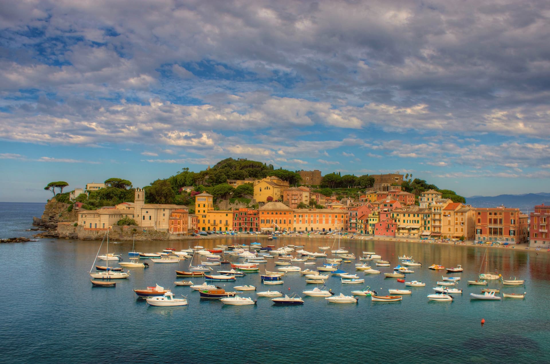
Why visit Sestri Levante
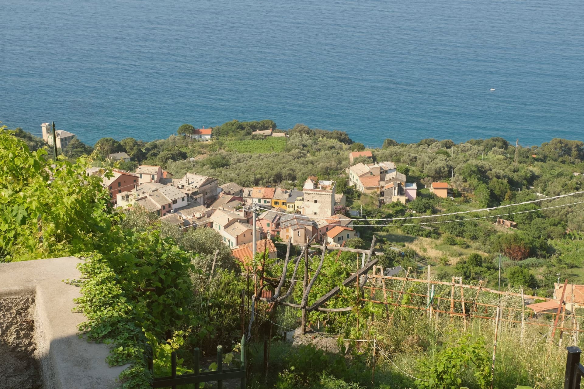
Sestri Levante sits at the head of the Tigullio gulf, forty kilometers southeast of Genova, on a former island the Gromolo river silted into a peninsula by the eighteenth century. Roman Segesta Tigullorum was the predecessor; the town joined the Republic of Genova in 1133.
The peninsula splits the coast into two bays that face different ways and carry different names. To the north lies the long beach known as the Bay of Fables, named by a television host in a 1950s broadcast for the Danish writer who stayed here in 1833.
To the south lies the smaller, quieter bay, named by a Ligurian poet in 1919. Between them, on the high ground of the peninsula, stands the old watchtower where an inventor ran some of his most advanced shortwave radio work, work significant enough that the Navy renamed the gulf itself for him.
A town this small holds a beach with a literary name, a bay with a poet's name, and a headland with an engineer's name, three separate claims to attention pressed into one stretch of coast shaped by a silted river.
What to see in Sestri Levante
- Baia del Silenzio. Smaller southern bay enclosed by colorful seventeenth- and eighteenth-century houses, named by poet Giovanni Descalzo in 1919.
- Baia delle Favole. Long northern beach and the Bandiera Blu stretch of the town, its name recalling Hans Christian Andersen, who looked out over the water from his inn.
- Torre Marconi. Old watchtower on the heights of the peninsula where Guglielmo Marconi carried out shortwave radio experiments in 1933 and 1934.
How to get to Sestri Levante
There is a railway station in the town, so you can arrive without a car and never need one while you are here. Genova is roughly 44 minutes away by road.
✷ We have written about Sestri Levante
“A steep hill falls into the sea. The houses are crammed on the slope and painted in bright colors because they are old, packed tight, and need help. There is a small port if the cove allows it and a bigger port if the cove is generous. There is a small piazza around a small church, with maybe four restaurants, three bars, and a gelato place. There is no space for a grand square, because there is no space for grand anything in Liguria.”
Read our piece on Sestri Levante →Tigullio Roadtrip | Four Versions of the Same Liguria
Our tip
April through June and September into October are the dry months on the Tigullio. The sea warms enough for swimming by late May. The Premio Andersen children's literature festival runs in June with author events across the town. Sagra dei Testaieu e Asado a Montedomenico falls in August.
Carrara
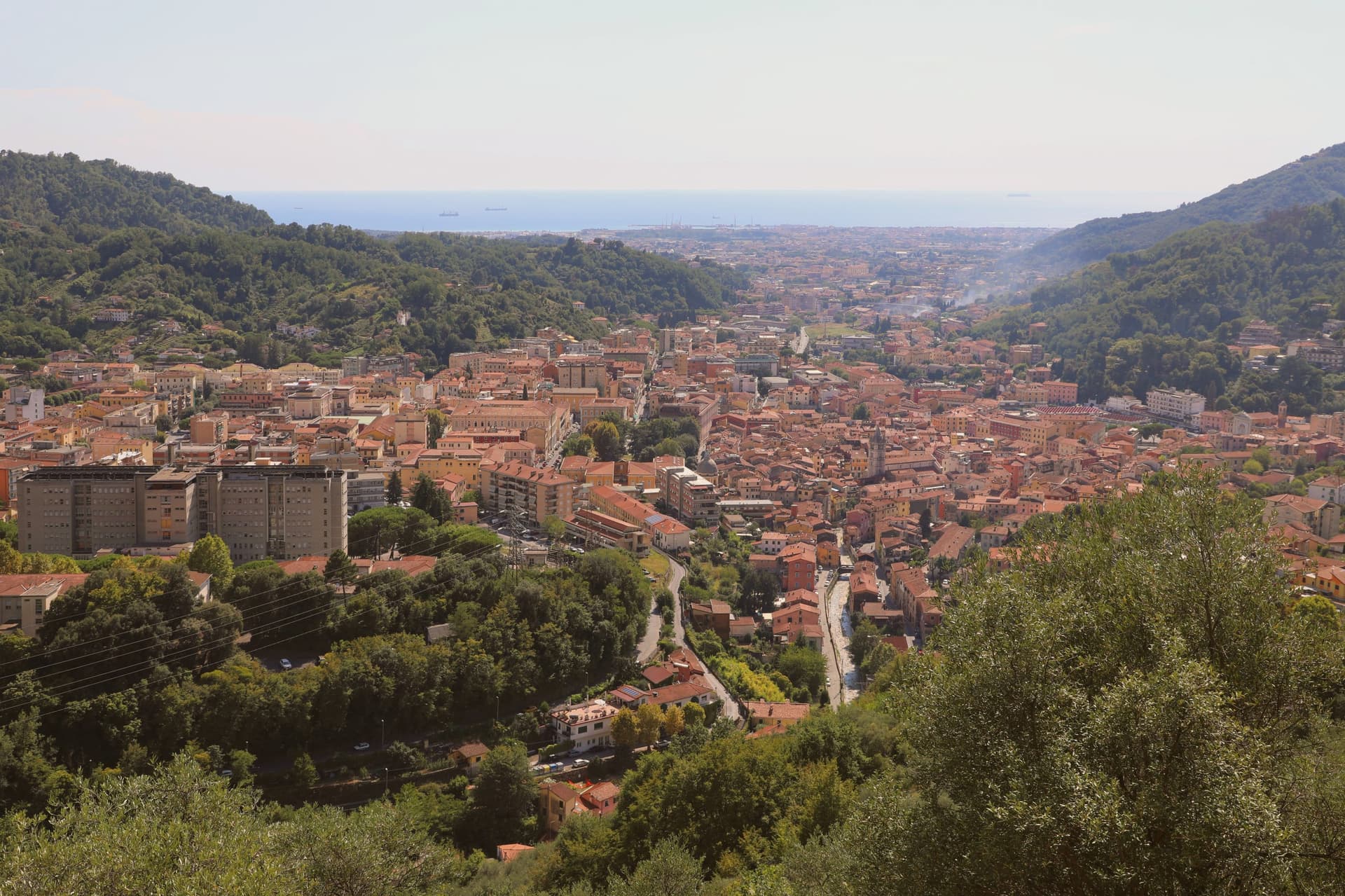
Why visit Carrara
Carrara sits at 80 meters in the narrow plain where the Apuan Alps drop to the Tyrrhenian. The 650-plus marble quarries in the three valleys above the town, Torano, Fantiscritti and Colonnata, have produced more marble than any other place on earth, worked since Roman times.
The white and blue-grey stone went into the Pantheon and Trajan's Column. Michelangelo first came in 1497 to find marble for his Pietà and kept returning until he opened his own quarry in the Polvaccio above Torano, still called Cava di Michelangelo.
The Duomo di Sant'Andrea, begun in the eleventh century, was the first medieval church built entirely of the local stone, with a bichrome marble façade. The city's Accademia di Belle Arti has trained sculptors since 1769 and the surrounding studi still work commissions for sculptors who never set foot in Italy.
What to see in Carrara
- Duomo di Sant'Andrea. Eleventh-century cathedral, the first medieval church built entirely of Apuan marble, with a Romanesque-Gothic bichrome façade finished in the fourteenth century.
- Cave di Marmo. Over 650 quarry sites in the Torano, Fantiscritti and Colonnata valleys, worked since Roman times and visible on cave tours from the town.
- Piazza Alberica. Sixteenth-century square built by Alberico I Cybo Malaspina inside the expanded city walls, ringed by marble façades and a central statue of Maria Beatrice d'Este.
How to get to Carrara
There is a railway station in the town, so you can arrive without a car and never need one while you are here. Pisa is roughly 55 minutes away by road.
✷ We have written about Carrara
“The road that goes up to Colonnata ends at Colonnata, and you understand this only when you arrive, because the village sits on a shelf of the mountain that the road was built to reach, and there is nowhere else for the road to go. I had driven up from the coast on a Tuesday in late spring with the windows open. I had come up to eat fat.”
Read our piece on Carrara →Colonnata, Carrara, and the Marble Mines | The White Mountain And The Fat
Our tip
May through September is when the cave tours run reliably and the seafront frazione of Marina di Carrara fills with families from Lombardia and Emilia. June is the best month for the quarries: long light, stable weather, and the white-on-white-on-grey of the cuts is visible at the Fantiscritti viewpoint without the August haze. July and August add heat and tour buses, particularly at Colonnata where the lardo cellars stay cool.
More from Anywhere Italy
 The best olive oil towns within two hours of Parma
- The best towns known for what they grow within two hours of Pisa
- The best coastal towns you can reach by train within 90 minutes of Pisa
 The best hill towns within 90 minutes of Pisa
 The best coastal towns within two hours of Parma
 The best olive oil towns that eat well in Liguria