
The best lake towns that eat well within 90 minutes of Verona
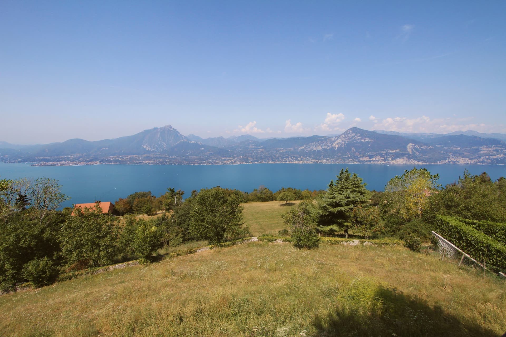
Lake Garda cooks differently from the countryside behind it. The water gives up perch, tench, lavarello and dried sardines, usually served with polenta or folded through risotto, and the hills at the southern end make lean red Bardolino, white Lugana and Custoza to drink alongside. Olive groves come almost to the shoreline, so the oil is local and peppery, and it turns up on everything. Houses are built in pale limestone and lake stone, with lemon-house pillars still standing in places, and the terraces open from spring, when the lake is cold and clear, through to the truffle and chestnut end of autumn.
Most people arrive from Verona and head for Malcesine, or take the ferry across to Limone sul Garda, and in July and August both are close to solid. The castle queue, the cable car queue and the lakefront gelato queue all overlap, and the restaurants nearest the water are cooking for people who will never come back. It is a reasonable day out. It is just not where the lake eats best.
The same shoreline continues, north into the steep olive terraces below Monte Baldo, south into the moraine hills where the vines start, and the kitchens continue with it. The towns here sit on the water within easy reach of Verona, and a dining guide has named a table in each, which is a duller claim than it sounds and a more useful one. Some are working ports, some are villages high above the shore with the lake laid out below.
Of the 15 communes we have mapped within 90 minutes of Verona, 6 qualify as lake towns that eat well: each sits on a lake shore, and a dining guide has named a table in each. The smallest, San Zeno di Montagna, has 1,464 residents.
If you are still choosing, we have also written The best towns with a serious restaurant that eat well within 90 minutes of Verona and The best lake towns within two hours of Bolzano.
San Zeno di Montagna
Why visit San Zeno di Montagna
The village sits thirty kilometers northwest of Verona. It took its current name in 1871, after unification, borrowing the name of Verona's patron saint; before that it was called Montagna di Monte Baldo, a plainer name tied directly to the mountain above it.
Pastoralism here goes back to the Copper and Bronze ages, when small communities drove herds up from the plain in summer along routes that still cross the mountain. Sheep and goats gave way to cattle as the dominant economy in the seventeenth century.
The frazione of Prada, reached by cable car from the lakeshore, holds the longest of these pasture terraces, its Church of San Bartolomeo built for the shepherds who worked the ground seasonally rather than for a settled parish. Below, the chestnut groves that ring the village are a separate, older layer of the economy, worked at lower altitude while the herds went up.
What emerges is a village organized on a vertical axis: lake view at one elevation, chestnut groves at another, pasture and summer huts higher still, each belonging to a different rhythm of use rather than to a single center.
Taverna Kus have been named by a guide.
What to see in San Zeno di Montagna
- Balcone del Garda. The viewpoint that names the commune, a place to stand at the edge of the ridge and take in the water and the opposite shore at once.
- Monte Baldo. Regional park rising above the village, its slopes still worked as pasture, with the old herding paths climbing through it toward the grass terraces higher up.
- Prada. Three-kilometer grass terrace on the mountain, reachable by cable car from the lakeshore, with the Church of San Bartolomeo standing among the summer pasture huts.
How to get to San Zeno di Montagna
Verona is roughly 51 minutes away by road.
Our tip
April through June and September through October are the months the commune works best. The chestnut groves green up in spring, the Baldo opens for walking, and the lake below stays cool enough to swim in by June. October brings the Festa delle Castagne over three weekends, with roasted Marrone di San Zeno and the woods turning to ochre and rust.
Brenzone sul Garda
Why visit Brenzone sul Garda
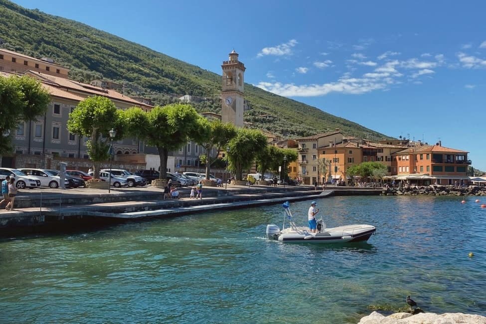
The comune sits on the eastern shore of Lake Garda at 75 meters, thirty-five kilometers northwest of Verona. It is not a town but a string of sixteen hamlets and small frazioni along the foot of the mountain: Assenza, Biaza, Campo, Castelletto, Castello, Magugnano which is the municipal seat, Marniga, Porto, Sommavilla and others, many named after the families who farmed the terraces above them.
Above the lake, fifteen minutes uphill on foot, sits the abandoned village, its stone houses reachable only by that path since the lakeside road below made the mid-slope route obsolete. Five permanent residents remain among the ruins.
The relation between the working shore strung with hamlets and the emptied village on the slope above is the story of the place: the road that connected the lake hamlets to each other was the same road that cut the mountain village off, and each half has stayed exactly where that change left it.
Nin, Al Pescatore have been named by a guide.
What to see in Brenzone sul Garda
- Campo di Brenzone. Reachable only on foot, with five permanent residents and stone houses standing in protected ruin.
- San Pietro in Vincoli, Campo. Church in the abandoned village, with frescoes by Giorgio da Riva dated 1358 still visible inside.
- Monte Baldo. Mountain ridge rising directly behind the lakeside hamlets to 2,218 meters at Cima Valdritta, with cable-car access from neighboring Malcesine.
How to get to Brenzone sul Garda
Verona is roughly 73 minutes away by road.
Our tip
April through October is the only real season. April and May bring the lake back to swimming temperature; the olive groves are flowering and Campo di Brenzone walkable on dry trails. June through August fills the lakefront with German and Austrian visitors; the lungolago path runs at full capacity on weekend afternoons.
Costermano sul Garda
Why visit Costermano sul Garda
The commune sits on a moraine amphitheater twenty-five kilometers northwest of Verona. The hills were a feud of the Brescia monastery of Santa Giulia in the early Middle Ages, then passed through Scaliger and Venetian rule before joining Italy in 1866; the name sul Garda was added only in 2018, to anchor the town's tourism identity to the water it sits above rather than on.
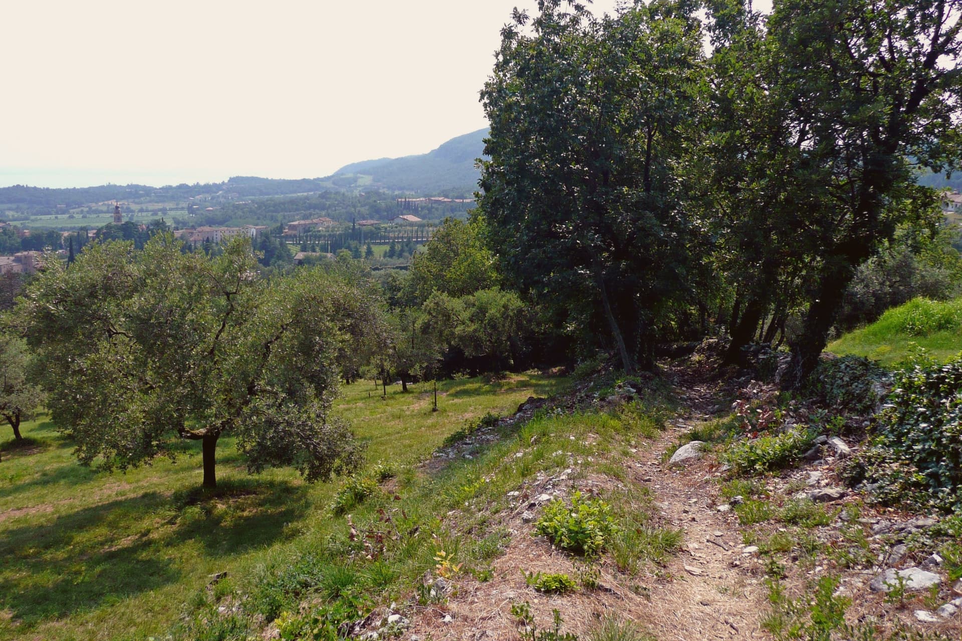
That distinction matters here: this is not a lakefront village but a hill settlement looking down at the shore, its center, its cemetery hill, and its vineyard slopes arranged around the belvedere at Marciaga rather than around a harbor. The economy runs on olive oil and hillside vines, and on the holiday accommodation that has filled these slopes since the 1970s, but the single largest reason people come here is not agricultural.
The cemetery holds the dead of a war fought decades after the monastery's feud and centuries after the Scaliger lords, and it sits on the same morainal hill as the sanctuary, the parish church, and the vine rows, a place where the working landscape and the memorial landscape occupy the same short walk rather than separate zones.
La Casa degli Spiriti, Osteria dai Coghi have been named by a guide.
What to see in Costermano sul Garda
- Santuario della Madonna del Castello. Sanctuary on the spur of Marciaga, its fifteenth-century frescoes intact, with a terrace looking over Lake Garda and the eastern shore.
- Deutsche Soldatenfriedhof. The graves cover the hillside above the lake, laid out since 1967 for the dead of the Second World War, a place kept in silence rather than commentary.
- Chiesa di San Siro. Parish church rebuilt in the nineteenth century in the center of the village, its freestanding campanile visible from the surrounding slopes, with a sightline to Monte Baldo across the water.
How to get to Costermano sul Garda
There is a railway station in the town, so you can arrive without a car and never need one while you are here. Verona is roughly 34 minutes away by road.
Our tip
April through October is the working window. April and May bring the lake back to swimming temperature on the shore four kilometers below, and the morainal hills into wildflower. June through August fills the holiday rentals and the lakefront day-traffic from Garda and Bardolino; the hills stay a few degrees cooler than the shore.
Bardolino
Why visit Bardolino
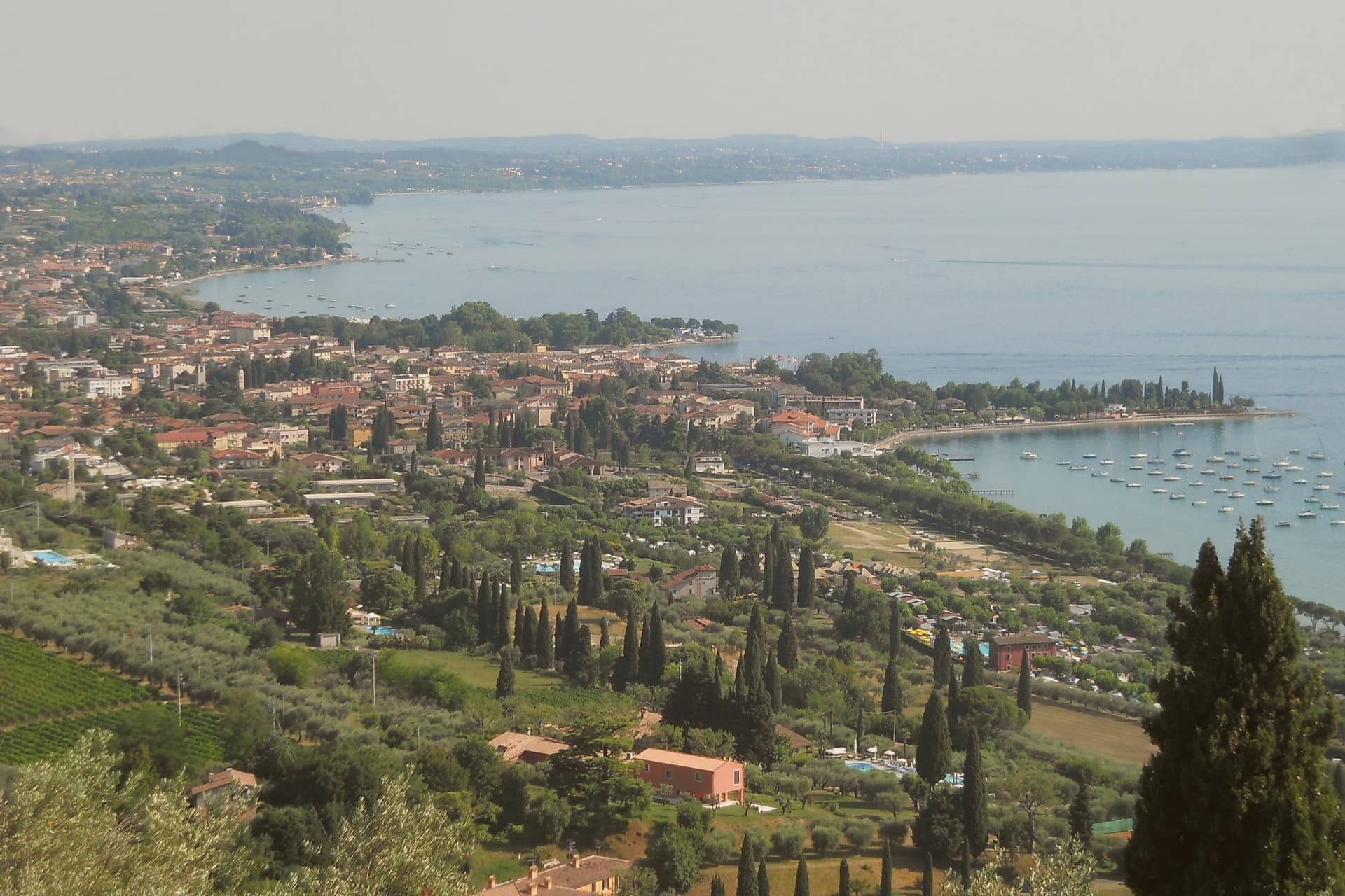
Bardolino sits on the eastern shore of Lake Garda at 65 meters, twenty-five kilometers northwest of Verona. The hills behind town have been planted with vines since the Roman period, and the modern DOC was granted in 1968.
Three grapes do the work: Corvina, Rondinella and Molinara. Long maceration produces Bardolino, the light red the town has lived on since the nineteenth century; short skin contact produces Chiaretto, the rosé that has overtaken the red in current sales.
Two churches hold the medieval line. San Zeno in the centro storico is ninth-century, one of the oldest in the province of Verona.
San Severo, built between the late eleventh and early twelfth centuries on the foundations of an earlier church mentioned in an 893 charter of Berengario, is the town's Romanesque anchor. The lakefront has been a tourist promenade since the 1950s.
The Palio del Chiaretto runs the first weekend of June; the Festa dell'Uva e del Vino runs the first week of October.
Il Giardino delle Esperidi, La Veranda del Color have been named by a guide.
What to see in Bardolino
- Chiesa di San Severo. Romanesque church built between the late eleventh and early twelfth centuries on the foundations of a structure mentioned in a 893 charter.
- Chiesa di San Zeno. Ninth-century church in the centro storico, one of the oldest in the province of Verona, on a Latin cross plan with a small apse.
- Centro storico. Walled medieval core around Piazza Matteotti, with arcaded streets dating to the Venetian period from the fifteenth century.
How to get to Bardolino
There is a railway station in the town, so you can arrive without a car and never need one while you are here. Verona is roughly 36 minutes away by road.
Our tip
April through October is the working season. April and May bring the lake back to swimming temperature and the Romanesque churches at their quietest. June through August fills the lungolago with German and Austrian visitors; weekends are crowded, weekday mornings still manageable. Bardolino Freddo falls in August.
Sirmione
Why visit Sirmione
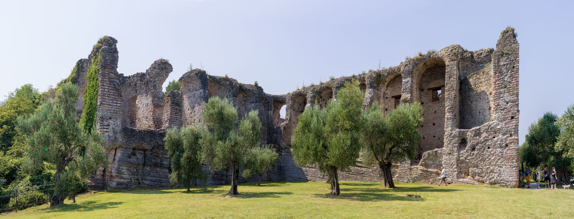
The peninsula runs four kilometers into the southern end of the lake, narrow enough that the old town occupies a triangle of land just over a mile long. Three low hills organize it: Cortine, San Pietro, and the rise at the tip where the Roman villa stands.
The fortress sits at the single entrance to the walled town, so the only way in by land passes through its gate, and the water it once enclosed as a fortified port is still shut in behind it. Past that gate the medieval streets are packed between the hills, and the ground rises toward the church at the highest point before falling away again toward the villa ruins at the peninsula's end.
The name attached to the villa is literary rather than archaeological: the poet's return in his thirty-first poem was to a family property on this tip of land, and nothing dug from the ground proves the two are the same place, but the name has held for a thousand years regardless. Maria Callas kept a villa here through the 1950s and 60s.
Between the enclosed water at one end and the hot spring at the other, the peninsula reads as a strip of land defined entirely by what edges it: lake on three sides, a gated approach on the fourth, and a history that settled into the name of a poem long before anyone could confirm it belonged there.
Caffè Grande Italia, Tancredi, La Rucola 2.0 and 2 more have been named by a guide.
What to see in Sirmione
- Castello Scaligero. Fortress at the entrance to the old town, with a 37-meter keep and a fortified port still enclosing a piece of the lake.
- Grotte di Catullo. Villa complex built late first century BC to early first century AD, its ruins scattered across olive terraces at the tip of the peninsula.
- Terme di Catullo. Thermal spa drawing on the same mineral spring that surfaces offshore in Lake Garda.
How to get to Sirmione
Verona is roughly 36 minutes away by road.
Our tip
April through October is the lake season. The Grotte di Catullo open with the spring archaeological calendar, the Scaligero is open year-round, and the peninsula promenade fills with day-trippers from Verona and the German A22 corridor. July and August are the heaviest months, with the old town packed between ten and seven; April, May, September and October are the easier months.
Peschiera del Garda
Why visit Peschiera del Garda
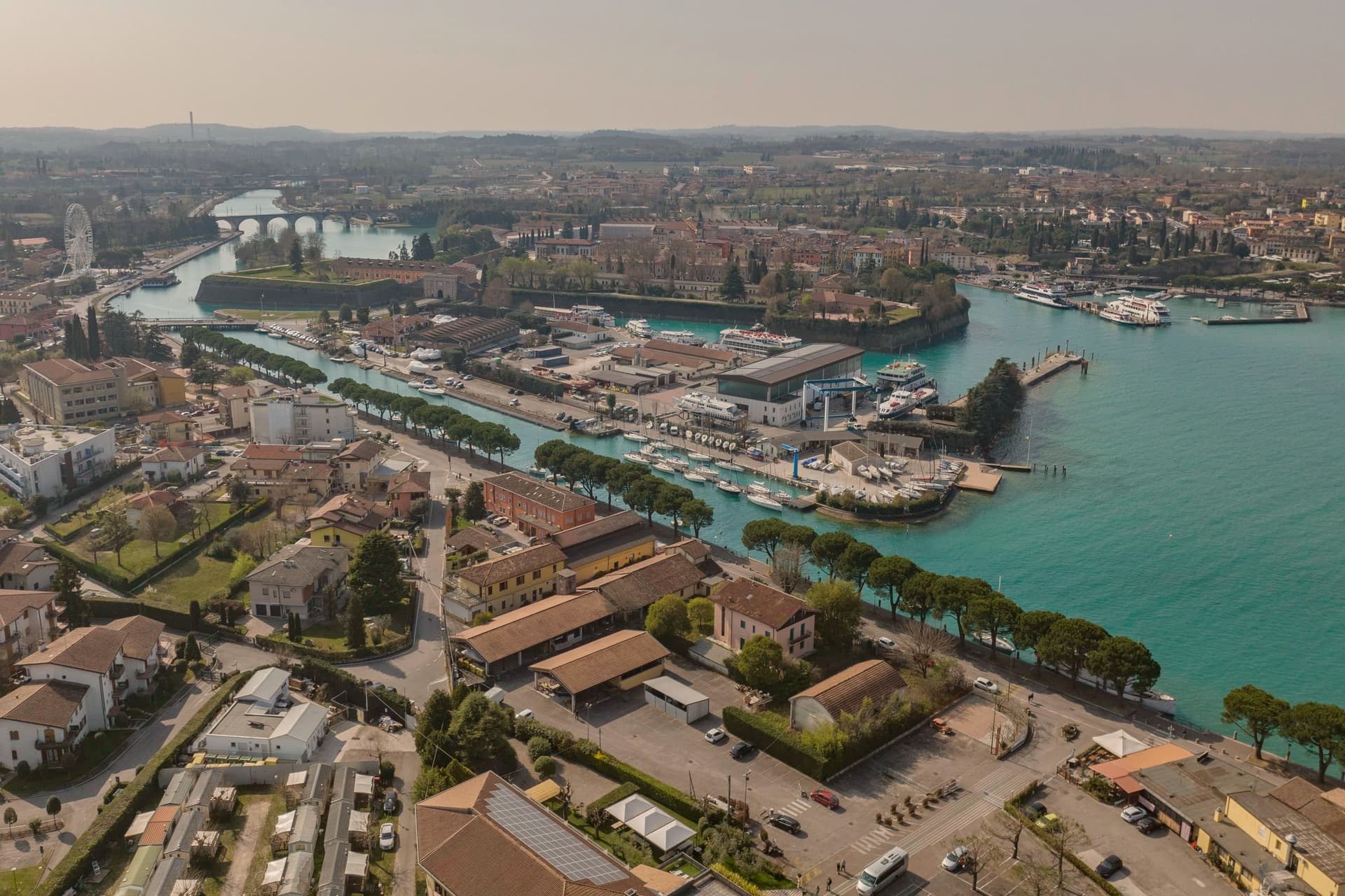
Peschiera sits at 68 meters on the Mincio at the point where the river leaves Lake Garda, twenty-five kilometers west of Verona. The Romans called it Ardelica.
The town the Republic of Venice rebuilt in 1549 was set on the medieval walls' corners, with a moat fed by the river, and the design came from Guidobaldo della Rovere before its execution on site. Austria took the town in 1815 and folded it into a wider system with Verona, Mantua and Legnago, the four together holding Lombardy-Venetia until 1866; Peschiera held the northwest corner of that arrangement, the point closest to the lake.
The fortress and the marsh settlement belong to different periods and different UNESCO listings, one Bronze Age and lakeside, one sixteenth-century and defensive, but both sit on the same stretch of water where the Mincio gathers itself before running south. The river itself is the town's organizing fact: it leaves the lake, splits into three canals to cross the walls, and rejoins below the railway bridge.
What Peschiera adds up to is a place built twice on the same threshold, where a lake becomes a river and a river becomes a border worth fortifying.
Osteria Bakarè have been named by a guide.
What to see in Peschiera del Garda
- Mura veneziane. Pentagonal fortress designed by Michele Sanmicheli for Venice from 1549, with five bastions, a moat fed by the Mincio and three water gates.
- Canali del Mincio. Three canals cross the fortress and rejoin below the railway bridge; the central one runs through the main square inside the walls.
- Piazza Ferdinando di Savoia. Main square inside the walls, bordered by the Palazzo del Comando, the Voltoni arches over the Mincio and the Caserma Catterin.
How to get to Peschiera del Garda
There is a railway station in the town, so you can arrive without a car and never need one while you are here. Verona is roughly 30 minutes away by road.
Our tip
April through June and September through October are the strongest months in Peschiera. The fortress walls, the moat and the Mincio canals are at their clearest in spring and autumn, and the lakefront south of the walls fills with sailing and ferry traffic. July and August push past thirty degrees and the southern Garda concentrates much of the lake's day-trip volume; the parking lots around the railway station queue from midmorning.
More from Anywhere Italy
- The best towns with a serious restaurant that eat well within 90 minutes of Verona
 The best lake towns within two hours of Bolzano
- The best lake towns within two hours of Venice
- The best small towns on Lake Garda's eastern shore
- The best lake towns within 75 minutes of Trento
- The best lake towns within 90 minutes of Padua