
The best hidden towns worth staying overnight in Trentino-Alto Adige/Südtirol
The mountain valleys of Trentino-Alto Adige run on a particular pleasure: waking up already high, with the rock lit pink before the coffee is poured. Houses here are built of stone at the base and larch above, with balconies that carry geraniums until the first frost and firewood stacked to the eaves after it. The food follows the same double logic as the language, canederli and barley soup on one page, tagliatelle with mountain butter and Trentino Teroldego on the next, Speck sliced thin against dark bread. Late September, when the meadows have been cut and the huts are still open, is arguably the best week of the year, and midwinter has its own case to make.
The default is the big name. Cortina d'Ampezzo and the Lago di Braies car park absorb an enormous share of everyone who comes to see the Dolomites, and the summer shuttle queues and the winter lift lines show it. Buses arrive, photographs are taken, and by late afternoon most of those people are driving back towards Venice or Bolzano. It is worth going. It is also worth understanding that a day trip buys you the crowded hours and none of the quiet ones.
The same limestone, the same pastures and the same kitchens carry on for valley after valley past the famous stop. The towns in this list sit along those valleys, in Badia, in Gröden, in Val Rendena, in the high Pustertal and up on the Nonsberg, and fewer people go to them. Each has somewhere to sleep that a travel guide has vouched for, which is what turns a drive-through into a base. Stay the night and the mountain belongs to the early walkers.
Of the 33 communes we have mapped in Trentino-Alto Adige/Südtirol, 11 qualify as towns worth staying overnight: each has a hotel a travel guide has vouched for, so you can stay rather than day-trip. This list is the hidden ones, 7 in all, ordered smallest first. The smallest, Corvara in Badia, has 1,396 residents.
Two more lists worth reading alongside this one: The best towns worth staying overnight in the province of Bolzano/Bozen and The best small ski towns that eat well in Trentino-Alto Adige/Südtirol.
Corvara in Badia
Why visit Corvara in Badia
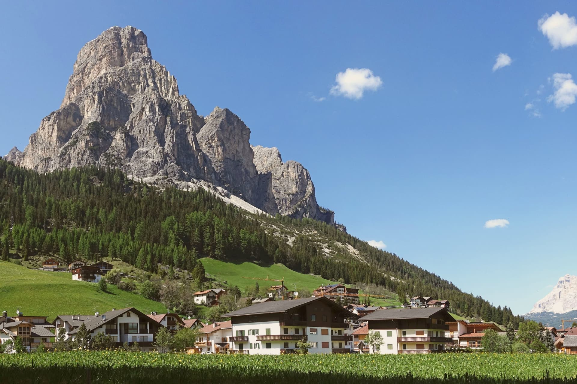
Corvara sits at 1,568 metres in a wide basin at the head of the Val Badia, below the rock spire of the Sassongher and inside the Dolomites UNESCO area. Ladin is the everyday language: in the 2024 census 87 percent of residents named it as their first tongue, with Italian and German distant second and third.
The settlement was a scattered group of farms until tourism arrived in the early twentieth century, and Corvara is considered the birthplace of organised Alpine tourism in the Val Badia. The village is one of four bases on the Sellaronda, the forty-kilometre ski circuit that loops the Sella massif through Corvara, Arabba, Canazei and Selva di Val Gardena on a single lift pass.
Above the village, the Pralongià plateau opens a long view to the Marmolada glacier. The Gran Risa piste at the next hamlet of La Villa hosts the men's giant slalom on the World Cup tour each December.
What to see in Corvara in Badia
- Chiesa di Santa Caterina. Late Gothic church first documented in 1347 and consecrated to Saint Catherine in 1452, holding the only well-preserved winged altar in Val Badia, dated 1520.
- Sassongher. Rock peak at 2,665 metres above the village, the signature silhouette of Corvara and a classic via ferrata climb on the eastern flank.
- Altopiano di Pralongià. Grassy plateau above the village reached by cable car, with open views to the Marmolada glacier and the surrounding Dolomite groups.
How to get to Corvara in Badia
Bolzano is roughly 75 minutes away by road.
Our tip
December through March is the ski season, the village at full capacity around the Sellaronda lifts, with the men's World Cup giant slalom on the Gran Risa each December at La Villa next door. June through September is the summer Dolomite season, cool even in July at 1,568 metres, with hiking, via ferrata and gravel cycling across the Pralongià plateau and the Puez-Odle park. April and May are quiet shoulder months, snow gone from the village but lifts mostly closed and hotels shut between seasons.
San Pancrazio
Why visit San Pancrazio
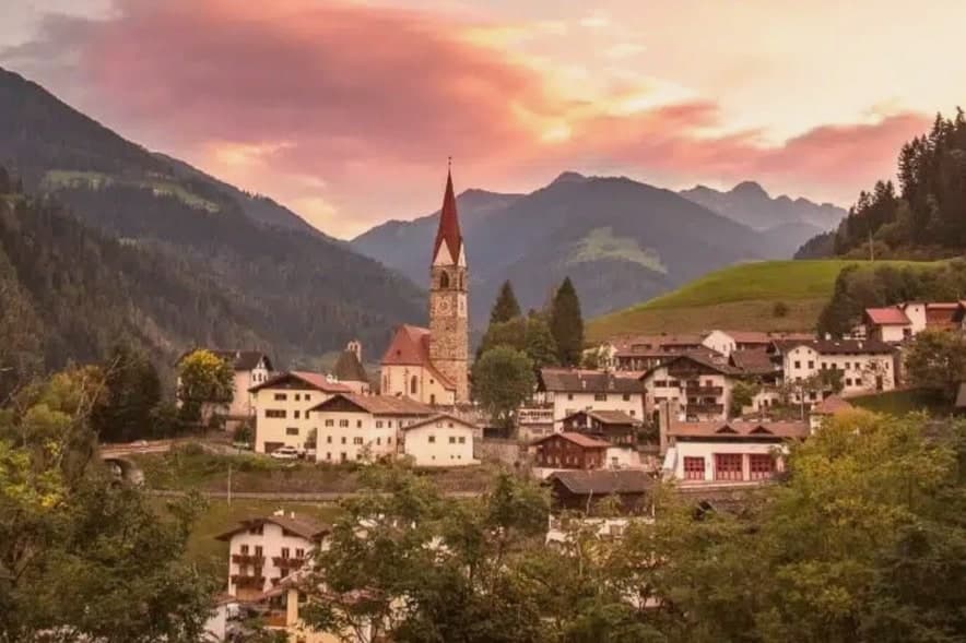
San Pancrazio (St. Pankraz in German) sits at 736 metres at the mouth of the Ultental — Val d'Ultimo in Italian — one of the most isolated alpine side-valleys of the Adige basin in South Tyrol.
The village is the largest of four comuni in the valley (San Pancrazio, San Walburga, Santa Gertrude, and the upper village around Pracupola), 92% of residents speak German as their first language, and the local economy is still organised around alpine pasturing on the south-facing slopes of the Maddalena group and the Ortles range to the south-west. The parish church of San Pancrazio Martire was rebuilt in 1796 in late-Baroque style after fire, with the tall narrow Tyrolean bell tower visible from the valley road.
The real draw is the Ultental itself: the protected Larici Millenari (Lahnerlärchen) above San Pancrazio include several larches over 800 years old, some of the oldest documented in Europe, and the Lahner Säge open-air sawmill museum a few kilometres up the valley preserves the 17th-century water-powered timber processing that built the Tyrolean church roofs. The Stelvio National Park boundary passes just south of the village.
What to see in San Pancrazio
- Larici Millenari di San Gertrude (Lahnerlärchen). Protected stand of larches above San Pancrazio, several documented at over 800 years old — some of the oldest verified larches in Europe. A signed circular walking trail.
- Chiesa di San Pancrazio Martire (St. Pankraz). Late-Baroque parish church rebuilt 1796 after a fire, with the tall Tyrolean bell tower that anchors the village skyline.
- Lahner Säge — open-air sawmill museum. 17th-century water-powered sawmill a few kilometres up the Ultental, preserved as an open-air museum demonstrating the Tyrolean timber processing that built the region's church roofs.
How to get to San Pancrazio
Bolzano is roughly 50 minutes away by road.
Our tip
May through October is the open season for the Ultental. June and September are the strongest months: alpine pastures green, the larch forests at their photogenic best (May for spring needle-out, October for autumn gold), and the high paths into the Stelvio NP comfortable. July and August are cool at this elevation but the lift queues at the Tyrolean honeypots stay south-east near Merano — Ultental stays empty.
Pinzolo
Why visit Pinzolo
Val Rendena runs the length of the valley floor, separating the granite of the Adamello-Presanella to the west from the Dolomites to the east, and Pinzolo sits at its center at 770 metres. The settlement is documented from 1211 as Penzollo, a medieval community of farmers and pastoralists that kept a degree of independence from the D'Arco counts through its own village assembly, the Università.
Most of the municipal territory now falls inside the Adamello-Brenta Nature Park, the largest protected area in Trentino, which places both mountain ranges within the same administrative boundary as the town itself. Up the valley, the frazione of Madonna di Campiglio grew from a travelers' hospice into a resort, and the two settlements are now linked by gondola as well as by governance, the older farming village at the valley floor and the younger resort on the slopes above it.
Pinzolo became a ski town in the second half of the twentieth century, and the cable car climbing from its centre to 2,100 metres is the physical expression of that link, carrying the town's growth up toward the peaks that have always framed it.
What to see in Pinzolo
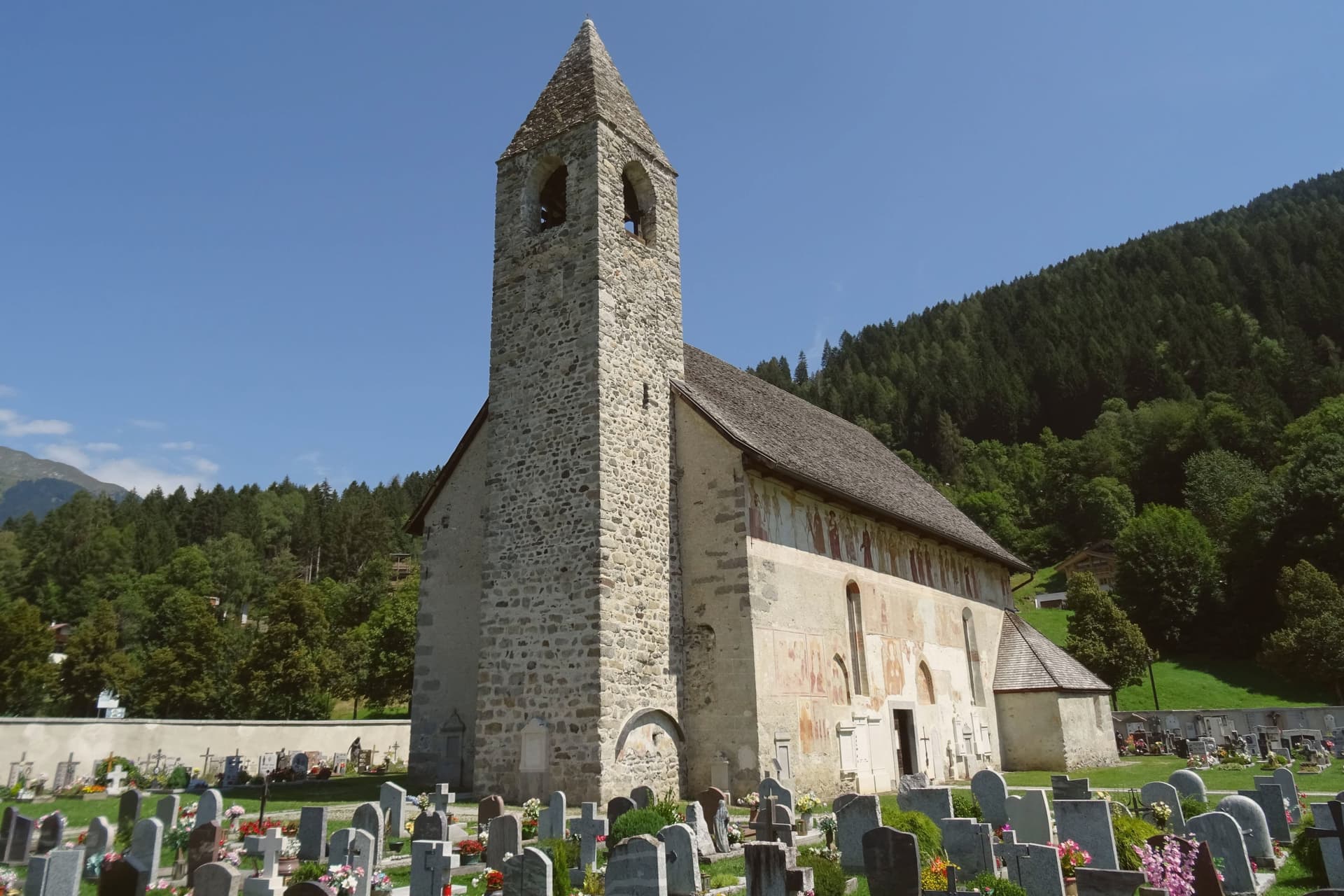
- Chiesa di San Vigilio. The church stands above the village. Its painted procession of eighteen skeleton pairs leads pope, emperor, king, beggar and child in a single line across the exterior wall, the fresco surviving in near-complete condition.
- Chiesa di Santo Stefano. Cemetery church on the edge of the village, frescoed inside and outside by the Baschenis painters with another Dance of Death cycle and scenes of saints.
- Parco Naturale Adamello-Brenta. Largest protected area in Trentino, covering most of the Pinzolo territory and including the Brenta Dolomites and the Adamello-Presanella glaciers.
How to get to Pinzolo
Trento is roughly 93 minutes away by road.
Our tip
May through October is the open season in Pinzolo, with the longest days in June and July and the Val Genova waterfalls running full from snowmelt. September is the cleanest light, the larches still green, the high refuges in the Brenta Dolomites still staffed. December through April reopens the village as a ski base, but the editorial calendar tracks summer use: hiking, the rifugio circuit, the Baschenis frescoes accessible without snow.
Toblach
Why visit Toblach
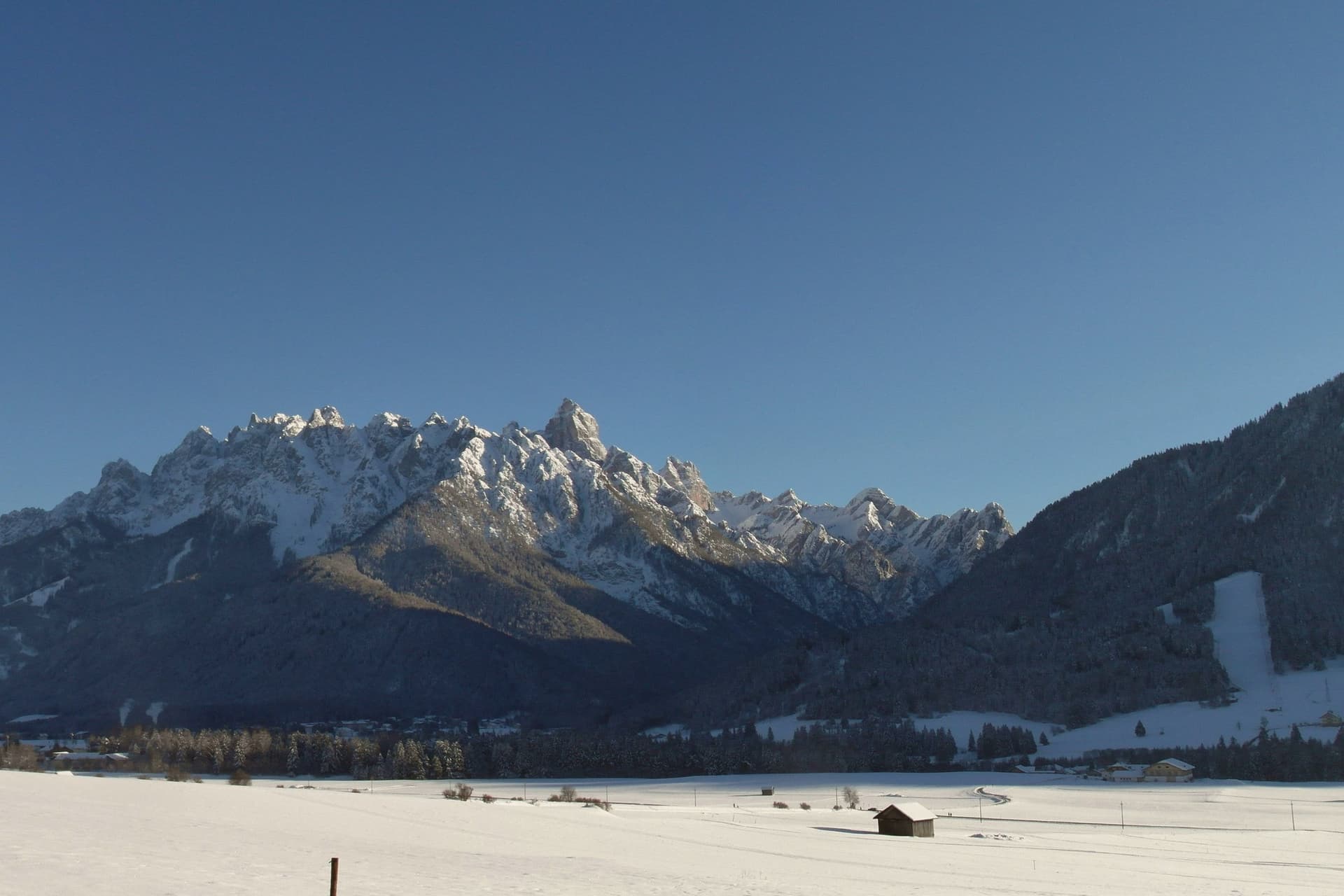
Dobbiaco sits at 1,256 metres in the upper Val Pusteria, on the Austrian border, its written record going back to 827. The old settlement, Alt-Toblach, grew around the parish church, while the newer part of town took shape lower down around the railway station built alongside the hotel that opened in 1877, which turned Dobbiaco into one of the first alpine resorts in the Habsburg empire.
Further out in the woods at Alt-Schluderbach stands the cabin where a composer once retreated each summer to write, apart from the hotel guests and the trains. South of the settlement the land opens into the Fanes-Sennes-Braies Nature Park, holding an alpine lake with a trail for walkers, and the old railbed continues in that direction as a route over Cimabanche pass toward Cortina d'Ampezzo.
Beyond all of it, reached by way of Val di Landro and Misurina, rise the three spires that anchor the eastern Dolomites. The Gustav Mahler Musikwochen festival fills the town each July and August with concerts named for the man who once needed its quiet.
Taken together, the town reads as three layers set one behind the other: a medieval nucleus, a Habsburg-era resort built on the railway, and beyond both, the mountains and woods that drew a composer to withdraw and now draw everyone else to pass through.
What to see in Toblach
- Chiesa di San Giovanni Battista. Rebuilt 1764-1774 over the remains of a ninth-century Benedictine chapel, standing at the centre of the historic settlement of Alt-Toblach, the nucleus the rest of the town grew around.
- Grand Hotel Toblach. Built 1877-1878 beside the new railway station. The building now holds the nature park visitor centre and the Mahler Auditorium, where the composer's name is heard again each summer.
- Lago di Dobbiaco/Toblacher See. Alpine lake south of town in the Fanes-Sennes-Braies Nature Park, with a circular educational trail and observation platforms for waterfowl.
How to get to Toblach
There is a railway station in the town, so you can arrive without a car and never need one while you are here. Bolzano is roughly 93 minutes away by road.
Our tip
June through September is the summer Dolomite season, with cool evenings, the Mahler Musikwochen in July and August at the Grand Hotel auditorium, and the Tre Cime and Dobbiaco-Cortina cycle path at their busiest. December through March is the ski and Nordic season: the Dobbiaco-Cortina cross-country track replaces the cycle path, and the Tre Cime ski circuit runs from nearby Plan de Corones. April and May are quiet shoulder months, snow gone but many lifts and hotels closed.
Innichen
Why visit Innichen
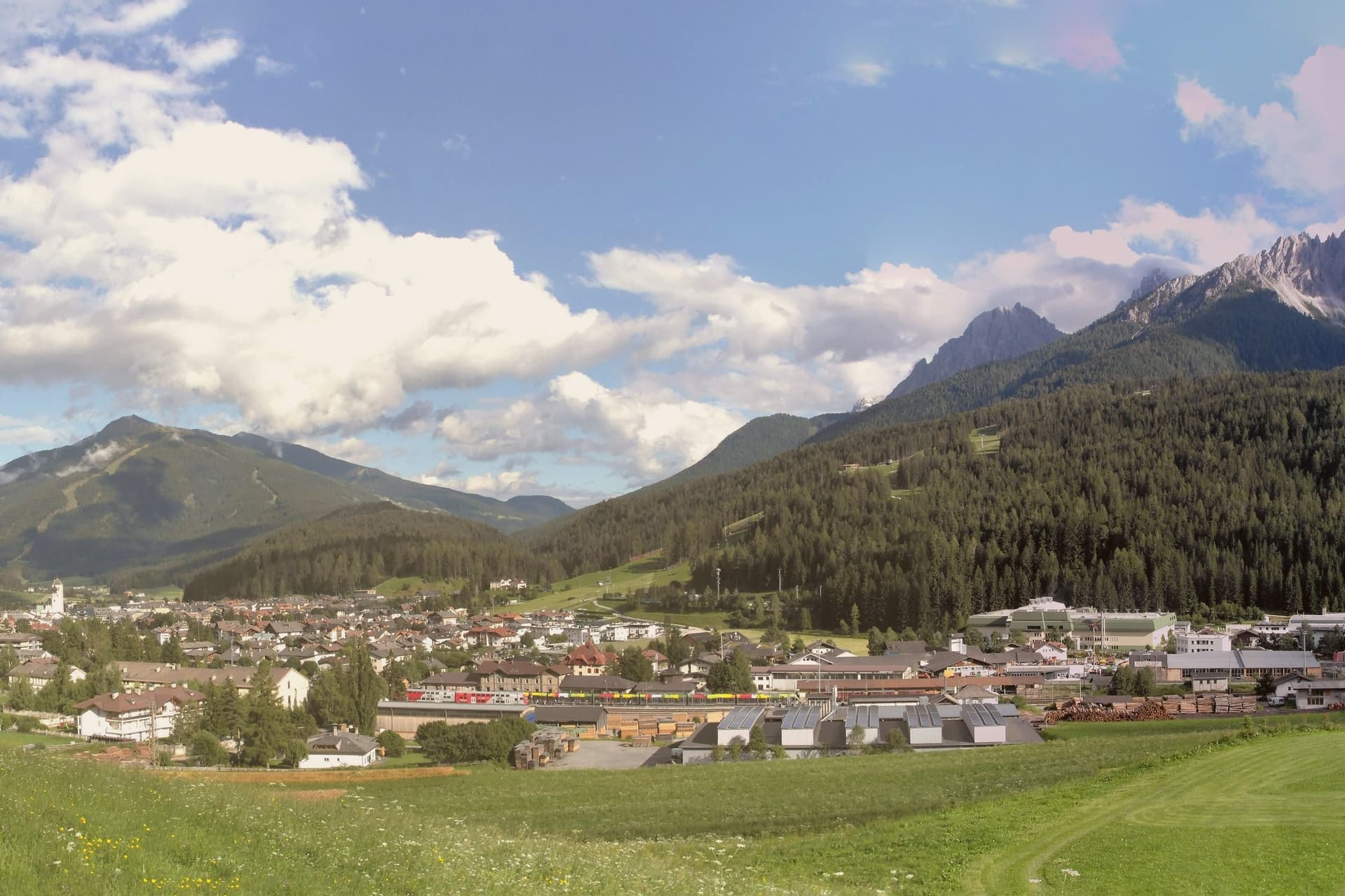
San Candido, Innichen in German, sits at 1,175 metres in the Alta Pusteria valley near the Austrian border, twenty-six kilometres west of Lienz and the headwaters of the Drava river. The town was founded as a Benedictine monastery in 769 by Duke Tassilo III of Bavaria, charged with the Christianisation of the Slavic populations of the eastern Alps.
The monastery was turned into a college of canons in 1143, which is the founding date of the collegiate church that still stands at the centre of the town today. The town is bilingual, German first and Italian second; the Italian name San Candido was applied after 1918 by the Tolomei programme that renamed every place in South Tyrol.
The old town, laid out along the Pusteria road with its squares and burgher houses, sits at the foot of the slope that rises directly into the Monte Baranci ski area, so the built centre and the mountain terrain meet with almost no transition. To the south the Drei Zinnen, the Tre Cime di Lavaredo, mark the most photographed silhouette in the Dolomites, with Innichen serving as the road, rail and trailhead base for reaching them through Sesto and Auronzo.
East, the valley opens toward the Drava river and Austria, followed for its whole length by the cycle path to Lienz. The town works because of this arrangement: a monastic and Romanesque core, a wall of Dolomite peaks to the south, and open riverine access to Austria to the east, three directions of identity meeting at a single, small, bilingual place.
What to see in Innichen
- Stiftskirche / Collegiata di San Candido. Extended around 1280 with a Creation cupola that is the largest surviving fresco of its kind, the interior carrying the weight of the building's Romanesque reputation in stone and paint.
- Stiftsmuseum. Chapter museum next to the church, holding thirteenth-century sculpture, manuscripts and liturgical objects that trace the life of the foundation across its centuries as monastery and college.
- Historic centre. Pedestrianised core around the church, with Tyrolean burgher houses, painted facades and the Pflegplatz and Atoplatz squares laid out along the old Pusteria road.
How to get to Innichen
There is a railway station in the town, so you can arrive without a car and never need one while you are here. Bolzano is roughly 101 minutes away by road.
Our tip
Innichen runs on a two-peak alpine calendar. June through September is the hiking and cycling season, with the Tre Cime trails open, the rifugi in the Sesto Dolomites fully staffed and the Drava cycle path busy with families heading to Lienz. July and August are the warmest weeks, comfortable at 1,175 metres while the valley floors farther south overheat. Platzl Fest / Festa in piazza at the Senfter's Platzl falls in August.
St. Ulrich
Why visit St. Ulrich
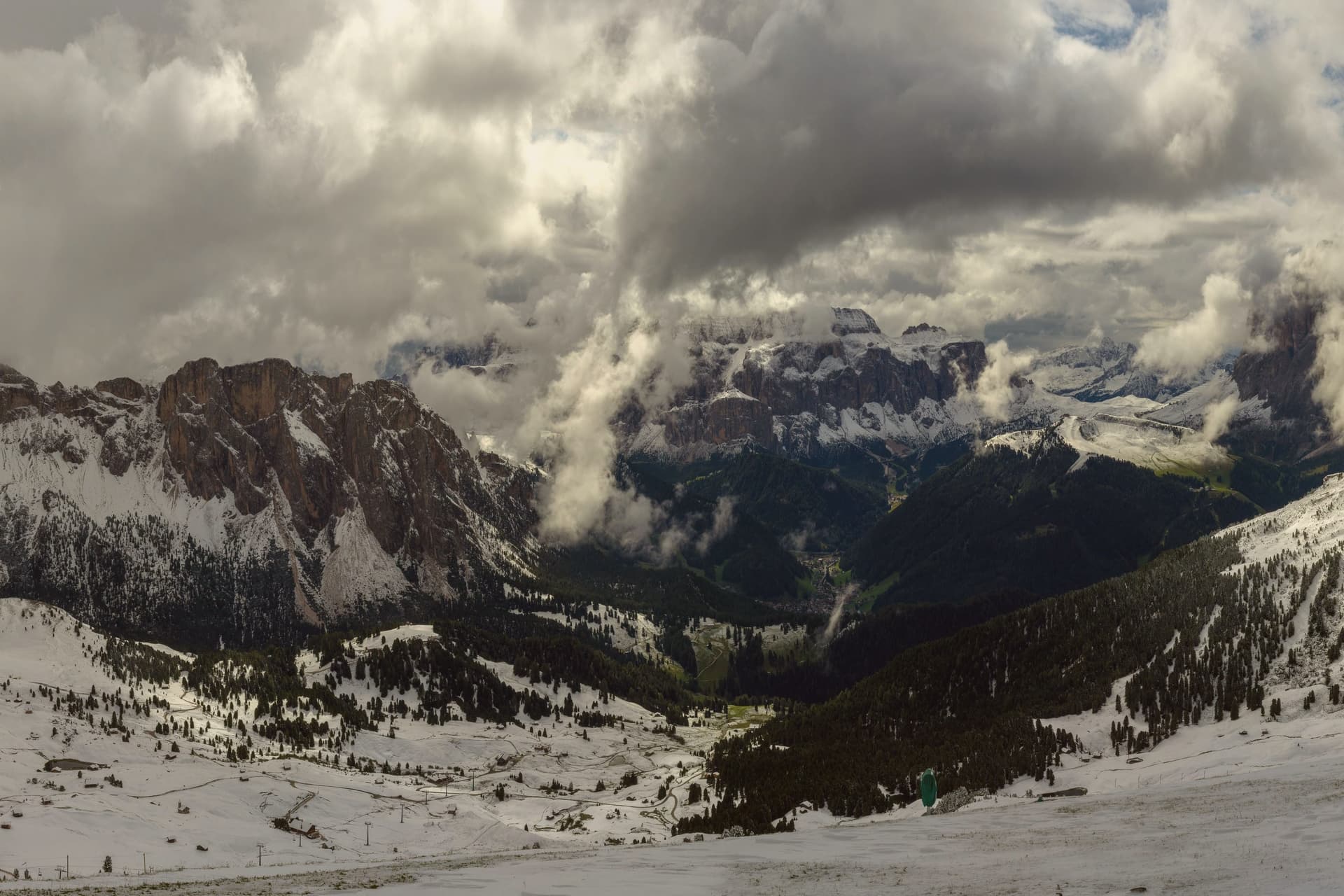
The valley climbs east from the Eisack toward the Sella and the Sassolungo, and the town sits at its middle point. Almost all residents speak Ladin at home, and signage runs trilingual in Ladin, German and Italian.
Three cable cars leave the village in three directions: one to the northwest onto a plateau, one north onto a long ridge below the Odle, and one south onto a high meadow that forms the valley's southern edge. The museum inside the Cësa di Ladins holds the record of the valley's carving tradition alongside fossils from the surrounding peaks and material on Luis Trenker, the mountaineer-actor-director who came from here.
The layout, a village hemmed by three lifts and named for the saint of its own parish church, reads as a place organized entirely around the ground it sits on: craft below, peaks and plateaus in every direction above.
What to see in St. Ulrich
- Parish church (St. Ulrich/San Udalrico). Neoclassical church with Baroque elements, rebuilt in the late 18th century, dedicated to the Epiphany and to St. Ulrich, the patron saint who gives the town its German name.
- Museum Gherdëina. Local-heritage museum inside the Cësa di Ladins documenting four centuries of woodcarving, wooden toys, sacred sculpture, Dolomite fossils and the Trenker family archive.
- Seceda. Long limestone ridge reached by cable car from the village, with the Odle/Geisler peaks rising sharply to the north and high meadows dropping toward the valley.
How to get to St. Ulrich
Bolzano is roughly 43 minutes away by road.
Our tip
June through September is the green Dolomite season: the Alpe di Siusi opens fully, the Seceda ridge is walkable from the cable car, and the rifugi of the Odle and Sassolungo run their full summer programmes. December through March is the ski half of the year, with the Sellaronda circuit accessed directly from Ortisei. April, May and November are the closure months.
Kastelruth
Why visit Kastelruth
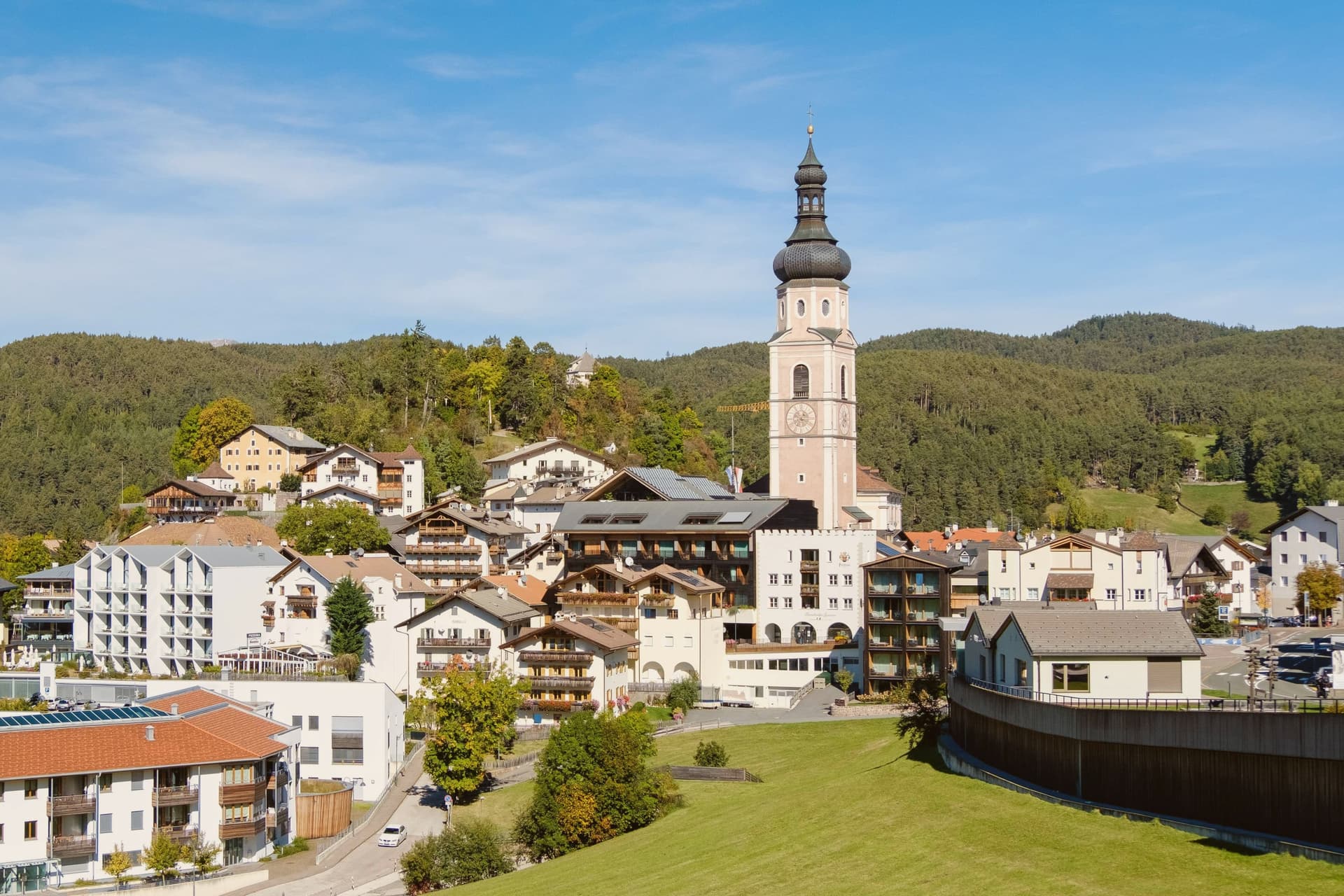
Castelrotto, in German Kastelruth and in Ladin Ciastel, sits at 1,060 metres on a shelf below the Sciliar, twenty kilometres northeast of Bolzano. The commune's territory rises from 720 metres at San Vigilio to over 2,400 metres on the Sciliar massif, with the Alpe di Siusi reached from within that territory.
The name first appears in the tenth century and goes back to the Castellum Ruptum, a destroyed castle on the Calvary hill above the village, so the hill above the square and the name on the map are the same story told twice. Of around 6,500 residents, 82 per cent speak German as their first language, 15 per cent Ladin and 3 per cent Italian.
That balance, and the position on a shelf between the valley floor and the high meadow above it, is what gives the village its Tyrolean character rather than an Italian one: a settlement whose centre, church tower, and surrounding pasture all sit within sight of each other, with the mountain doing most of the work of orientation.
What to see in Kastelruth
- Campanile della Parrocchiale. Standing apart from the parish church of Saints Peter and Paul, the tower is visible from the surrounding pastures long before the village itself comes into view.
- Chiesa Parrocchiale dei Santi Pietro e Paolo. Baroque interior beside the detached tower, the principal religious building of the commune since the medieval period.
- Alpe di Siusi/Seiser Alm. Reached by cable car from Siusi, the meadow opens out with the Sciliar and Sassolungo on either side, a scale that is hard to read from photographs alone.
How to get to Kastelruth
Bolzano is roughly 44 minutes away by road.
Our tip
June through September is the high-meadow season on the Alpe di Siusi, with the Seiser Alm pastures green, the chairlifts running and hiking and biking routes open from the village to the Sciliar. December through March is the ski season: the Seiser Alm has fifty-six kilometres of slopes, mostly red and blue, and connects by the Saltria-Mont Sëuc gondola to the rest of the Dolomiti Superski. Late June brings the Oswald von Wolkenstein Riding Tournament, the historical equestrian event held in the meadows around the village.
More from Anywhere Italy
- The best towns worth staying overnight in the province of Bolzano/Bozen
 The best small ski towns that eat well in Trentino-Alto Adige/Südtirol
- The 9 best small high-altitude villages that eat well in Trentino-Alto Adige/Südtirol
 The 8 best hidden towns you can reach by train in Trentino-Alto Adige/Südtirol
- The best mountain towns in the province of Bolzano/Bozen
- The best mountain towns you can reach by train in Trentino-Alto Adige/Südtirol