
The best hidden hill towns you can reach by train in the province of Perugia
The province of Perugia is built from pale limestone and river stone, and the towns sit high, above olive groves that turn silver when the wind comes off the Apennines. Autumn is the season the region works for: the frantoi open, new oil goes on grilled bread with nothing else, and lentils, farro and black truffle arrive on the same table. Spring brings flowering along the Clitunno springs and windows hung with geraniums. Umbrian food is plain and heavy in the good sense, pork from Norcia, strangozzi under a coarse tomato sauce, Sagrantino and Trebbiano Spoletino in the glass. The regional trains run the valley floors all day, and the buses up to the historic centres meet them.
Most visitors take the fast line to Assisi, walk up to the Basilica of San Francesco, look at the Giotto cycle and leave the same afternoon. It deserves the attention, and it gets far more than any other place in the province, which means coach parks, queues at the security check and a main street given over to souvenirs. Perugia takes the overflow with its escalators and its chocolate. Between them, the two absorb almost everyone who comes to Umbria by rail.
The same hills, the same oil, the same stone continue north towards Gubbio and south along the Spoleto valley, and the trains keep stopping. Fewer people get off at these stations. The towns here are smaller, and they hold the things Assisi has as well, Roman foundations, frescoed churches, walls you can walk, workshops that still fire ceramics. All of them can be reached without a car, which is the point of the list.
Of the 37 communes we have mapped in the province of Perugia, 15 qualify as hill towns you can reach by train: each is an inland hill settlement, and we have confirmed each is reachable without a car. This list is the hidden ones, 10 in all, ordered smallest first. The smallest, Vallo di Nera, has 345 residents.
Elsewhere in the catalogue: The best hidden towns inside a nature park in the province of Perugia and The 10 prettiest hidden villages you can reach by train in Umbria.
Vallo di Nera
Why visit Vallo di Nera
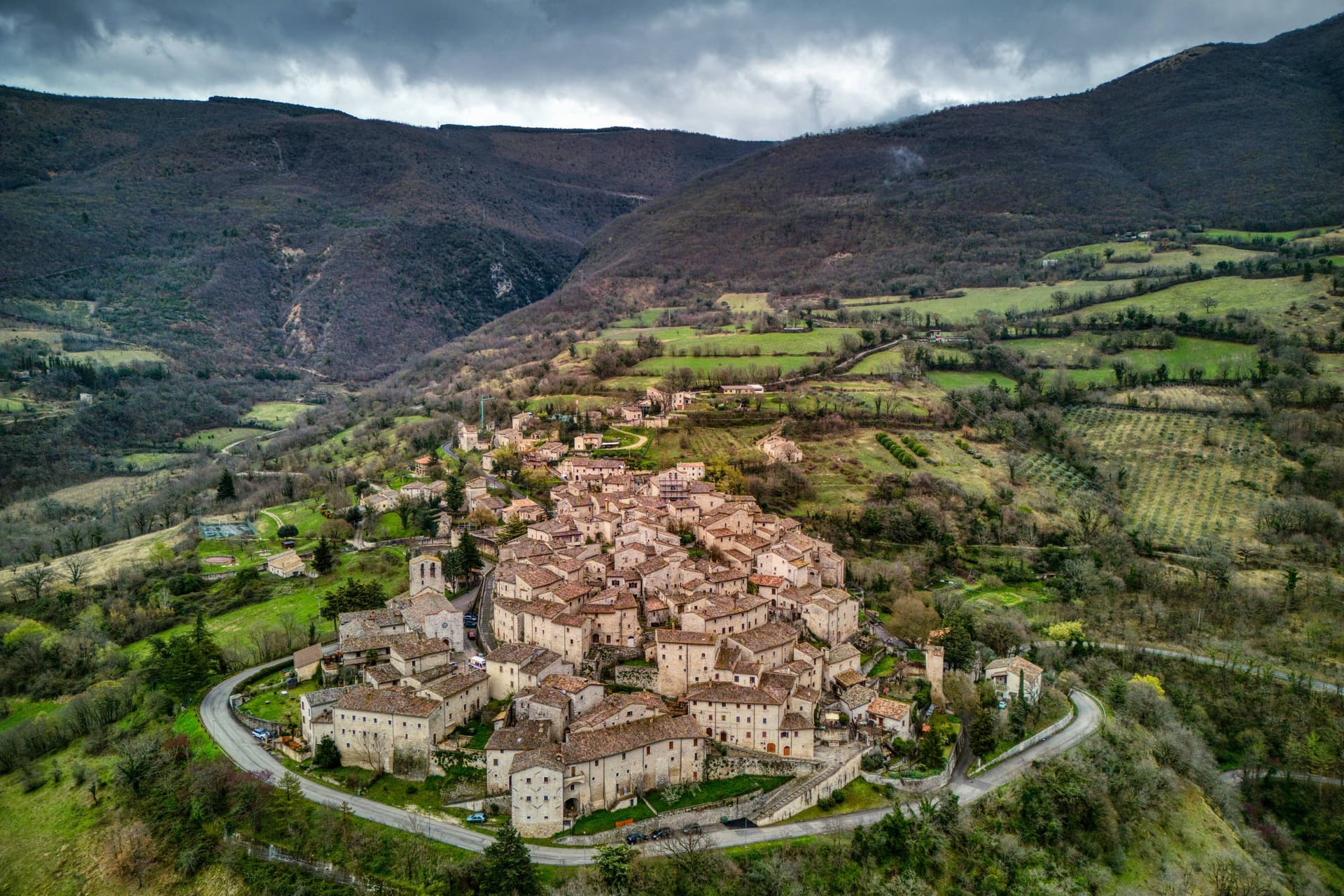
Vallo di Nera sits at 467 meters on a spur of the upper Valnerina, above the Nera river. The town of Spoleto granted the men of Vallo permission to build a castle here in 1217, on the hill where an earlier fortress had stood; the stone houses, the walls and the two symmetrical gates, Portella and Portaranne, have barely changed in eight centuries.
Inside, the village climbs in concentric rings to the Chiesa di Santa Maria Assunta at the top, built in 1176 and given to the Franciscans in the 13th century, who turned a defensive tower into a bell tower and frescoed the apse with a cycle of the Giotto school dated 1383. The Procession of the Whites, traceable to 1401, still leaves the church each year.
The population today is 345, smaller than at any point in the medieval records. Black truffle from the woods above and olive oil from the slopes down to the river are the surviving trades.
We confirmed you can reach this one by train.
What to see in Vallo di Nera
- Chiesa di Santa Maria Assunta. Built 1176, Franciscan from the 13th century, with frescoes of the Giotto school dated 1383 in the apse, by Cola di Pietro da Camerino among others.
- Medieval walls. Twelfth-century walls and towers still encircle the village, with two original symmetrical gates, Portella and Portaranne.
- Centro storico. Light stone houses leaning against each other on three concentric rings, with embrasures, narrow alleys and stone portals preserved since 1217.
How to get to Vallo di Nera
There is a railway station in the town, so you can arrive without a car and never need one while you are here. Terni is roughly 53 minutes away by road.
Our tip
April through June and September into October are the months for Vallo di Nera. The Valnerina is green, the Nera river runs cold, and the trails up to Sellano or down to Scheggino are walkable. July and August push the valley into the mid-thirties; the stone houses hold their cool but most of the 345 residents close shutters between two and six.
Campello sul Clitunno
Why visit Campello sul Clitunno
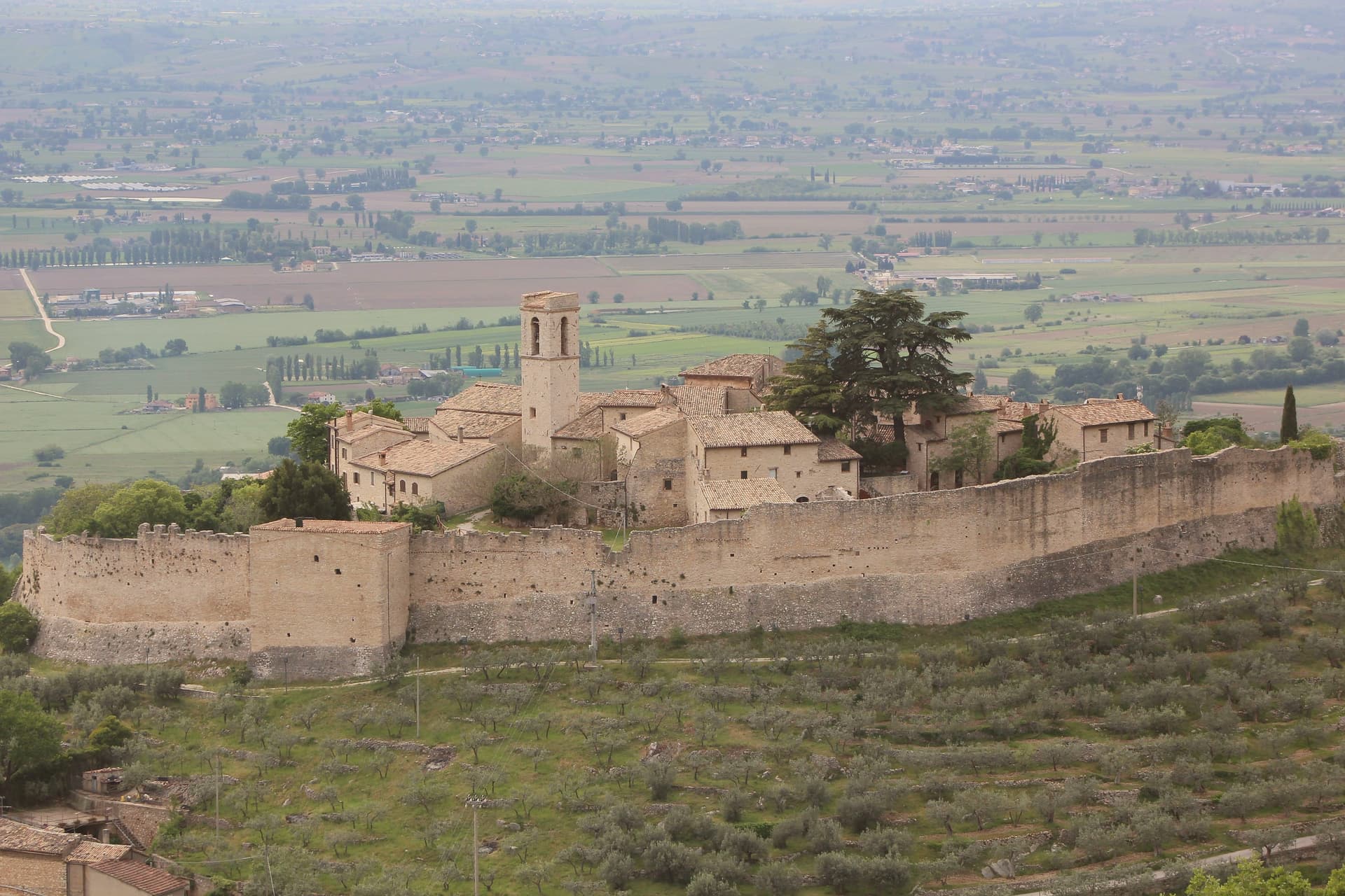
Campello sul Clitunno sits at 290 meters along the Clitunno river, a few kilometers north of Spoleto. The name comes from the Counts Campello, originally Champeaux of Reims, who founded the hilltop nucleus of Campello Alto in the mid-10th century under the Burgundian noble Rovero.
The Fonti del Clitunno, the springs that form the river, produce 1,300 to 1,500 liters of water per second; Pliny the Younger wrote about them, and Lord Byron and Giosuè Carducci returned to the place in poems centuries later, the latter with the ode Le fonti del Clitumno. A kilometer downstream from the springs, in the frazione of Pissignano, the Tempietto del Clitunno is a 4th- or 5th-century pagan sacellum reworked by the Lombards in the 7th and 8th centuries; the interior frescoes have parallels with Santa Maria Antiqua in Rome.
The Tempietto entered the UNESCO World Heritage List in June 2011 as part of the serial site The Lombards in Italy: Places of Power. The Castello di Pissignano above the temple covers the medieval layer.
We confirmed you can reach this one by train.
What to see in Campello sul Clitunno
- Tempietto del Clitunno. Small temple-shaped chapel of the 4th-5th century reworked by the Lombards in the 7th-8th, with frescoes of the Saviour, Peter and Paul; UNESCO World Heritage.
- Fonti del Clitunno. Springs producing 1,300-1,500 liters per second, forming the source of the Clitunno; visited by Pliny, Byron and Carducci.
- Castello di Pissignano. Eleventh-twelfth century hilltop castle just above the Tempietto, founded by Benedictine monks who enclosed the settlement with walls.
How to get to Campello sul Clitunno
There is a railway station in the town, so you can arrive without a car and never need one while you are here. Terni is roughly 86 minutes away by road.
Our tip
April through June and September into October are the months for Campello sul Clitunno. The springs run cold and full, the willows along the lake at the source hold the morning light, and the trails between the Tempietto and Campello Alto are walkable in shade. July and August touch the mid-thirties in the Spoleto valley; the Fonti basin runs a few degrees cooler at the water's edge.
Fossato di Vico
Why visit Fossato di Vico
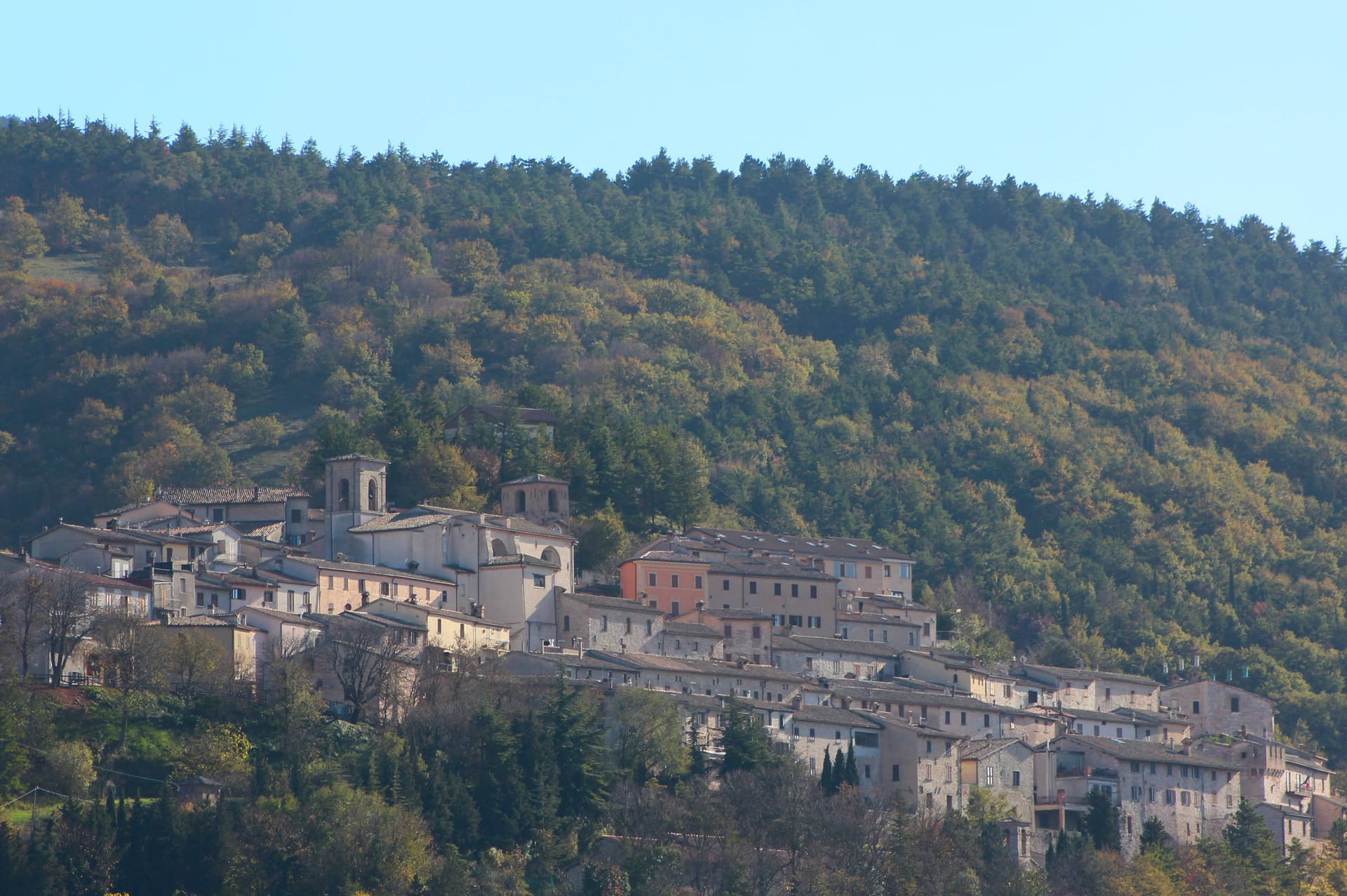
Fossato di Vico stands at 581 meters on the slopes of Mount Mutali, on the line of the Via Flaminia between Foligno and Gubbio. The Romans built a changing station here called Hellvillum after laying the road in 220 BC.
The borgo proper was founded in 980 by Lupo, called Vico, son of Monaldo, count of Nocera. In the twelfth century it passed to the Marsciano counts, who eventually sold it to Gubbio; in the thirteenth Perugia took it militarily and the commune declared independence.
What survives from that period is the network of covered passages called Le Rughe, stone vaults that turned the street into a defensible interior, a rare example of thirteenth-century castle architecture used as everyday infrastructure. The church of San Pietro, the oldest in town, predates the castle and was founded as a Camaldolese monastery.
The Chiesa di San Benedetto outside the walls keeps Eugubine-school frescoes including what is taken to be one of the earliest known portraits of a pope.
We confirmed you can reach this one by train.
What to see in Fossato di Vico
- Le Rughe. Thirteenth-century covered alleyways under round stone vaults, rare surviving example of defensive castle-street architecture.
- Chiesa di San Pietro. Oldest church in town, founded as a Camaldolese monastery, Romanesque structure predating the medieval castle.
- Chiesa di San Benedetto. Thirteenth-century Benedictine abbey outside the walls, fragments of fourteenth and fifteenth-century Eugubine-school frescoes including an early papal portrait.
How to get to Fossato di Vico
There is a railway station in the town, so you can arrive without a car and never need one while you are here. Perugia is roughly 47 minutes away by road.
Our tip
April through June brings the slopes of Mount Mutali green and the upper Flaminia corridor walkable in long evenings. September and October are clear, with first frost on the higher pastures by month's end. July and August push the lower valley into the mid-thirties; at 581 meters the borgo stays cooler, and the vaulted Rughe hold a constant temperature that feels engineered. Sagra del Cinghiale falls in August.
Magione
Why visit Magione
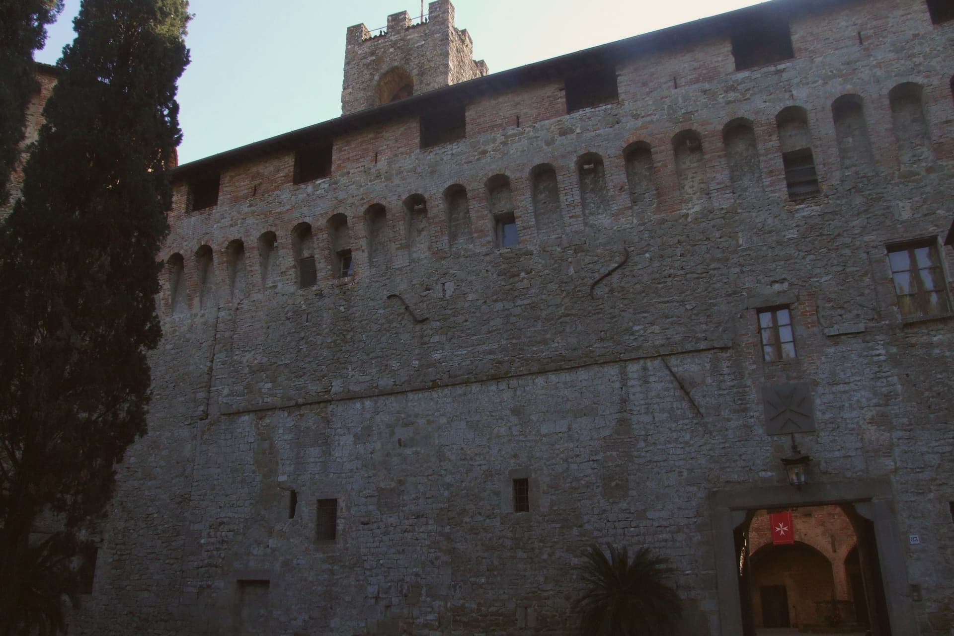
Magione sits at 299 meters on a hill east of Lake Trasimeno, fifteen kilometers from Perugia. The name comes from the Knights Hospitaller, who built a hospital here in the mid-twelfth century dedicated to Saint John the Baptist and called their convent Maison in their own language.
The original nucleus stood on the Perugia-Tuscany route and grew into the fortified base that still anchors the town today. The lower town is organized around two medieval poles: the castle complex near the old route, and the quadrangular tower rising thirty meters over the settlement, built in the same period by the same Order.
The vineyards on the surrounding hills lie between 250 and 350 meters above sea level, and the town's territory extends down to the lake's eastern shore. In October 1502, the castle hosted a plot against Cesare Borgia: his own captains and allies conspired against him inside its walls.
Niccolò Machiavelli, on diplomatic mission for Florence, learned the details and passed them to Borgia, who dismantled the conspirators within months. A hospital, a tower, and a plot against a Borgia: the town's history reads as a sequence of episodes gathered around the same fortified point on the road between Perugia and Tuscany.
We confirmed you can reach this one by train.
What to see in Magione
- Castello dei Cavalieri di Malta. The fortified complex built by the Knights Hospitaller stands as the town's anchor, its walls the setting where the Conspiracy of Magione was plotted against Cesare Borgia.
- Torre dei Lambardi. Thirty-meter quadrangular tower built between the twelfth and thirteenth centuries by the Gerosolimitani Knights, three floors and a summit terrace.
- Chiesa di San Giovanni Battista. Parish church inside the castle complex, dedicated to the saint of the original Hospitaller foundation.
How to get to Magione
There is a railway station in the town, so you can arrive without a car and never need one while you are here. Perugia is roughly 23 minutes away by road.
✷ We have written about Magione
“The lake is like a sanatorium compared to the sea. It’s relaxed. It’s calm. It’s silent. To find this level of almost disturbing quietness, you either go up into the mountains, or you really need to know your way around the sea to find that particular spot not overrun by vacationers and beach people. In Trasimeno, this is easy. Even the most popular towns like Castiglione or Passignano sit in quiet harmony with the stillness of the water.”
Read our piece on Magione →Lago Trasimeno | Never Compete with the Sea
Our tip
April through June and September into October are the working months on the eastern Trasimeno: clear lake light, olive groves on the hills above, evenings cool enough to walk between the Castello and the Torre. July and August reach the low thirties in the basin; the lake helps but weekends fill with Perugia and Florence day-trippers and the lakefront frazione of San Feliciano runs heavy. The olive harvest in late October and November turns the territory busy with frantoi at full capacity. Festa del Giacchio - Sagra del Pesce del Lago Trasimeno falls in July.
Massa Martana
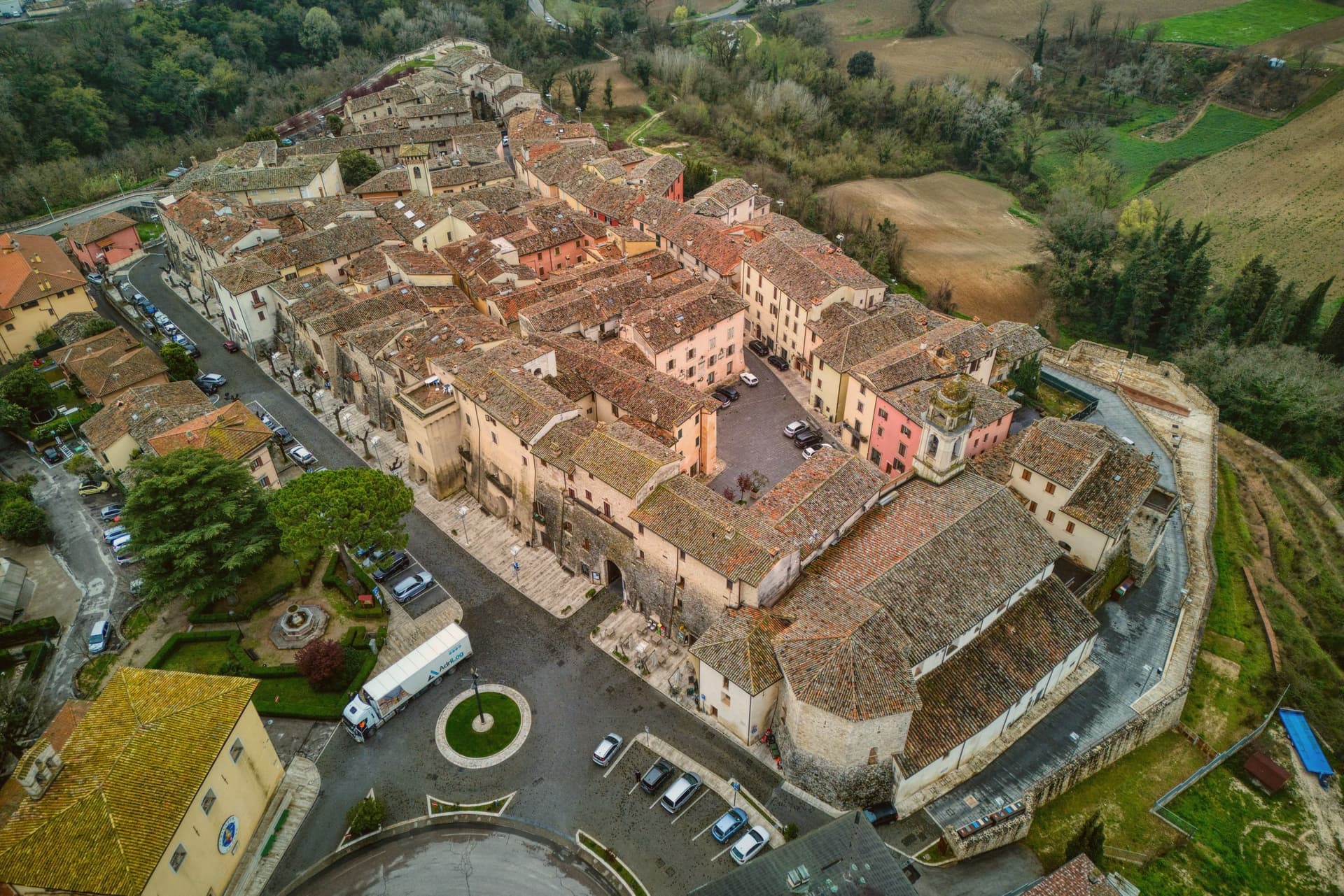
Why visit Massa Martana
Massa Martana is here for the Roman road. The Via Flaminia (the original 220 BC consular road from Rome north over the Apennines to Rimini, the spine of Roman Italian infrastructure for 500+ years) passes directly through the village — and Massa Martana sits at exactly the point where the road begins climbing into the Apennine pre-massif, with sections of the original Roman paving still visible in the surrounding countryside.
This made the area an important late-antique Christian community: the Catacombe di Villa San Faustino (3-4 km north of the centro) are the only Roman-era Christian catacombs in all of Umbria — discovered 1968, in continuous use from the 3rd to the 6th c AD, with 200+ tombs, original frescoes, and Latin inscriptions. The Abbazia dei Santi Fidenzio e Terenzio (9th-c Benedictine, on the hill above town, with surviving Carolingian elements + 12th-c restorations) is the other major monastic-era survivor.
The town itself is 3,613 residents at 351m altitude in central Umbria, 17 km southeast of Todi, with a medieval-Renaissance centro that was severely damaged by the 26 September 1997 Marche-Umbria earthquake (the same event that brought down the vault of the Basilica di San Francesco in Assisi). The reconstruction was completed in stages through 2010, and the town was re-inscribed on the Borghi più belli d'Italia list after restoration.
Today the centro reads as a meticulously restored small medieval ensemble — the Porta Santa Maria, the Chiesa Madre di San Felice (rebuilt), the Palazzo Comunale, the Torre Civica. Surroundings: the Monti Martani limestone massif (the prehistoric source of the Martana name) rises immediately east, with marked hiking trails, the Lago di Corbara just south, and the Todi UNESCO-fortified town 17 km away.
The food is Umbrian: strangozzi with truffle (Umbria's signature pasta), porchetta, salumi, Pecorino, the local Sagrantino di Montefalco 25 km west. The Festa di San Felice (25 January) and the Sagra del Tartufo (October) are the year's main events.
We confirmed you can reach this one by train.
What to see in Massa Martana
- Via Flaminia Roman road. Original 220 BC consular road from Rome to Rimini passes directly through. Sections of Roman paving visible in the surrounding countryside — the spine of Roman Italian infrastructure for 500+ years.
- Catacombe di Villa San Faustino. The only Roman-era Christian catacombs in all of Umbria — 3-4 km north of the centro, in use 3rd-6th c AD, with 200+ tombs, original frescoes, Latin inscriptions. Guided tours.
- Abbazia dei Santi Fidenzio e Terenzio. 9th-c Benedictine abbey on the hill above town. Surviving Carolingian elements + 12th-c restorations. The most important monastic survivor in the comune.
How to get to Massa Martana
There is a railway station in the town, so you can arrive without a car and never need one while you are here. Terni is roughly 32 minutes away by road.
Our tip
Massa Martana is best April–June and September–October. The Sagra del Tartufo in October is the year's culinary highlight. Festa di San Felice (25 January) is the winter patronal event.
Nocera Umbra
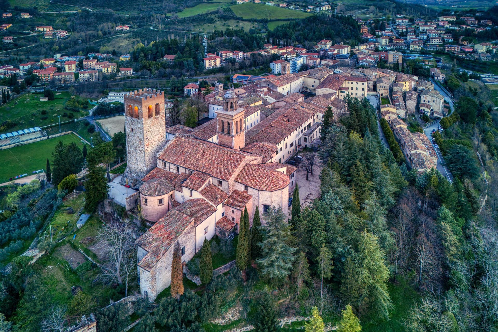
Why visit Nocera Umbra
Nocera Umbra sits fifteen kilometers north of Foligno. The Romans called it Nuceria; the town has held its own bishopric since the early Middle Ages and was contested between Perugia, Spoleto and the Trinci of Foligno through the medieval period, a tug of war between larger powers that left it walled and defensible on its slope rather than absorbed by any one of them.
The centro storico climbs to a summit where the tower, the cathedral and the former Rocca stand together, the civic and the religious and the military crowded onto the same high ground. Below, five kilometers down from that core, the springs form a separate pole of the town's life, functional rather than defensive, drawing visitors for water rather than for stone.
The Bandiera Arancione recognition was reconfirmed after reconstruction, a marker that the rebuilding did not just replace what fell but held the town to the standard it met before the quake.
We confirmed you can reach this one by train.
What to see in Nocera Umbra
- Campanaccio (Torre Civica). Eleventh-century square tower at the highest point of the borgo. Only part of one side remained standing after 1997; the rest is reconstruction, stone matched to stone.
- Pinacoteca e Museo Civico. Civic gallery in the deconsecrated Chiesa di San Francesco with works by Niccolò Alunno, Matteo da Gualdo, and the school of Cimabue.
- Cattedrale di Santa Maria Assunta. Cathedral at the summit of the centro storico, partially damaged and restored, set beside the tower and the former Rocca.
How to get to Nocera Umbra
There is a railway station in the town, so you can arrive without a car and never need one while you are here. Perugia is roughly 57 minutes away by road.
Our tip
April through June and September into October are the months locals prefer. The slopes around the centro storico hold light well into the evening and the Bagni di Nocera springs are at their easiest to walk. July and August push temperatures into the low thirties, manageable at this elevation; the Pinacoteca and the cathedral stay cool through the afternoon. Palio dei Quartieri falls in August.
Città della Pieve
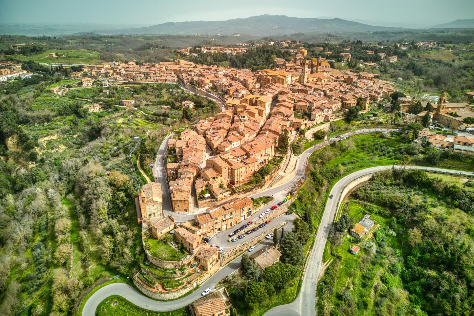
Why visit Città della Pieve
Città della Pieve sits on a hill at 508 meters between Umbria and Tuscany, about 260 meters above the Valdichiana and within sight of Lake Trasimeno. The town is built almost entirely of the local red brick that has been fired here since the Middle Ages, which gives the centro storico a uniform terracotta color.
Pietro Vannucci, known as Perugino, was born here around 1448 and returned in 1504 to fresco the Adoration of the Magi inside the Oratorio di Santa Maria dei Bianchi, one of the largest works he ever painted. The Cathedral of San Gervasio holds two more Perugino panels from 1510 and 1514.
Pope Clement VIII elevated the town from Castel della Pieve in 1600, restoring its episcopal seat. Vicolo Baciadonne, eighty centimeters wide, threads between two brick walls and is regularly cited as the narrowest alley in Italy.
We confirmed you can reach this one by train.
What to see in Città della Pieve
- Cattedrale dei Santi Gervasio e Protasio. Cathedral on the main piazza with two Perugino panels, the Madonna and Child with Saints of 1514 and the Baptism of Christ of 1510.
- Oratorio di Santa Maria dei Bianchi. Confraternity oratory holding Perugino's Adoration of the Magi, frescoed in 1504 and considered one of his largest single works.
- Torre del Pubblico. Twelfth-century civic tower in Lombard Romanesque style, thirty-nine meters tall, set next to the cathedral on Piazza Plebiscito.
How to get to Città della Pieve
There is a railway station in the town, so you can arrive without a car and never need one while you are here. Perugia is roughly 47 minutes away by road.
Our tip
April through June and September into October are the months locals prefer. The Valdichiana below stays green or gold depending on the half, and the brick of the centro storico holds the late light well. The Infiorata in June covers the main streets in petal carpets for Corpus Domini, drawing the year's largest crowd. Palio dei Terzieri falls in August.
Trevi
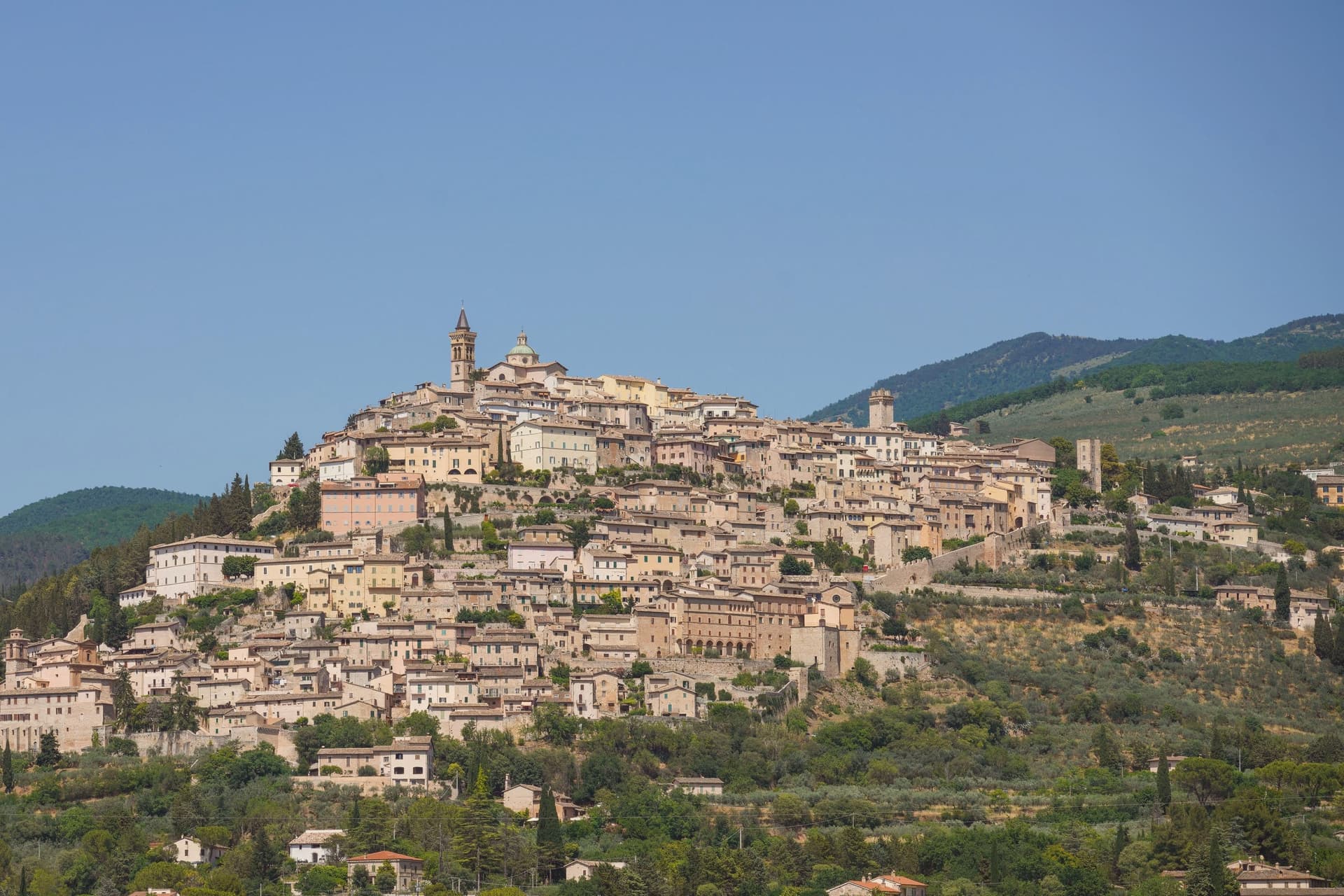
Why visit Trevi
Trevi sits at 412 meters on a conical hill above the Spoleto valley, the centro storico still inside the Roman walls of the 1st century BC. The town stood on the Via Flaminia, the consular road from Rome to the Adriatic, and grew into a Guelph commune by the 12th century.
Olive oil is what people come for. Over 200,000 trees blanket the slopes below the walls on near-ideal calcareous, well-drained soils, and the Olivo di Sant'Emiliano near the abbey of the same name is about 1,700 years old, identified with the tree the bishop of Trevi was tied to in 304 before his martyrdom.
The Santuario della Madonna delle Lacrime, built in 1487 to mark a miracle, holds a fresco by Pietro Perugino. The centro storico runs in concentric rings up the hill, each ring older than the last, with the Palazzo Comunale and the Pinacoteca holding works by Lo Spagna at the top.
We confirmed you can reach this one by train.
What to see in Trevi
- Santuario della Madonna delle Lacrime. Built in 1487 after a Marian apparition wept tears of blood in 1485, with a fresco by Perugino in the Cappella dell'Adorazione.
- Chiesa di Sant'Emiliano. Romanesque parish church at the top of the centro storico, dedicated to the bishop martyred in 304, the patron saint of the town.
- Olivo di Sant'Emiliano. About 1,700-year-old olive tree near the eponymous church, nine meters tall, traditionally the tree to which the bishop was tied before martyrdom.
How to get to Trevi
There is a railway station in the town, so you can arrive without a car and never need one while you are here. Perugia is roughly 47 minutes away by road.
Our tip
April through June and September into October are the months for Trevi. The olive groves are in leaf or in harvest, the hill is green or silver-gold depending on the half, and the valley below holds the morning light. The Festa di Sant'Emiliano runs the last week of January with the Palio dei Terzieri, when the three quarters of the town compete.
Spello
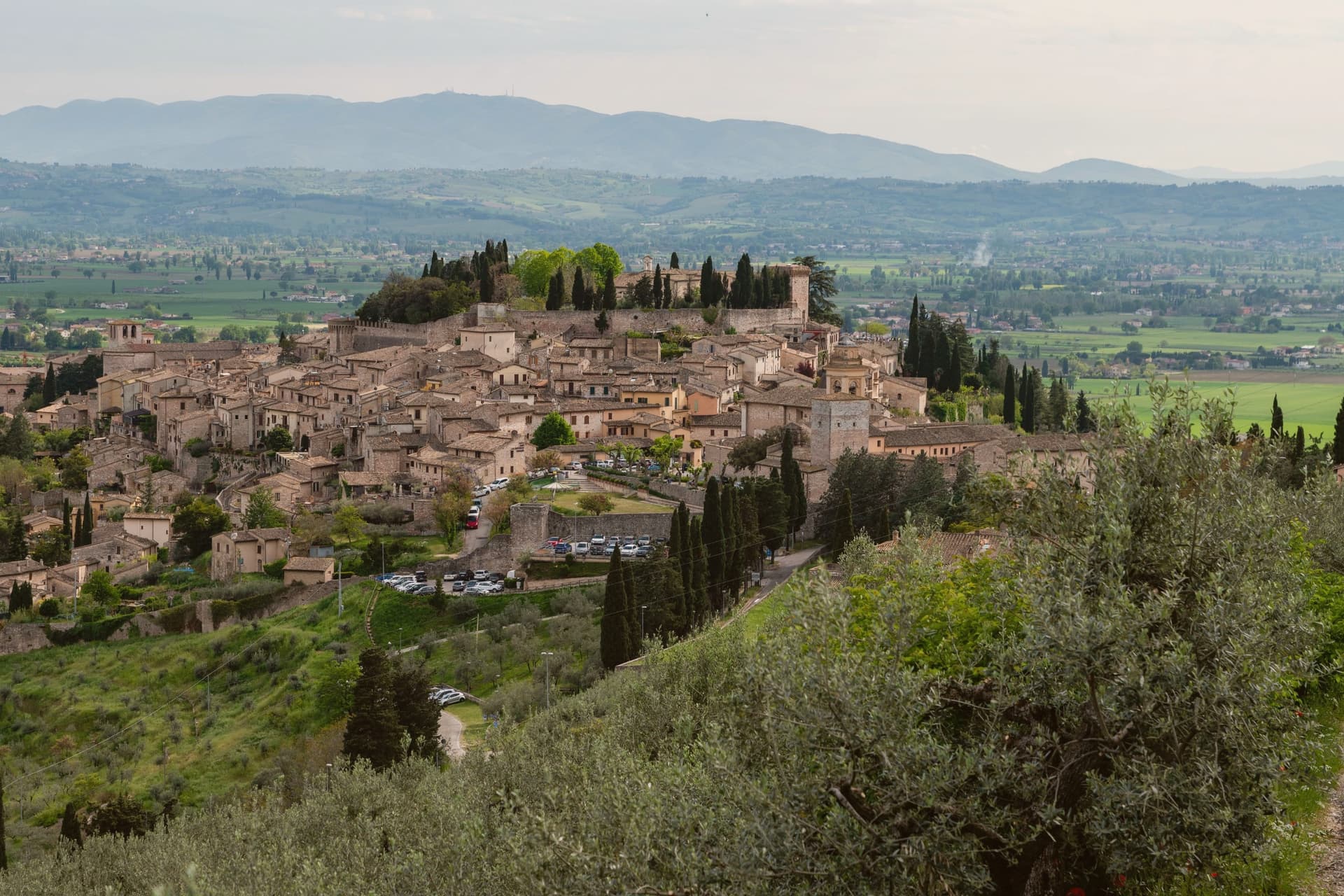
Why visit Spello
The centro storico climbs the lower southern flank of Monte Subasio, still contained within the circuit of walls raised when the town was renamed Splendidissima Colonia Julia by Augustus. Before that it was Hispellum under the Umbrians.
The Roman gates and stretches of wall from the Augustan period were not rebuilt over, so the line of the ancient town is still readable in the streets that climb from them today. The same streets carry the Infiorata each June and the fresco Pinturicchio completed for the chapel he painted in Santa Maria Maggiore, two things separated by roughly fifteen centuries but occupying the same short stretch of the old town: the chapel's Annunciation, Nativity and Christ Among the Doctors sit near the piazza the petal pictures are laid across.
A Roman villa with ten mosaic floors, found only in 2005 and left in place under cover, adds a third layer beneath the town that is still being uncovered rather than one that was always on view. The town's Roman skeleton, its painted chapel, and a floor uncovered within living memory all sit within the same small radius, which is unusual: most places show one era at a time, Spello keeps three in view at once.
We confirmed you can reach this one by train.
What to see in Spello
- Cappella Baglioni. The Cappella Bella, commissioned by Troilo Baglioni, with four sibyls ranged across the vault above the painted scenes below.
- Santa Maria Maggiore. Twelfth-century church on Piazza Matteotti, its interior built around the fresco cycle and the later panel it houses.
- Porta Venere e Torri di Properzio. First-century BC gate flanked by two dodecagonal towers, still standing at close to full height with the stonework legible course by course.
How to get to Spello
There is a railway station in the town, so you can arrive without a car and never need one while you are here. Perugia is roughly 33 minutes away by road.
Our tip
April through June and September into October are the months for Spello. The slopes of Monte Subasio above town carry wildflowers, Cammino di San Francesco walkers pass through, and the Infiorata weekend on Corpus Domini in late May or June is the most concentrated day on the calendar. July and August touch the mid-thirties on the valley floor; the centro storico at 280 meters stays a few degrees cooler in the upper streets, but most visitors come early or wait until after seven. Borgo diVino tour falls in October.
Deruta
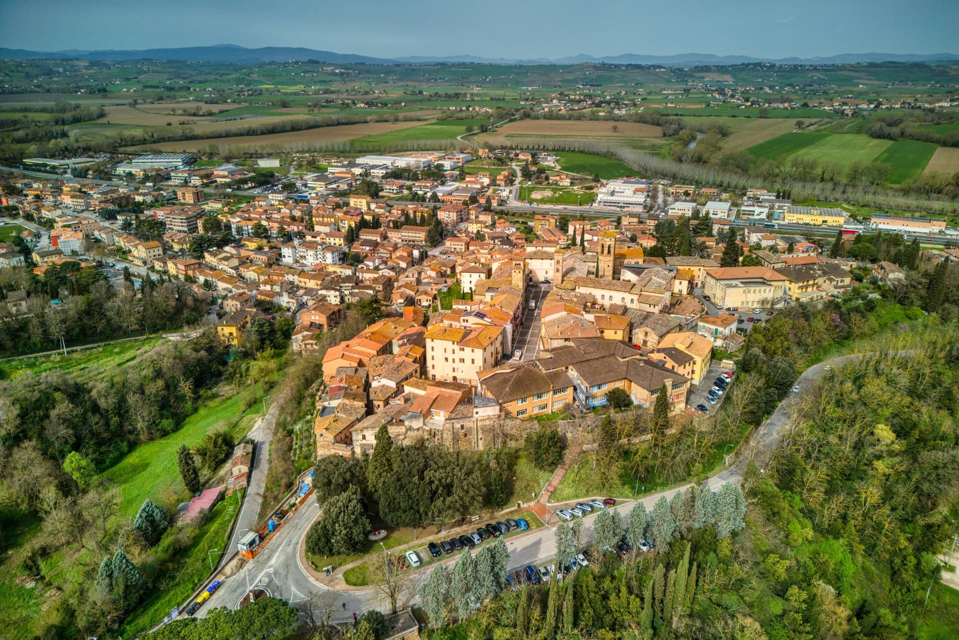
Why visit Deruta
Deruta sits fifteen kilometers south of Perugia, its hill rising above the Tiber on the river's left bank. The walled medieval core, organized around Piazza dei Consoli, occupies the high ground, while the lower town spreads along the old road linking Perugia to Rome.
That road is where the workshops cluster, most of them family businesses running three or four generations deep, and it is also the route that carries traffic five kilometers south to the pilgrimage church, its walls built up over four centuries from votive tiles left by travelers on the same stretch of road. The first documented kilns appear in the archaeological record in the late thirteenth century, and by the early sixteenth the town's workshops had developed the lustro finish that gave Deruta wares their metallic shine, along with the Bella Donna plates that paired painted portraits with flattering banderoles naming the women depicted.
That convent complex, once a working monastery, now holds both the ceramics museum and, next door, the civic gallery with its Perugino and Alunno panels, so the town's religious architecture, its art collection, and its ceramics history sit under the same roof by accident of reuse rather than design. The upper town's churches and museums hold the record of what Deruta made and believed; the lower town's workshops are still making it.
We confirmed you can reach this one by train.
What to see in Deruta
- Museo Regionale della Ceramica. Holds over 6,000 pieces from medieval to modern, arranged through the convent's old cloister and cells.
- Chiesa di San Francesco. Consecrated 1388 after earthquake reconstruction, Sienese 14th-century frescoes inside, Domenico Alfani Raphael-school panel above an altar.
- Pinacoteca Comunale. Civic gallery with Perugino's Eterno and Saints Romano e Rocco, plus two altarpieces by Niccolò Alunno from the surrounding churches.
How to get to Deruta
There is a railway station in the town, so you can arrive without a car and never need one while you are here. Perugia is roughly 19 minutes away by road.
Our tip
April through June and September into October are the months locals prefer. The Tiber valley stays mild and the workshops keep regular hours, with kilns running on weekdays and tastings open on weekends. The Festa della Ceramica in late August opens the cellars and the older workshops to the public. Palio della Brocca falls in August.
More from Anywhere Italy
 The best hidden towns inside a nature park in the province of Perugia
- The 10 prettiest hidden villages you can reach by train in Umbria
- The 8 prettiest villages you can reach by train in the province of Perugia
- The best hidden towns you can reach by train that eat well in the province of Perugia
- The best olive oil towns you can reach by train in the province of Perugia
 The best hidden towns you can reach by train that eat well within 90 minutes of Perugia